| (Up&Coming Vol. 9, 2011) |
 |
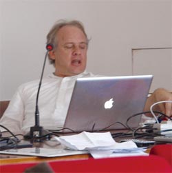
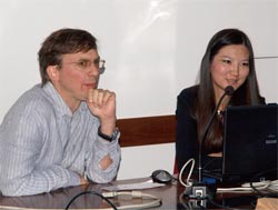
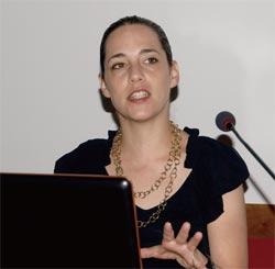
On July 25, Mr. Yoshihiro Kobayashi of Arizona State University greeted
in advance of holding of the workshop held at the Pisa university, Italy.
16 members using the same platform confirmed the vision of World16 of promoting
the research and development about the virtual reality practical use for
construction and city planning.
The purpose and meaning of making the development and the announcement
of research by a virtual reality using UC-win/Road were explained through
the symposium and workshop which are held every year.
 Summer Workshop schedule Summer Workshop schedule
| Day 1 |
July 25(Mon)9:00-18:00 University of Pisa (Pisa) |
- Opening(Mr. Kobayashi、Professor Paolo)
- Greeting of the chief of engineering of Pisa university
- World16 member presentation
- FORUM8' s presentation
- Guest speaker's invitation speech
- Walking and dinner in Pisa
|
| Day 2 |
July 26(Tue) 9:00-23:30 University of Pisa (Pisa) |
- World16 member presentation
- Special guest's speech(Dinitech Spa Mr. Enrico Dini)
- Walking and dinner in Lucca
|
| Day 3 |
July 27(Wed) 9:00-12:30 Hotel meeting room (Venice) |
- Walking around in Firenze
- Dinner in Venice
- NightWorkshop
|
| Day 4 |
July 28(Thu) 9:00-23:30 Hotel meeting room (Venice) |
- Closing Workshop/"Business Modeling Research Award" announcement
and commendation
|
|
|
 |
|
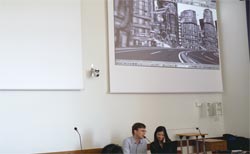
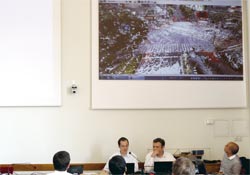
 The main building of the Pisa The main building of the Pisa
university of engineering faculty used
as the workshop holding hall |
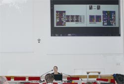
| The contents of a presentation and the research schedule by a member of
World16 |
Here, the contents which each member announced on the 1st day and 2nd day
of a workshop are introduced. Each member will announce the further
developed contents which is based on the announcement of this at the
5th international VR symposium held in Tokyo in November.
| 1 |
Mr. Wael Abdelhameed University of Bahrain/ Bahrain |
|
The virtual reality was introduced to project management and the example
of practical use which increases the efficiency of a process of planning
and report business was explained.
The spatial relationship of a structure component, the construction step
of the building accompanying progress of construction, etc. were serially
expressed by the virtual reality.
 Attribute information is given to UC-win/Road. Attribute information is given to UC-win/Road.
In order to make project management virtual reality, the attribute information
on a structure component was given to UC-win/Road by making the data of
the structure component of UC-win/Road and a building cooperate by an XML
file. Moreover, he also takes in the output result of Microsoft Access
which is database software, and is trying to make it display in virtual
reality space. |
|
| 2 |
Mr. Thomas Tucker Winston- Salem State University/ The USA |
|
Using the technique of motion capture, the motion of an animal and a human
being was measured and the unique research content were introduced, for
example reappearing with reality by a virtual reality, or making an art
work with 3D animation or sound. In addition, the ruins of UAE are modeled
and wind analysis is conducted. He is planning to make a database of a
motion of 12 to 14 patterns such as the time of talking, various ways of
walking and cooking, cleaning, etc from now on and to recreate a motion
on UC-win/Road.
A more natural and real motion is pursued.
On UC-win/Road, the state of a town can be freshly expressed because people
and an animal move with vehicles, such as a car and a train.
However, a default motion also has a little awkward point.
By research of Mr. Tucker, the model of people or an animal can be moved
with reality as if we are seeing the video images. Furthermore, the
motion by people's expression and various living scenes will be able to be
expressed precisely.
In the questions and answers after an announcement, by Pencreach Yoann,
VR development technical manager of Forum8, there was also an opinion
that he would like to use these technology in FBX form in the future. |
|
| 3 |
Mr. Ronald Hawker Zayed University/UAE |
|
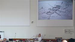
While modeling the geographical feature around a wadi, distribution of
a private house, etc. by GoogleEarth or SketchUp, the relation with the
flow of a three-dimensional model and water, etc. are studied.
Wadis are often located in the farm village of a mountain slope, and also
there are the places in which two or more wadis have gathered.
And it is also possible to cultivate all year long using the waterway which
rain in winter is stored and it flows with gravity.
The dynamical simulation by UC-win/Road
Futhermore Mr. Hawker builds the model of a wadi on UC-win/Road, performs
more dynamic simulation and will announce the multimedia project of a result
at the international VR symposium held in November. |
|
| 4 |
Mr. Tomohiro Fukuda Osaka University/Japan |
|
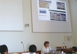
When using the "point group" data measured with 3D laser scanner,
there are three problems. The 1st one is that it's hard to use it on 3DCAD,
BIM and on virtual reality because it has too many polygons, the 2nd one
is that the position of the "angle" of the measured object is
inaccurate, and the 3rd one is that there is a missing part in point cloud.
In order to solve these, the system "Poly-Opt" was developed.
In addition, the cloud computing type virtual reality system was utilized
and the example which the meeting on city planning was held
in remote places was also introduced.
A simple model is created from point cloud data.
Although there are many buildings which are consisted of plane walls, it
is very difficult to understand the angle of a building from the point
cloud data measured by 3D scanner.
Poly -Opt understands the position of the plane with few errors from the
point cloud of the wall of a building, and by setting up the intersection,
it has a function which computes the position of an angle automatically.
By doing this, even if it has some lacks of point clouds, it's complemented
automatically and simple model data can be made. Moreover, there is also
a function which creates the texture on the surface of a building automatically,
and the model of a building can be efficiently created from the point cloud
data of 3D scanner. |
|
| 5 |
Mr. Kostas Terzidis Harvard University/the USA |
|
"E parking system" which can trade parking spaces, such
as a general parking lot, a parking meter, a private road, by a mobile
communication device in the city area where it is difficult to find the
empty parking lot were invented. It's the mechanism that from the car parked,
the charge which yields a parking space to the system is showed and the
driver who is looking for the parking lot contrasts the distance and the
charge to waiting time or a parking lot, and trades with the most advantageous
parking space provider in real time. Carrying out the simulation of this
system by UC-win/Road, he would like to evaluate the feasibility.
The possibility of the parking business by a floating rate system is pursued.
It is necessary to test various scenarios, such as a fixed charge, variable
toll, operation divided by a peak hour and off-peak hour and claim of excess
pastage and delay fee.
The service which trades with a highest bidder in a parking space by the
auction is also considered. |
|
| 6 |
Mr. Matthew Swarts Georgia Institute of Technology/the USA |
|
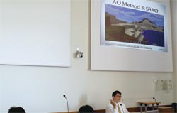
The plug-in software of "AmbientOcclusion: AO" which attaches
a soft shadow to a building etc. was developed for UC-win/Road. The mounting
stage to UC-win/Road was performed by dividing into five, AO was performed
to the virtual reality model of the whole campus of Georgia Institute of
Technology and the demonstration which performs a rendering in real time
was conducted.
To make the expression of UC-win/Road
If the Ambient occlusion can perform a rendering in real time, the textures
of a virtual reality look more natural. In this workshop, the research
which expresses the motion which Mr. Tucker also measured by motion capture
on a virtual reality was presented.
If real expression can be performed by both sides of a motion and a rendering,
UC-win/Road can produce the richer power of expression as a simulator.
|
|
| 7 |
Mr. Marc Aurel Schnabel/Mr. Yingge Qu The Chinese University of Hong
Kong/China |
|
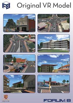
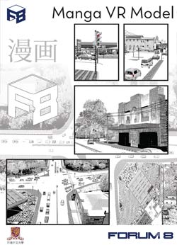
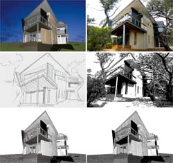
The system which creates the illustration of the comics style automatically
from a photograph was announced. The feature of the scene painting of comics
is expressing a building etc. by the "texture" by the "line"
and a screen tone. Then, when carrying out image processing of the photograph,
creating the illustration of the comics style automatically was succeeded
by the strength of a line, and investing several kinds of patterns
as a texture.
Scuttle in the town of comics by UC-win/Road.
Mr. Aurel and others created the model of virtual reality which has arranged
the cityscape illustration of the comics style created automatically
from the photograph on both sides of the road created by UC-win/Road.
The demonstration of driving in the rows of houses of comics in real time
at the end of an announcement using this system was announced. |
Digital Manga UC-win Road Manga-Me Plugin
|
| 8 |
Mr. Taro Narahara New Jersey Institute of Technology/the USA |
|
Based on the experience which has tackled development of the technology
which visualizes human action on UC-win/Road, three ideas about the practical
use and its realization for a new field of the UC- win/Road model were
introduced. The 1st is a data input/output device called a "micro
controller" and the development of the interface which UC-win/Road
can exchange datas directly. If this is realized, the obstacle etc. which
restrict the walk range of people on UC-win/Road can be moved in real time,
and people's stream coordinated with it can be analyzed. The 2nd is cooperation
with an extended actual feeling (AugmentedReality:AR), and it's able to
be seen on iPhone etc. in conbination the real world and virtual reality.
The 3rd is the idea that the load of a virtual reality will be reduced
by expressing not as 3D model but as a silhouette of 2D, when expressing
much crowds and trees, etc.
Introduction real time system to UC-win/Road
If cooperation with a micro controller is realized, a weather information
etc. are taken into virtual reality world, and can be used on the Internet.
The weather, temperature, and rainfall can also make a model match reality
by taking the water level of a river, etc. into real time, and the simulation
based on actual conditions becomes possible.
It will be also used effectively at the time of simulation of the unsteady
people's flow at the moment of walking range being changed such as the
beginning and ending of pedestrian paradise. |
|
| 9 |
Mr. Amar Bennadji Robert Gordon University/the UK |
|
In order to ease traffic congestion, monitoring technology by the fixed
camera installed in the integrated technology which utilized the cellular
phone, application of an in-vehicle sensor, the lighting or a crossing
point was explained.
He said that a large-scale traffic control room was unnecessary any longer
by utilizing car navigation system which a car and a data analysis center
exchange information each other in real time, vehicle speed by the camera
of signal integration around the intersection and the detection system
of a direction, etc.
The huge bridge construction project which connects Africa to Europe
At the beginning, 3D modeling of the Europe-African bridge construction
project which connects Tunisia to Italy currently planned for commemorating
the 150th anniversary of Italy unification was introduced. It is a grand
project which consists of a road and a railroad from the "tiptoe"
portion of the Italy peninsula to Tunisia in Africa via Sicilia. It is
a concept which a man-made island is prepared in the middle of a bridge,
and a town and an airport are built. A part of this huge project was reproduced
by UC-win/Road. |
|
| 10 |
Mr. Nik Luka McGill University/Canada |
|
This year in FARMM (Facility for Architectural Research inMediation), VR
model using data chipped in the point group created by 3D scanner is developed,
and the project which expresses simultaneously various viewpoints by two
or more persons concerned in the Saint Charles area near State Montreal
of Quebec is advanced. The staff of the laboratory made an announcement.
"The shadow of data" is utilized.
This model is "a shadow of data" which originally exists. That
is, using the space which exists between the data which are lacked from
point cloud literally and the points, and piles up at the same time it
differentiates the pluralism database in one simulation. Two or more point
group data from sauce is dealt with, and there is an intention to mount
the tool for taking it into UC-win/Road. |
|
| 11 |
Ms. Ruth Ron University of Florida/ the USA |
|
The project which makes the simulation by the noise analysis software "Cadna-A"
and the traffic simulation of UC- win/Road in city environment cooperate
is undertaken. She has been thinking to arrange the point data of noise
simulation to VR environment and express acoustic simulation aurally.
Modeling simulation result with 3D printer
While using the simulation map which cooperates from UC-win/Road to Cadna-A
and visualizing noise by 3D, creating a model with 3D printer is planned.
|
|
| 12 |
Mr. Marcos Novak University of California, Santa Barbara/ the USA |
|
With the theme "Vector of Value", how to acquire the required
information in this information excessive society
and how to connect it to the realization of the purpose were explained
with the example of latest iPhone application. Mr. Novak is thinking about
the development information service system which combined a composition
tool, a game engine, iPad, etc.
New practical use of information in cooperation of iPhone and UC-win/Road
The application "Aurasma" which was introduced in the speech
presents the contents such as an animation and sound automatically when
the iPhone was turned to the thing which you want to know the information."INNERACT.US"
is the thing which someone finds and help for the realization when its
hope is uploaded to Cloud. If the information on UC-win/Road can be utilized
at such an information terminal,
new information practical use is likely to be produced. |
|
| 13 |
Mr. Yoshihiro Hayashi Arizona State University / The USA |
|
"3D projection mapping" is to project the image which suits the
form and size of a building by two or more projectors on the surface of
a wall of a building, and it can be shown like an actual building may move
or break.
He thinks to perform the practical use combined with the virtual reality
by combining this technology with UC-win/Road. He participated the meeting
and a workshop with 3D mapping persons concerned and felt that the realization
seemed to be not so difficult.
He says he would like to realize some projects by the symposium in November.
In addition, the model edit method, "mesh editing" and
the "urban design tool" which sticks texture parts on a
simple-shaped building and creates a city model efficiently were developed.
A dynamic feeling of virtual to the building and structure of things
The unprecedented stage effects which give a dynamic feeling of virtual
to an actual building are realizable by projecting the image of a virtual
reality not to a monitor and head-mounted display of PC but to the building
and structure of thing.
The worlds using a city infrastructure, such as a new art and an event
spread, and the possibility of opening up a new market could also be expected. |
|
| 14 |
Mr. Paolo Fiamma University of Pisa/ Italy |
|
In the ancient city, Luke which is surrounded by the rampart built in the
17th century, various institutions, such as a technical center, bus terminal,
museum and a market will be built by 2015 by the city planning "PIUSS
(Integrated plan of maintainable urban development)" . The influence
which these institutions have on road traffic was analied by UC-win/Road.
The data of GIS was used for construction of the street, the data of the
traffic style was analyzed, and the model was created by UC-win/Road.
As a result, it turned out that the road affected by influence by an institution
is a zone of the perimeter road in alignment with a rampart, and the west
side of the city.
Making the whole old walled city virtual reality
Although the model which made the rows of houses from the time of the Roman
Empire in the inside of a rampart and an external road virtual reality,
it's so beautiful as if we look at the city model. |
|
|
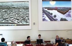
Mr. Simon Mabey Earth urban modeling /Ove Arup and Partners |
|
Having the 10,000 staff in 37 nations in the world, Mr. Mabey leads 3D
modeling section of the northwestern branch in the company of Ove Arup
which develops a broad service from a design to a plan, engineering, and
execution management.
The modeling of a building or a city has been tackled since 1996, making
full use of an aviation laser measurement, an aerial photograph measurement,
a ground type, an in-vehicle model 3D laser scanner, etc.
The example which modeled the city 400 acres (about 1.6 km2) is in it.
The example utilized for problem solving, such as a scene, traffic and
environment, and a flood, was introduced combining CAD, the measurement
in the ground and aviation laser, an aerial photograph measurement, etc.,
and using four steps of modeling methods properly.
By [determining] the screen displayed after pushing this button, the lattice
range set up on the [circle slide examination result] screen can be initialized.
|
|
Professor Seki Fumio Nihon University Science Engineering
department |
|
He told about the practical use effect of the design technique of a civil
engineering structure, or CG and modeling based on experience which has
practiced the design with the broad civil engineering structure such as
the slope of a road, a bridge, a tunnel, the service area of a highway
etc, during his career with Taisei corporation. He also introduced the
example of a design in a familiar structure like a retaining wall besides
the technique which employs a shadow in a design efficiently by attaching
the texture which has asperity in a bridge beam or a bridge pier, or shows
an arch bridge slender. Moreover, examples of construction, such as a road
which took in the load support mechanism of the stone wall of a castle
in the area which cannot use concrete, and the tree planting technique
of slope were also introduced.
|
After Forum8 president Yuji Ito expressed his thanks for the correspondence
and the thoughtfullness to East Japan great earthquake, he explained functional
enhancement of UC-win/Road, the evaluation from users and the business
activity of Forum8. The award of a CSAJ alliance grand-prix, the start
of the supercomputer Cloud service including VR in the Kobe laboratory,
development of an office robot, and the BIM workflow maintenance that made
Allplan and UC-win/Road the core were also mentioned. Finally he appealed
also for the participation in the virtual design World Cup.
Then, Mr. Pencreach Yoann explained the new function of UC-win/Road Ver5.2,
Mr. Soulier Chrstophe explained VR-Cloud (TM) and Mr. Niniss Hafid explained
about the cooperation of a robot development with UC-win/Road in detail.
 |
 |
 |
 |
| Yuji Ito, CEO of Forum8 |
New function of UC-win/Road Ver5.2 |
Introduction of VR-Cloud(TM) |
Development of a robot and cooperation with UC-win/Road are introduced. |
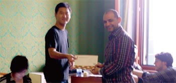
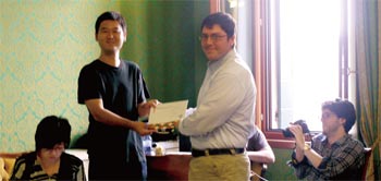
| Five projects are selected to a business modeling research encouragement
prize. |
The following projects of five affairs were selected and commended as a
"business modeling research encouragement prize", and grants
for encouragement of research were presented. For these researches, Forum
8 will preponderantly support them in respect of technology and development.
| 1 |
VR practical use in monitoring of a construction project |
|
|
| Wael Abdelhameed (Bahrain university ) |
 |
|
| 2 |
e parking simulation |
|
|
| Kostas Tersidis (Harvard University) |
 |
|
| 3 |
Shader graphics of UC-win/Road |
|
|
Matthew Swarts (Georgia Institute of Technology )
|
 |
|
| 4 |
UC-win/Road "Digital comics" |
|
|
Marc Aurel Schnabel & Yingge Qu
(The Chinese University of Hong Kong) |
 |
|
| 5 |
Navigation in a media domain |
|
|
| Marcos Novak(California State University SB school ) |
 |
|
|