Geographical map data including pre-built 3D City Model provided by SIRADEL, a French Geo-Data specialists.
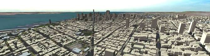
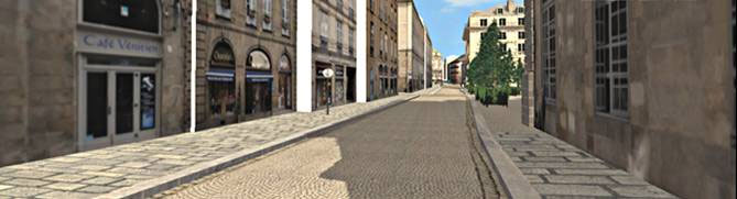
FORUM8 and SIRADEL, specialists in Geo-Data and 3D City Model, became premier partners. SIRADEL has been producing accurate and realistic 3D city models for more than 15 years and has built up a unique collection of 3D digital models of thousands of cities from all over the world. SIRADEL is a top-tier editor of geographical map data in the world and controls the whole production chain, from the image acquisition (aerial, satellite and terrestrial) to the post-production.
|
|

 |
FORUM8 and SIRADEL have developed a seamless integration of FORUM8’s award-winning
3D Visual Interactive Simulation software VR-Design Studio (UC-win/Road)and SIRADEL’s 3D City models. This exciting new development of being able
to offer pre-built SIRADEL 3D City models within VR-Design Studio will
undoubtedly save a huge amount of time and money for FORUM8 customers and
partners alike who require an interactive 3D model of a town, city or streetscape
as a part of a current or future project.
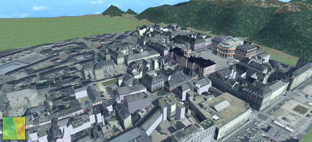 |
| Example of 3D city model created by SIRADEL (Rennes/ France) |
Map Data, 3D City Model
- Japan (Tokyo, Yokohama), China (Beijing, Hong Kong), Belgium, Brazil, Cameroun,
Canada, Czech Republic, Danmark, France, Germany, Hungary, Indonesia, Italy,
Lebanon, Mauritius, Mexico, Portugal, Rumania, Slovakia, England, USA
|
 |
 |
 |
 |
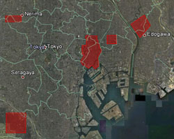
| Data model (Tokyo and Yokohama, Japan) available for sales |
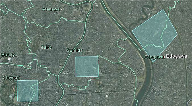 |
Light blue parts (Chiyoda-ward, Sumida-ward and Edogawa-ward in Tokyo)
in the above map is available 3D city model.
It was built based on the aeronautical map in 2009. Total 10Km2.
| High Resolution 3D Database |
| Target Area |
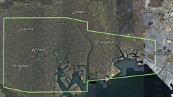
The following 3 areas in Tokyo (Light blue of the above map : Left, Middle,
Right)
- Left:Area around the vicinity of the border between Chiyoda-ward and Tyuo-ward
(Including Tokyo station and a part of Imperial Palace)
- Middle:Southeastern part of Sumida-ward (In other words, the vicinity of
Kinshi-tyo station of JR Sobu line)
- Right:Area around the vicinity of the border between Edogawa-ward and Katsushika-ward
[Northwestern part of Edogawa-ward (between Arakawa River and Shinnakagawa
River) and Southern part of Katsushika-ward (just South of the point where
Nakagawa River and Shinnakagawa River merge). In other words, the vicinity
of Kinshi-tyo station of JR Sobu line]
|
| Size of Target Area |
Total of 3 areas=10Km2 |
| Base Map |
Aerial imagery in 2009 |
| Price (Tax is not included.) *1 |
\581,400 |
| Available Format |
3DS, and other standard format |
| Delivery Period |
Immediate delivery from P.O. for 3DS format (or another standard format) |
|
|
|