 |
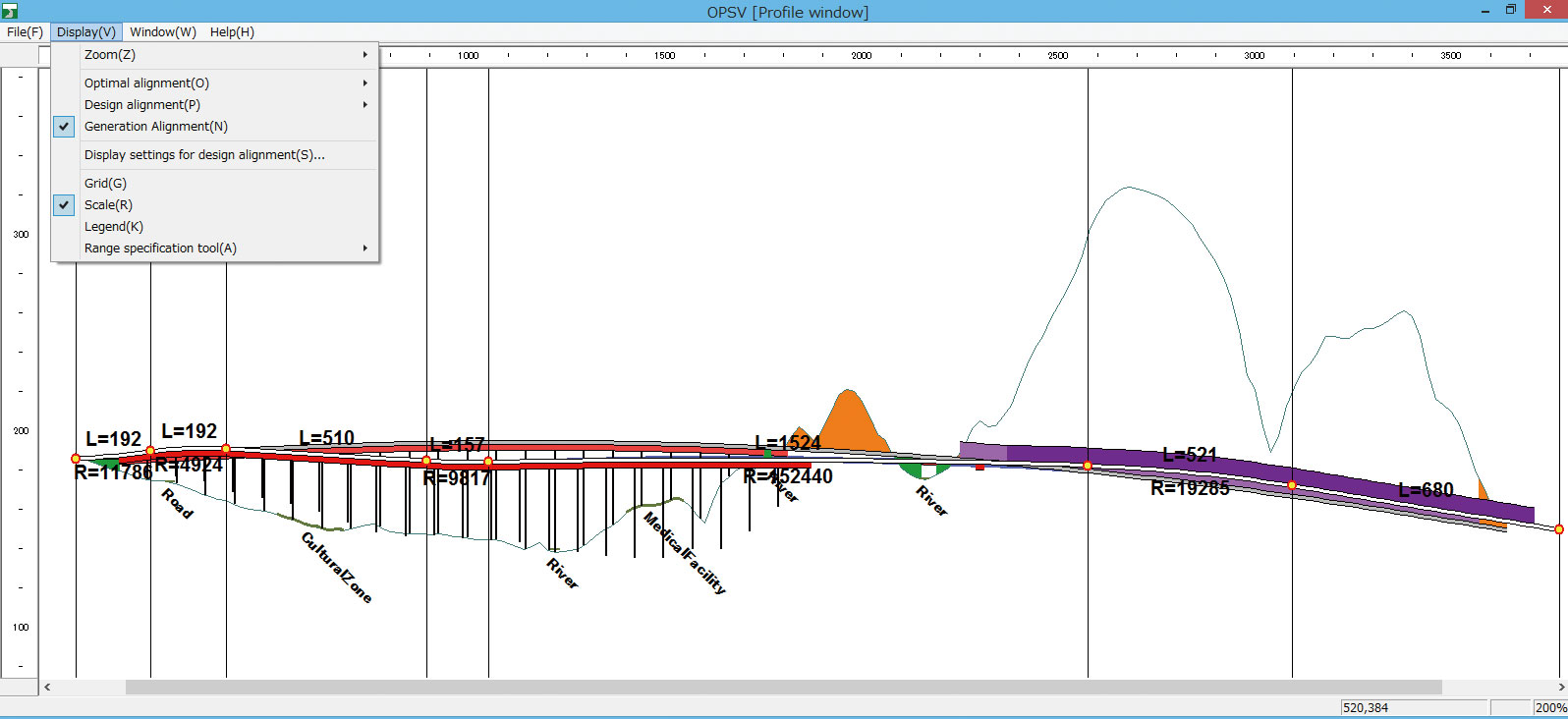
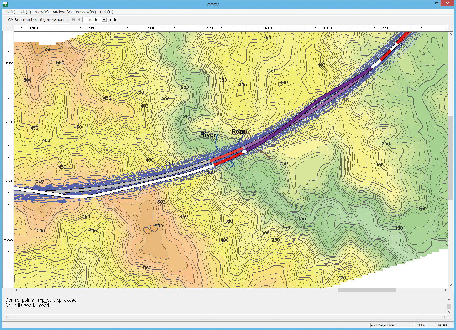
| ▲Figure 1 Optimal path analysis result |
 |
| ▲Figure 2 A cooperation example of OHPASS and UC-win/Road |
| New Products | |||||||
|
|||||||
| Overview |
OHPASS
(Optimal Highway Path Automatic Search System) is a system that quickly
searches the optimal path for highways. Using Genetic Algorithm (GA),
deriving the economical path of the best linear shape, business cost
and soil volume while fulfilling laws, regulations and various
conditions is possible. Also, by converting the optimized linear data
into a LandXML format, it can be imported into UC-win/Road and
visualization and various simulations can be performed by simple
operation.
|
| Purpose of the English version |
| In recent years, demand of building new highway path is decreasing within
Japan, but overseas, especially in the Asian-Pacific region where economic
development is remarkable, an active infrastructure demand exists, and
by developing an English version, usage in these regions is expected. In
particular, abundant experience and technology is necessary in order to
conduct a rational road design from a point of view of landscape, comfort
ability, and construction costs, but OHPASS can derive the optimal path
from a number of path, which makes it possible for inexperienced technicians
to design ideal roads. Therefore, it is thought to be a big help especially
for the developing countries. Also, by cooperating with UC-win/Road which
is widely used abroad, evaluating the travelling performance and landscape and helping consensus building with the local residents of the planned construction site becomes possible. |
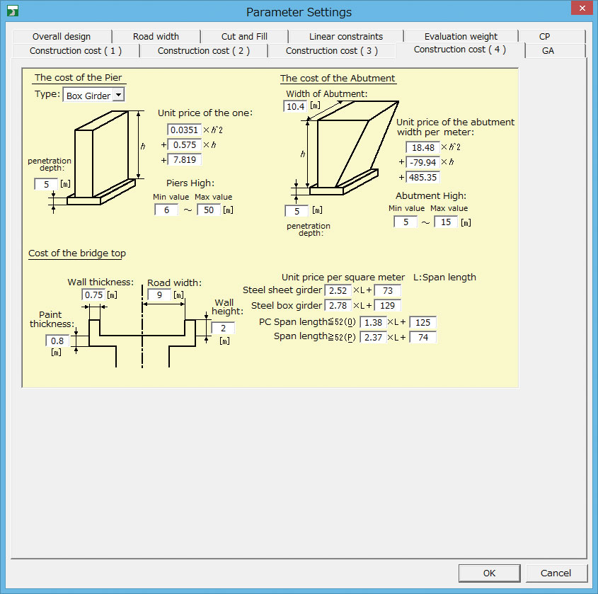
| Features of the English version |
| Menus
and dialogs in the English version are all in English, and it can
analyze the optimal path and earthwork costs and output results just
like the Japanese version of OHPASS. In the Japanese version and the English version, the set point of the parameter used for linear analysis is different. The Japanese road regulations differ from the foreign road regulations, so setting a parameter appropriate for the land to be analyzed is necessary. Also, due to the English version, we are planning to have a result display taking into account the difference of currencies. Since the parameter default value used by OHPASS for the analysis uses an external file separate from the program body, preparing an external file will make it possible to correspond to any region in the world. Of course, the parameters can be directly specified on the setting screen too. (The image is under development.)
|
| (Up&Coming '14 Fall issue) | ||
 |