New Products
UC-win/Road
UAV Plug-in Option
A creation of UAV flight plan, a remote control,
and a log acquisition by collaborating with 3DVR

Price $3,000 (SS:$520) Released July 2016
Simulation
 Introduction
Until recently, almost all UAVs (Unmanned Aerial Vehicles) used to be utilized for the purpose of military or defense like monitoring and collecting information. Appearances of inexpensive UAVs like AR.Drone and DJI Phantom increased general uses such as aerial photograph, creation of 3D graphic, and delivery. However, the operation of UAV requires certain skills and trainings and this is one of the factors to limit this technology.

In order to deal with this problem, we are developing a solution to operate UAV completely in a simple and natural control by the VR function equipped to UAV plug-in of UC-win/Road. In the 3D environment, flight plans can be made by an easy way of selecting a position on the three-dimensional, and they can be executed by uploading the information to UAV. Monitoring the UAV flight on real-time and continuously, it can be checked if the flight is going according to the plan.

Supported models:
Phantom 2 (Ph2) Vision, Ph2 Vision+, Ph3 Standard,
Ph3 Advanced, Ph3 4K, Ph3 Professional, Ph4,Inspire 1
 Major Functions
UAV for the current development is DJI Phantom 3 Professional which supports the intelligent flight control and flies stably, and UAV plug-in is designed also for other UAV platforms that have autonomic flight ability.

Figure 1 is the all devices to be used. The system consists of DJI Phantom 3 Professional, a remote controller, a tablet (Android interface), a laptop (UC-win/Road and UAV plug-in), and a Wi-Fi router (for the connection between UC-win/Road and Android interface).

Recently we have succeeded in the field flight test to check the functions of flight plan editing, upload, execution, and monitoring on real-time.
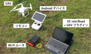
Click to enlarge the image.
Fig.1 UAV operation system

At the upper left of Figure 2 is a UAV plug-in window. It is for various settings and a display of real-time data. At the lower left is the flight editing screen, on which flight plans can be created by setting the passing points and the behavior (taking photos or videos) there. Users can start the flight after the creation of the flight plan. Figure 3 is an image of a flight. Automatically the UAV takes off, flies along the planned route, and lands at the final passing point.

Click to enlarge the image.
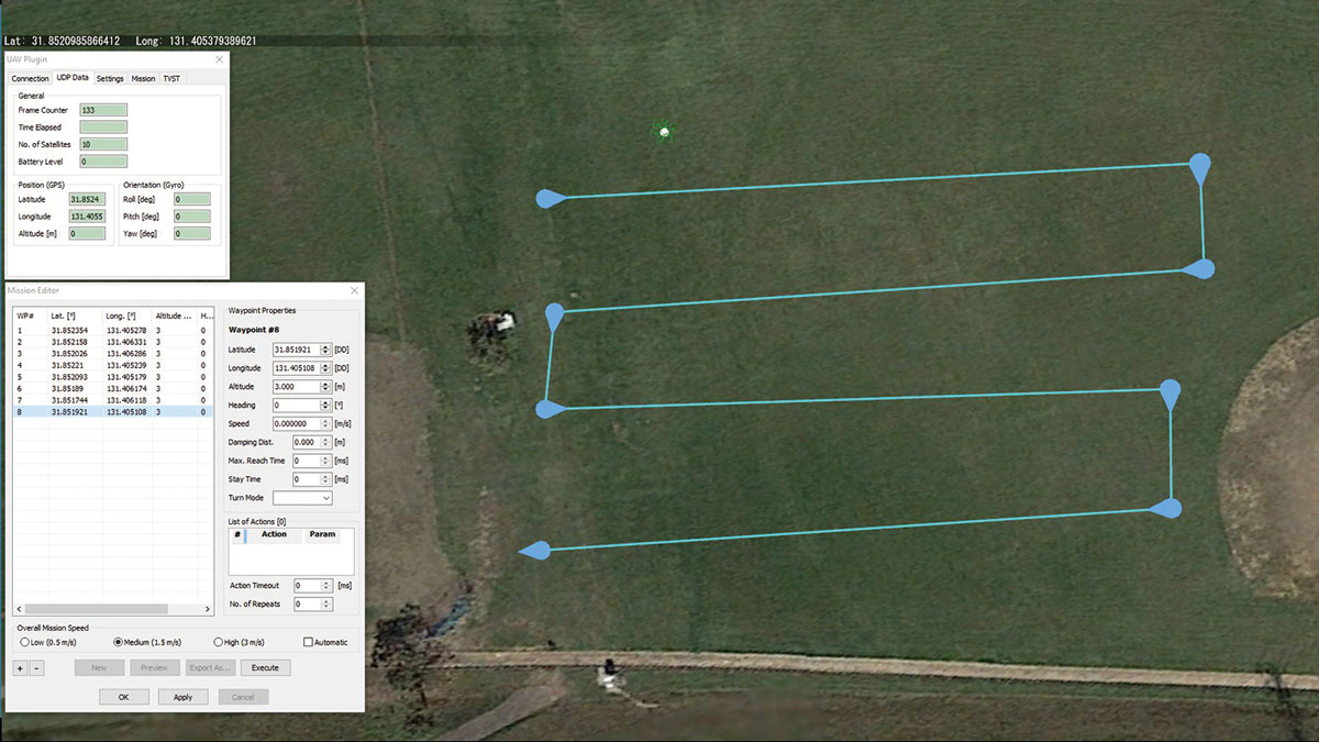
Fig.2 UAV plug-in of UC-win/Road
and the flight editing screen

A white line under the UAV in the figure 3 is a visualization of the vertical line to the ground to make the UAV's height clear.

Click to enlarge the image.
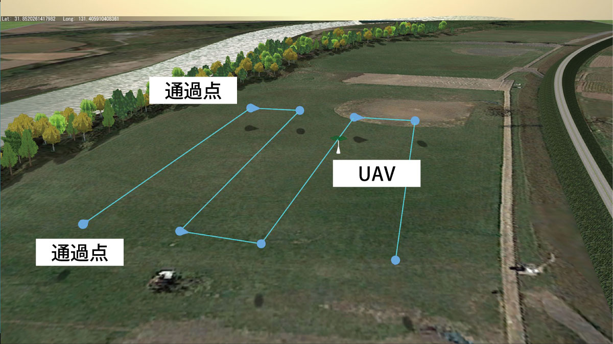
Fig.3 Execution of the flight plan
 Additional Information
An additional function of taking photos or videos during the flight is under development. This function makes it possible to create the flight plan which shooting positions are added to. And a full system will be finished with this flight plan, UAV monitored flight, and automatic download of media files after the flight for post-processing such as the creation of a 3D graphic from a 2D one.
(Up&Coming 2016 Summer Issue)
back
Up&Coming

FORUM8