New Products
UC-win/Road UAV Plug-in Option
Ver. 2
Linkage with 3DVR enables flight plan creation, remote control, and log acquiring

●Price $3,000 (SS: $520) ●Released date December 2016
Simulation
 UAV Plug-in
With the first edition UAV plug-in, you can create a flight plan by selecting passing points in UC-win/Road and adding actions on the points such as taking photo or starting video recording. The information of the flight plan is uploaded on the UAV after the creation. The UAV fully automatically takes off, passes each passing points, acts if defined, and finally lands. Media files of photos and videos can be downloaded from UC-win/Road over the wireless after finishing the flight.
 New features
Display shooting range
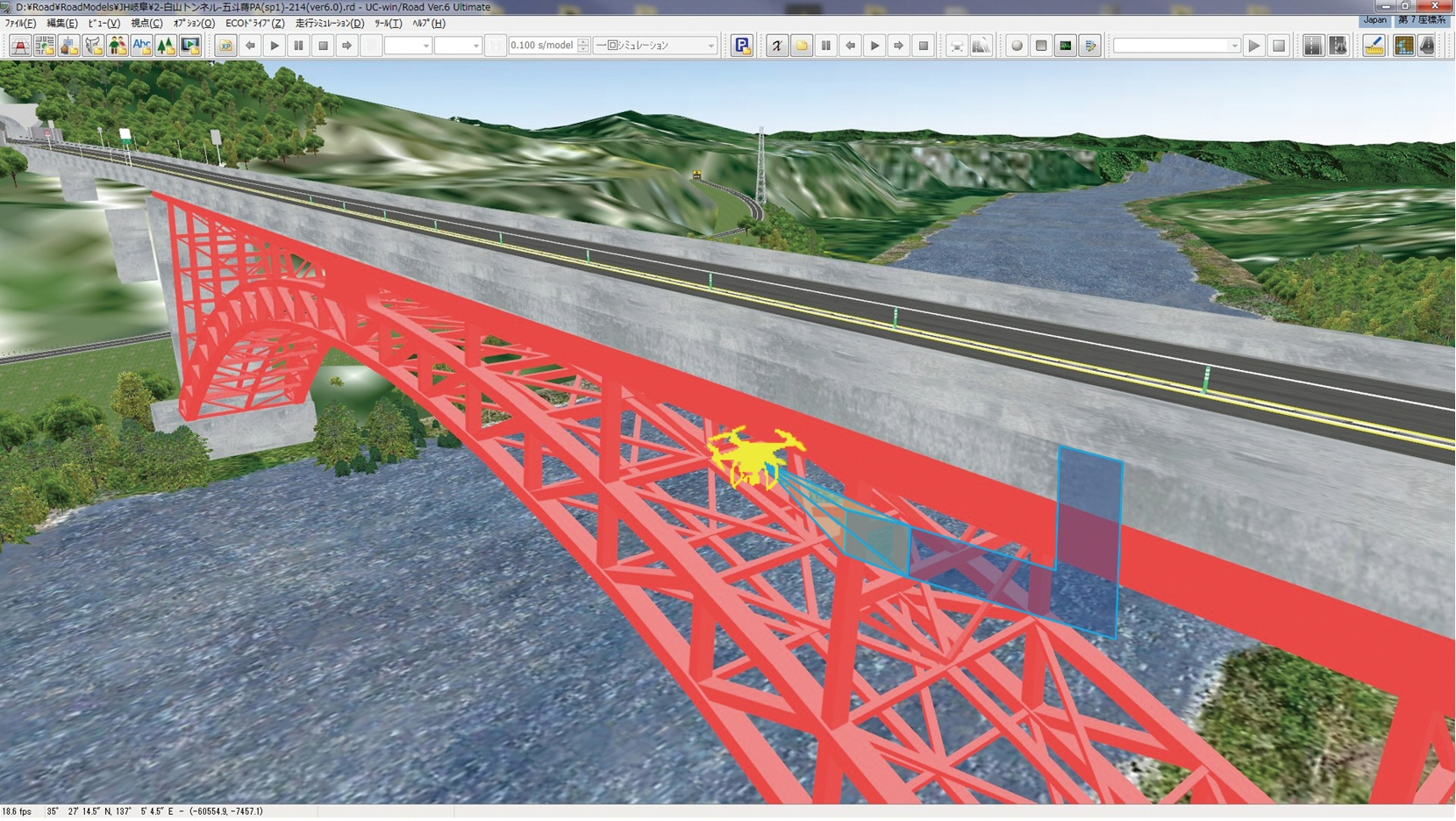
Display of camera contents in 3D environment is planned, for example, the real-time display of recorded range. This feature is sometimes useful when mapping, enabling users to find out uncovered range in real time and to set flight until covering entire mapping area.

Manage multiple UAVs
Until now, it was assumed that one UAV would fly at a time, but it is difficult to cover a wide range with a single UAV in a relatively short time. Wherein, by allocating tasks to multiple UAVs, each UAV can perform mapping the area in charge. The progress can be monitored in UC-win/Road in real time.

In addition, major transportation companies are investigating the actual possibility of sending small packages with UAV, and there is a good chance that UAV will contribute to it in the near future. However, safety issue is standing over if actually using UAV. To solve this problem, UAV batch management system is effective, and it can be used, for example, to evaluate algorithm of flight collision.

画像をクリックすると大きな画像が表示されます。 画像をクリックすると大きな画像が表示されます。
Fig. 1 Display shooting range in real time Fig. 2 Manage system for multiple UAVs
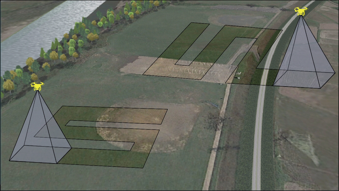
and its task allocation
 Improvement of current features
Flight plan manager
Flight plan manager is planned to be introduced in order that users can search the flight plan they created before, import it to UC-win/Road, and execute or edit flight. Currently, created flight plans are automatically saved as a file name with the creation date. Addition of display in thumbnail or calendar format enables easier flight plan searching.

Download media file
There is also room for improvement about the wireless download of media file recorded during the flight. SD card must be initialized every time because currently all downloadable media files in UAV SD card are downloaded. By displaying contents in the SD card in a file list, you will be able to download all files at once or select the file you want to download. This feature will also shorten the time of getting video files.
 UAV case study
FORUM8's "System based on Autonomous UAV and 3D VR for Inspection and Assessment of Structures" chosen as "The Robot for the Next Generation Social Infrastructure with Target Application in Onsite Inspection" in the field of 'bridge maintenance and management', by Japan Ministry of Land, Infrastructure, Transport, and Tourism. This is a system to utilize UAV for bridge checking. VR is used in this system for setting of flightpath and generating of point cloud from photo data taken by UAV.

News Release (July 17, 2014) http://www.forum8.co.jp/forum8/press/press140716-e.htm
(Up&Coming 2016 Fall Issue)
Back
Up&Coming

FORUM8