| New Products & Service | UC-1 Debris Flow simulation |
|
UC-win/Road 3D real-time VR simulation ●Price USD3,360 ●Release October 2020 |
|
|
Introduction This product is a system integrating the "UC-1 Debris Flow Simulation" that executes a set of debris flow analysis and the UC-win/Road "Debris Flow Simulation Plug-in" that creates input data for analysis and visualizes analysis results. The "Debris flow simulator (Kanako)", developed by the Graduate School of Agriculture of Kyoto University, is used for the analysis part. 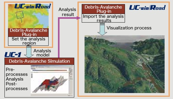 Fig.1 System overview In this revision, the following functions mainly for the UC-1 Debris Flow Simulation have been added. (1) Import of LandXML file Automatic Calculation of Hydrograph Using Rainfall Intensity and UC-win/Road Terrain Data To calculate the time-series amount of debris flow with this product, it is necessary to input the flow rate coming in river or in path of debris flow as hydrograph. However, users have to calculate the amount of flow separately or prepare for data published by observatories before creating the hydrograph. In this version, the flow rate can be calculated by using the rainfall intensity and the terrain data in UC-win/Road and can be entered as a hydrograph. A general analysis method of flow analysis "Kinematic Wave method" is used for the calculation of the flow rate. The concept is shown in Figure 1. The basin is divided and replaced with simple models, then it calculates the amount of runoff in each section per unit hour. The outflow from the upstream is naturally calculated too. Enter the computed time-series amount of flow at the end of the basin as a hydrograph. 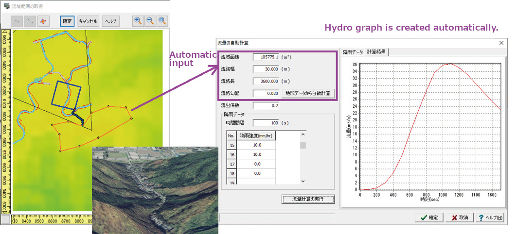 Fig.2 Automatic creation of a hydrograph 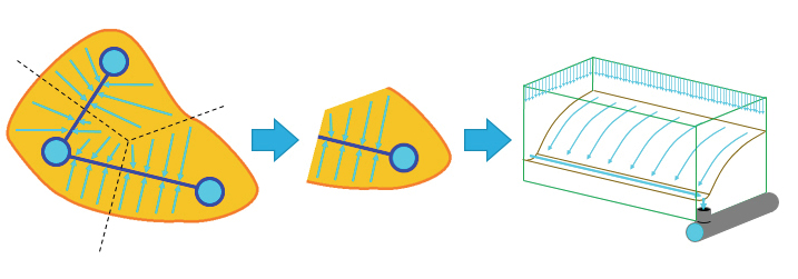 Fig.3 Concept of Kinematic Wave method Import of LandXML File The existing "UC-1 Debris Flow Simulation" can import separately prepared DEM (Digital Elevation Model) in the 2D area setting. In this revision, it can import LandXML files that are encouraged for BIM/CIM. This enables debris flow simulations by terrain data in LandXML format that is often used for reviews and designs. 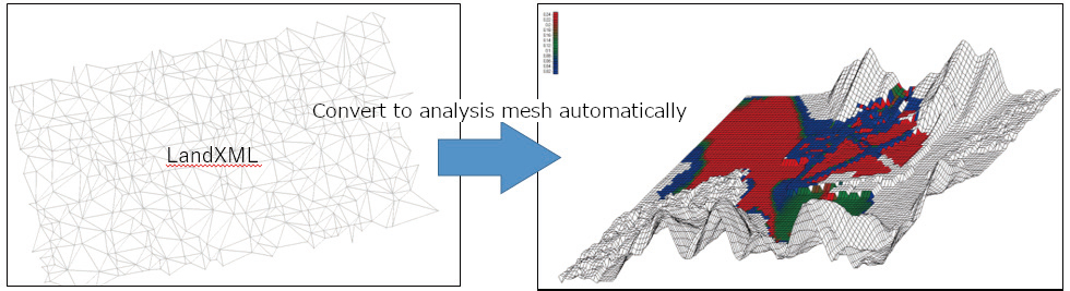 Fig.4 Utilization of LandXML import Data Cooperation with Sediment Control Dam Design 3DCAD The Sediment Control Dam Design can be used for checking the appropriateness of the height and position of dam but not for the stability calculation. So, users need to execute the stability calculation of each dam with another design software. However, it is troublesome to input conditions of all dams in the calculation software. To solve this issue, we added a function to export data for "Sediment Control Dam Design 3DCAD" containing each condition of dam set in the Debris Flow Simulation. This function makes the input with "Sediment Control Dam Design 3DCAD" more simple and the designing will be more smooth. In addition, if conditions exported from the debris flow simulation are changed in the "Sediment Control Dam Design 3DCAD", the modified data can be imported in the debris flow simulation again to update the height of dam and other data. 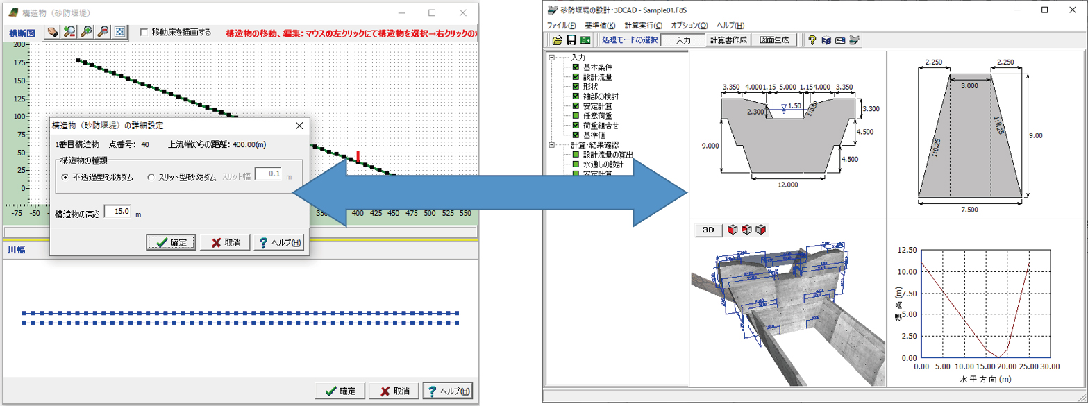 Fig.5 Cooperation between the UC-1 Debris Flow Simulation and the Sediment Control Dam Design 3DCAD. Conclusion Besides the revised contents we explained in this topic, we have added a variety of functions to improve the usability. We hope this software helps you to prepare for frequent debris avalanches. |
|
| (Up&Coming '20 Fall issue) | ||
|

