
| 3D Realtime Virtual Reality |
UC-win/Road for 12d Model is the new plug in tool for the data link between UC-win/Road 12d Model. 12d Model offers a total civil engineering solution including surveying. FORUM 8 has developed the plug in, thinking that the bilateral linkage of these 2 software packages contributes to our customers' improved efficiency.
The data file is basically based on “12d Ascii File Format", which is a text file, easy to read and its data can be output easily by a string. For details see the following URL.
http://www.12d.com/downloads/12d_ascii_file_format.pdf
(1) Data link from UC-win/Road to 12d Model
 Link of terrain data
Terrain data of UC-win/Road can be converted and exported to Tin file of 12d Ascii File Format.
Link of road data
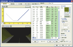
Data is divided into horizontal alignment data, vertical cross section data and cross section data. In 12d Model, horizontal alignment data and vertical cross section data are regarded as input data, while cross section data is regarded as result data. Therefore, horizontal alignment data and the cross section data is converted and exported to 12d Model. In addition, users can define the conversion of the the UC-win/Road 12d to the Alignment of the Super Alignment of the Ascii File Format.
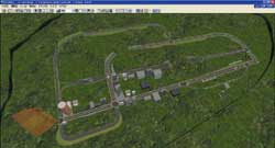
▲1 UC-win/Road ▲2 Imported UC-win/Road data to 12d Model
(2) Data link from 12d Model to UC-win/Road
- Link of terrain data
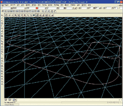
12d Model regards terrain data as TIN data structure and the range of the terrain is not limited. UC-win/Road regards terrain data as grid data structure. There are 4 patterns of the grid: 200 x 200, 200 x 400, 400 x 200 and 400 x 400. There are no limits to the range of the terrain, but the size of the cell changes according to the size of the range of the terrain. For example, 10,000m x 8,000m with 400 x 400 grid pattern, the size of the cell is 25m x 20m. To express more detailed terrain data, UC-win/Road can generate terrain patch. Diagram 3 shows the range of TIN data: 24,700m from South to North, 32,500 from East to West with the number of TIN triangle apex 946,215. In addition, TIN model of 12d Model terrain can be converted to UC-win/Road terrain data or terrain patch data.
Link of road data
There are two ways: Alignment and Super Alignment in 12d.Users can define the Alignment or the Super Alignment when converting the road data.
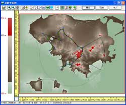
 3 Link of terrain data and road data4 Link of vertical cross section data
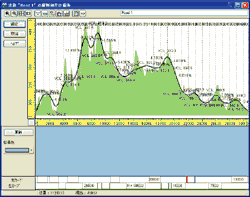
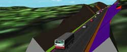 5 Link of cross section data6 Expression by UC-win/Road
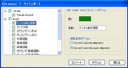
(1) Data export screen to 12d Model Data export screen can be checked even when users are editing project in UC-win/Road. On the screen to the left, the list of the terrains and roads in question are shown, on the screen to the right, convert option of the selected items, where you can set "colors", "names", and "road generation option" are shown. (2) Data import screen from 12d Model 12d Model data import screen is for users to import 12d Model data to UC-win/Road. After importing the data, this can be converted to terrain data, terrain patch data or road data and the setting can be done on the screen. Road data conversion requires 3 kinds of data: center line data of horizontal alignment and vertical cross secction alignment, and cross section data and template. Naming of the model on 12d Model side helps users to recognize the cross section data easily. |
 |
