VR/CG data generation and technical support service using UC-win/Road
Since 2001.10.01
Overview and Features
The service undertakes data generation tasks concerning UC-win/Road such as the generation of 3-D VR simulation data, 3-D models, and textures. The expertise of functions in UC-win/Road provides high-quality data at a low cost. There have been many achievements, awards and public recognition received, including works presented at FORUM8’s 3D VR Contest, starting from when the service commenced in October 2001.
FORUM8 provides not only UC-win/Road as a product but also services supporting VR and CG data creation including the creation of 3D models, textures and Road simulation data.
We provide full support for simulation work for road projects, urban planning, various public projects, and private development. 3D CG simulations with motion can be a powerful presentation tool for engineers and presenters. UC-win/Road and its support systems will further expand the world of virtual reality simulation. Also, application of 3D VR to design discussions and studies serve as a common language for many parties involved. Using 3D VR for design and planning is the first step toward consensus building.
The followings are estimates of the service cost for your reference.
UC-win/Road Standard Cost Estimate List
If you have any inquiries or comments please feel free to reach to us at UC-win/Road Support System Desk or sales office.
■Related Service
Shade3D CG Input Support Service >>Details
This is a service that we undertake the creation of 3D models, 3D printers, and animation data. Staff who are knowledgeable in Shade3D functions will create high-level 3D data even with a small amount of information such as illustrations, diagrams, pictures etc.
In addition to Shade3D, we have many experience in 3D data creation, and excellent VR data have been presented at the 3D VR contest (organized by our company). This 3D data creation service does not only provide Shade3D but also supports VR/CG data creation in general, from creating 3D models and textures to creating simulation data.
Related Information
- ◆Seminar
- UC-win/Road Training Seminar
Service example >>UC-win/Road Standard Cost Estimate List
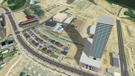
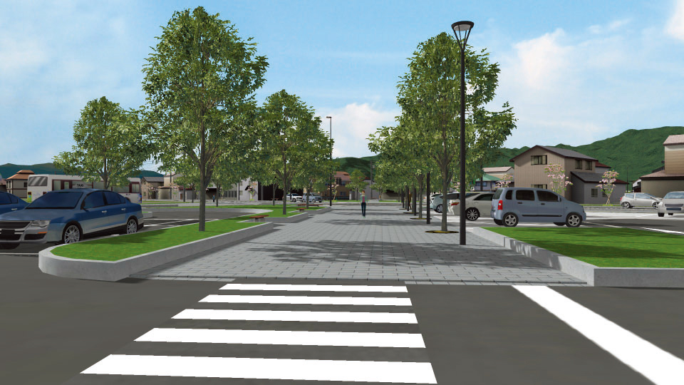
Urban Planning and Development
-
- The ocean and mountains seen from the city and beloved by local people - we create a VR of a target development and reproduction area including surrounding terrain and nature. We support the city planning in consideration of terrain, environment, traffic, and disaster prevention essential for a consensus building.
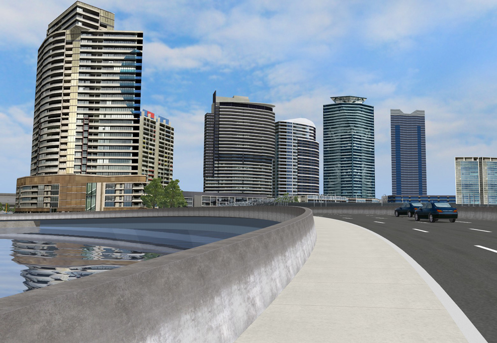
- The current scenery and planned scenery after development can be compared from any positions in VR space such as windows of buildings and houses, sidewalks, and moving vehicles.
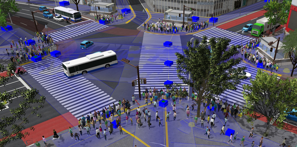
- In addition to architecture, important city elements such as road, intersection, and traffic can be reviewed easily. Users can share the image of active move of human and vehicle and bicycle. This will be effective to simulate railroad, new traffic system, and station square redevelopment.
- We help engineers to operate and explain the VR space.
A VR solution that supports full town development that meets technical standards in an optimized visualization.

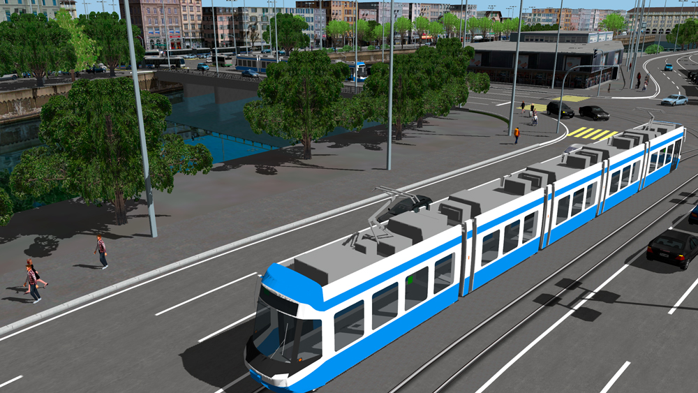
▲Tram simulation VR
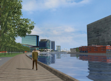
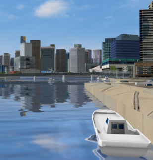
▲Waterfront redevelopment VR
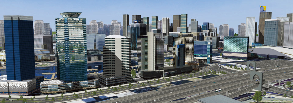
Redevelopment VR simulation This is a material for the review of redevelopment plan including planned roads and a new traffic system. We created buildings in the planned area and faraway landmarks and imported buildings in surrounding areas in IFC format. The data includes context settings about switch of landscape before and after design, season select, change of time and weather, and camera position switch. One driving scenario on the planned road, terrain edit, and plant rendering are available. 
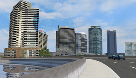
Total Distance (A) 8.030km
Man-day (B) 4.550
Option work Man-day (C) 11.500
Aerial Photos / Additional Cost Optional
Data creation cost USD38,200
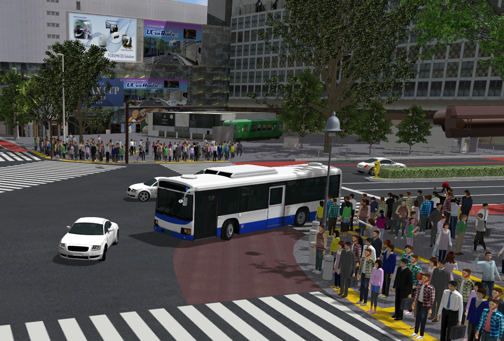
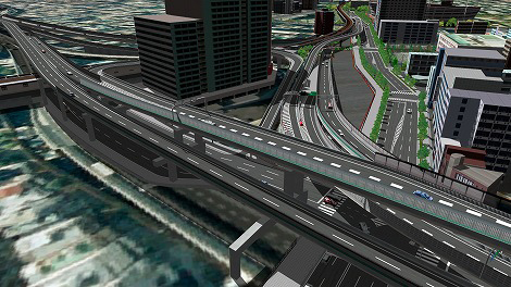
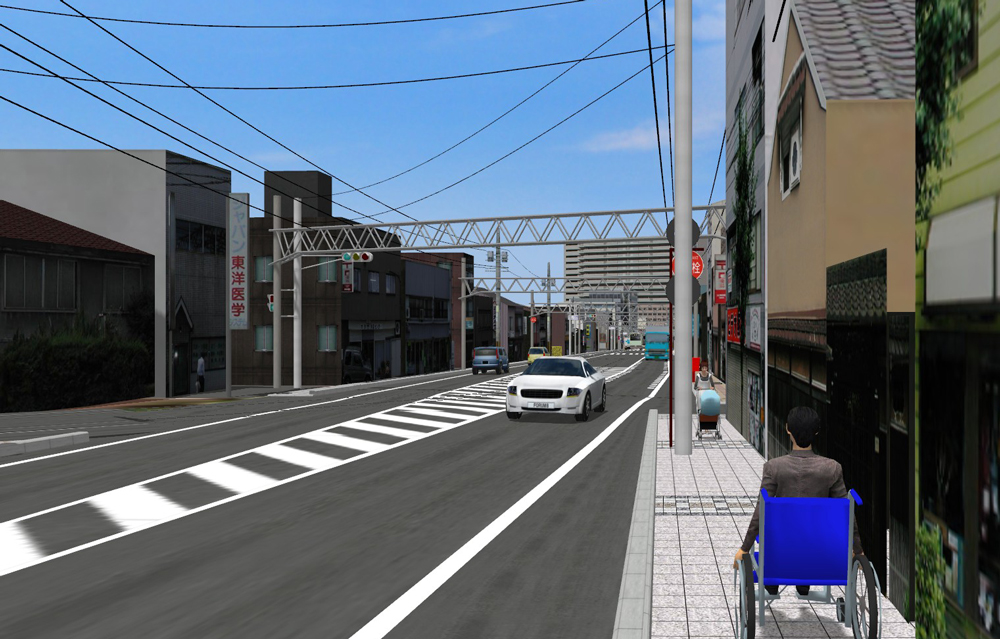
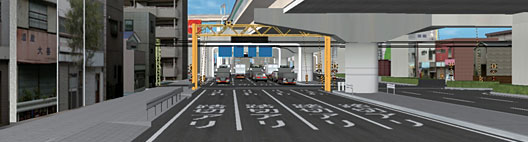
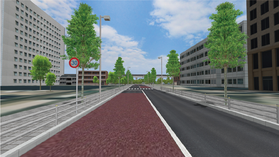
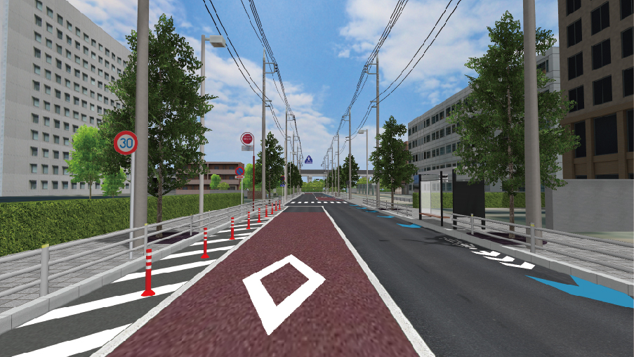
Urban Intersection VR Simulation Large intersection in an urban area with 2 roads and a crossing are shown. It is possible to load point cloud and compare it with VR. Buildings directly impacting the area can be directly translated into the VR simulation by using accurate point cloud measurements. Pedestrians will move around the area freely with the crowd function. 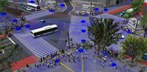

Total Distance (A) 1.705km
Man-day (B) 5.000
Option work Man-day (C) 9.400
Aerial photo Optional
Data creation cost USD14,200
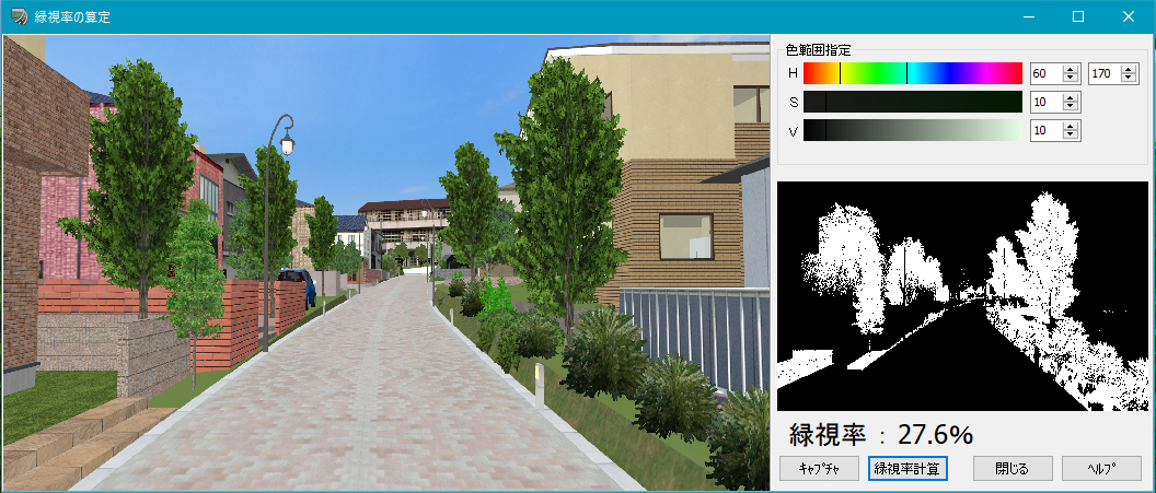
City Planning VR Simulation We created VR as an assessment material for a land development and area arrangement. The VR can be used to check landscapes after the area arrangement, height differences in the developed land, and streets leading to the residential area from the planned roads. In this simulation, users can review the sunshine blocked by high buildings. As for the solar panel install plan on the roof of a low building, the sunshine reflection to south and northern buildings is predicted. The 5m mesh is used for the terrain, and surrounding objects and roadside objects are expressed by samples in RoadDB. It has context settings of the winter and summer solstice. Assessment plug-in is used. 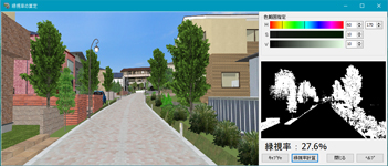
▲Calculate green view rate
▲Sunshine investigation
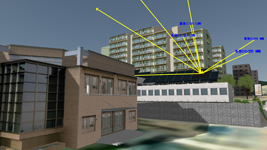
▲Sunlight
Total Distance (A) 1.580km
Man-day (B) 4.100
Option work Man-day (C) 8.200
Aerial photo Not included
Data creation cost USD11,600


Road Project
-
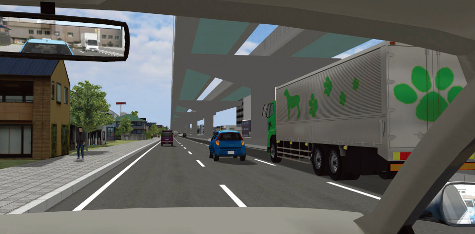
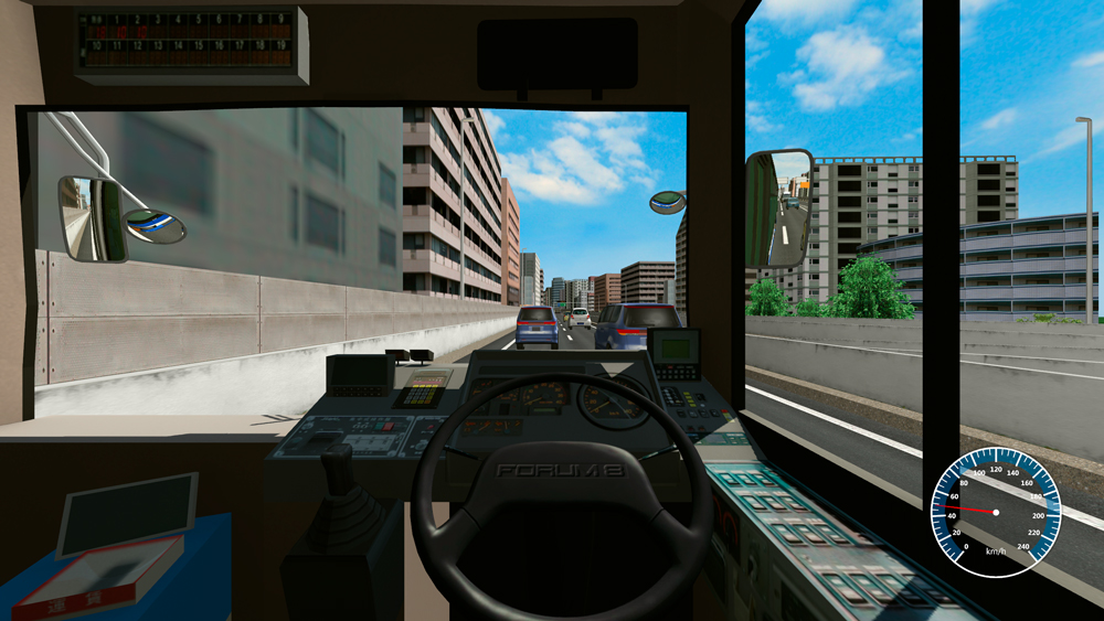
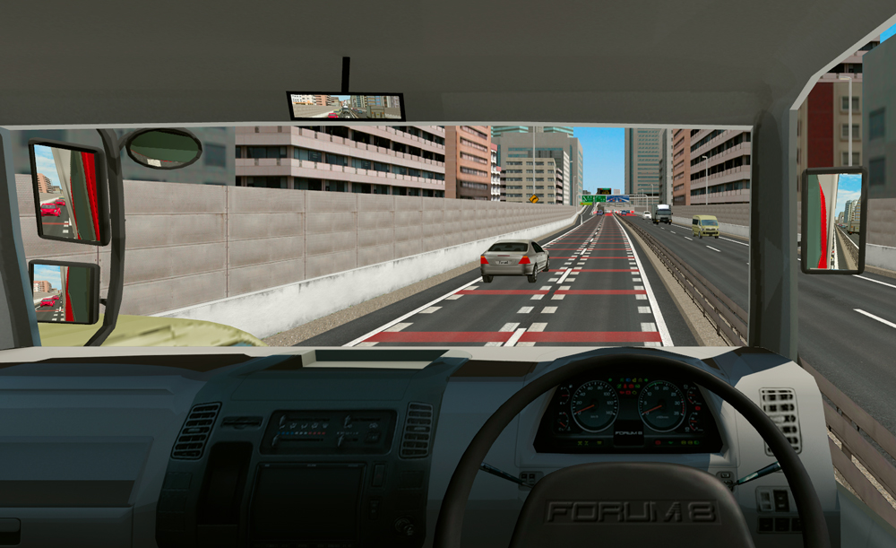
- Controls objects other than own vehicle (other vehicle, pedestrian, signal). Hazardous situations that are difficult to reproduce in real world can be experienced and reviewed in VR.
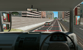
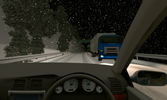
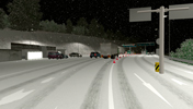
- Date, season, and weather in the created course can be changed. Experiences via driving simulator are supported.
- The VR contributes to the check of issues such as drivability on junction or detour, visibility of road signs, and traffic limitation by visualizing it.
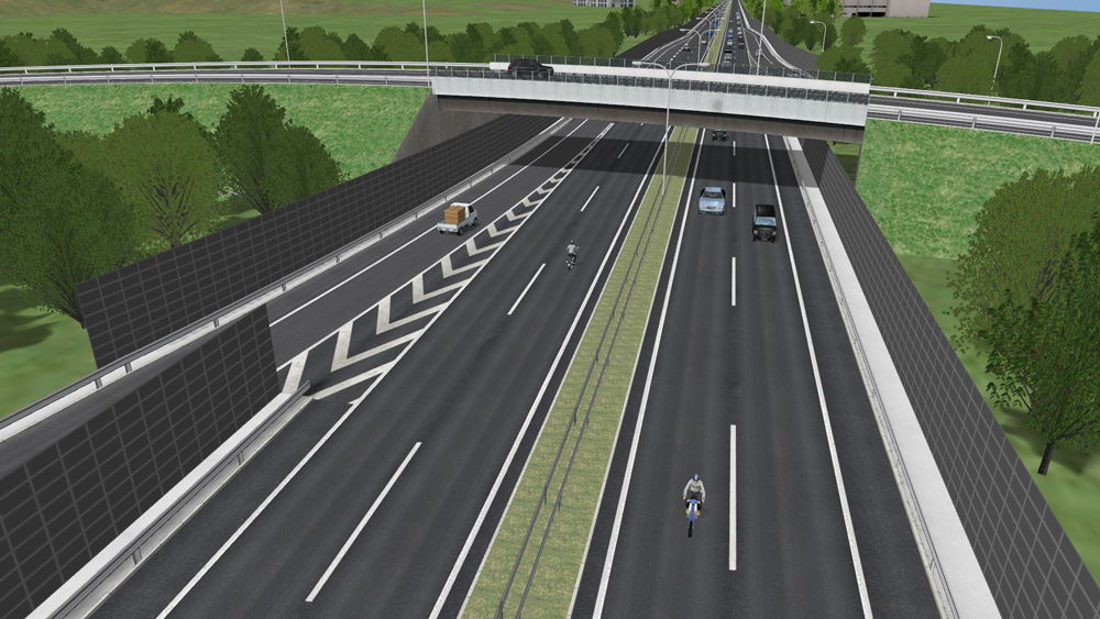
- Creates a driving course of autonomous driving. A cycling route can be created too. These driving courses help users to check roads from each view of cyclist, pedestrian, and driver.
Reproduce hazardous situations in VR and provides driving experience
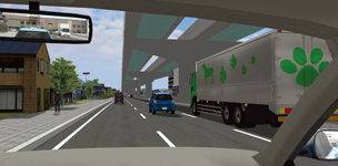
▲Autonomous driving tests using VR
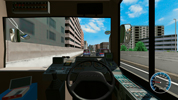
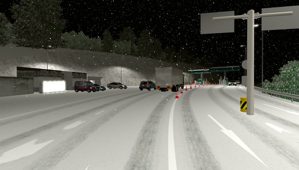
Interchange DS Experiment VR We created a highway intersection VR data that can be used for driving simulator experiment. In the data, drivers simulates driving from a normal road to a highway via a toll gate. We created several merging and splitting scenarios. The VR has a high reality with toll gates and management facilities. ETC lane bars open and close. The scenario control can display other vehicle movement. 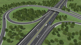

Total Distance (A) 6.666km
Man-day (B) 5.100
Option work Man-day (C) 15.000
Aerial photo Optional
Data creation cost USD39,000
Junction VR Simulation This data contains a JCT with total of 8 ramps in both directions connected to other roads. The complicated road structure is expressed with a road connecting to the main highway after merging in from different ramps. Users can drive on all routes. One autonomous driving scenario is available. 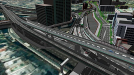
Total Distance (A) 10.895km
Man-day (B) 4.500
Option work Man-day (C) 11.000
Aerial photo Not included
Data creation cost USD47,800
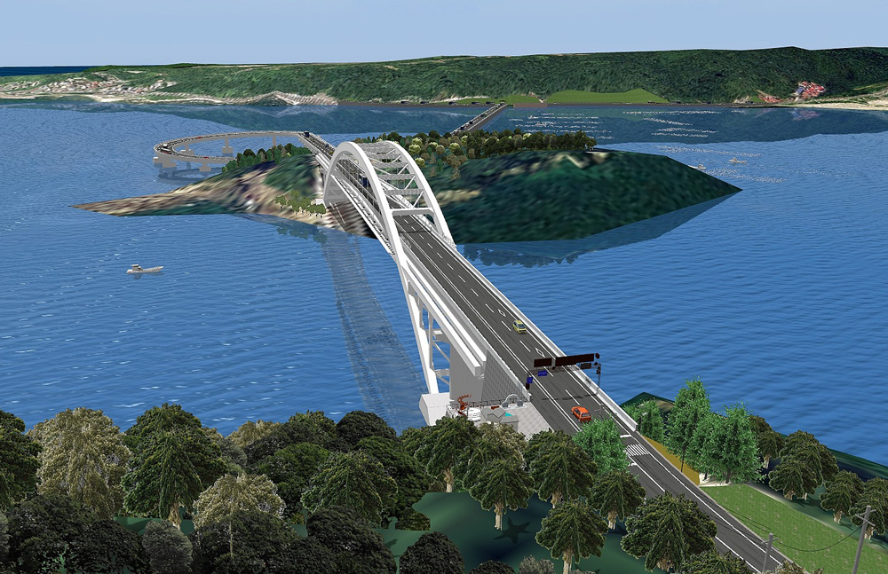
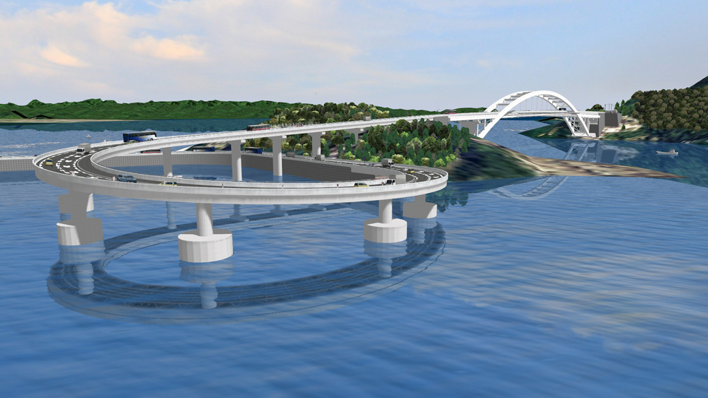
Kushimoto Bridge / Myouga Loop Bridge Simulation Kushimoto Bridge and Myouga Loop Bridge (1.6km) to link Oshima with Kushimoto-cho, southernmost end of Honshu and road data model (0.3km) in Oshima. Kushimoto Bridge designed by Osaka office of Nippon Koei Co., Ltd. This sample data is used as proposal of bridge preliminary design. 

Total Distance (A) 2.985km
Man-day (B) 4.100
Option work Man-day (C) 9.200
Aerial photo Included
Data creation cost USD17,000


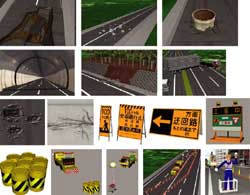
Civil Engineering / Construction Simulation
-
- Easy to imagine construction step
- Utilize point clouds to express the current situation
- Easy to check cutting and banking, landscapes before / during / after development
- Not only construction staff members but also citizens can share and understand construction image.
- Support the data utilization for a new method presentation including video creation.
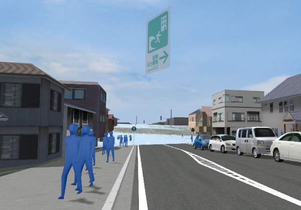
- "Visualize" the range of damage and the arrival time
- Share images and utilize them for evacuation planning and training
Visualize changes over time

▲5th 3D VR Simulation Contest Grand Prix
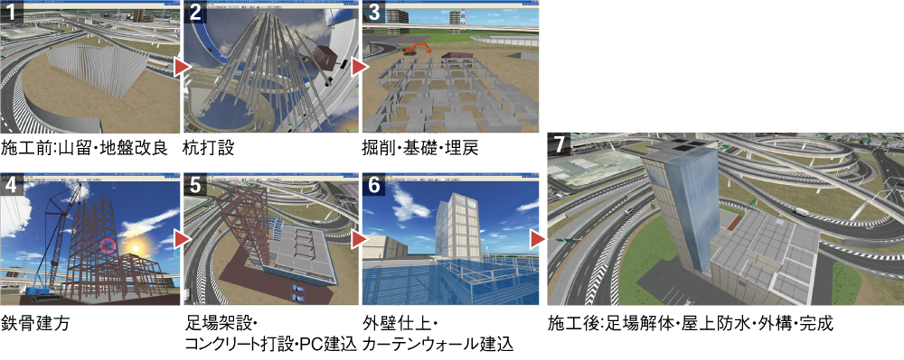
"Daishi Junction and Daishi Ventilation Station Construction Simulation"
Metropolitan Expressway Company Limited, Kanagawa Construction Bureau
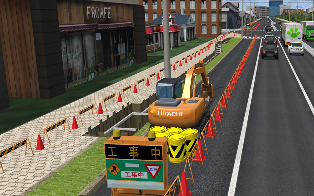
Underground wiring construction VR simulation Data of the underground wiring construction for 100m within a total of 500m-long road. The lane closer is also depicted, and normal road and limited road can be switched. At the construction spot, the landscape switch shows the construction step and safety measures. Buildings, roadside objects, and pedestrians are reproduced. 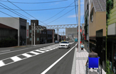
▲Before undergrounding
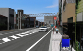
▲After undergrounding

▲Lane restriction
▲After install of common channel
Total Distance (A) 0.740km
Man-day (B) 4.100
Option work Man-day (C) 9.300
Aerial photo Optional
Data creation cost USD9,800
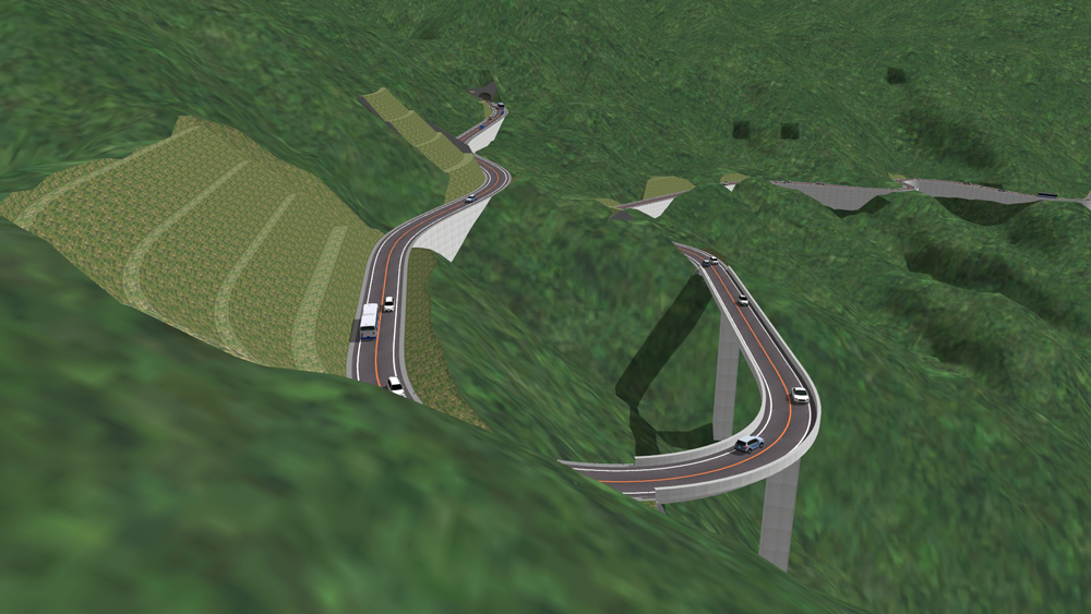
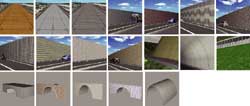
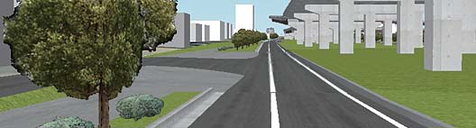
Mountain Road VR VR Simulation This is 2.23km of mountain road data. 1 tunnel and 1 bridge are set in the section. As to creation area, detailed current terrain is displayed, by creating the terrain patch data corresponding 1 meter mesh from terrain contour data (DXF). Cut slope / embankment in each side of road, such as berm are reproduced faithfully. Earthwork volume is also calculated. 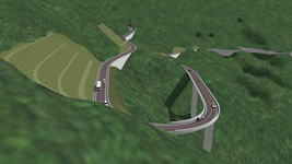
▲Mountain road
▲Earthwork volume calculaion
Total Distance (A) 2.512km
Man-day (B) 5.700
Option work Man-day (C) 5.900
Aerial photo Optional
Data creation cost USD16,100
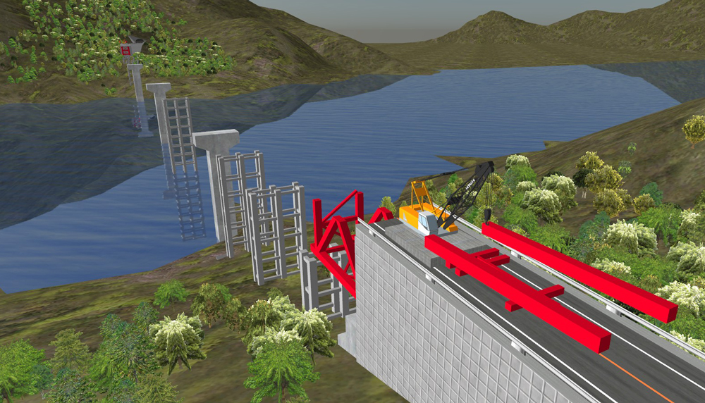
Bridge Erection VR Simulation The data express the bridge erection steps of 560m of road across mountains and a ravine. All erection steps can be seen for the setting of movable models. Synchronizing truss erection with crane action provides the clear erection images and setting of road alignment provides driving images after construction complete. 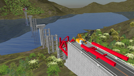
Total Distance (A) 1.074km
Man-day (B) 4.200
Option work Man-day (C) 11.400
Aerial photo Optional
Data creation cost USD12,600
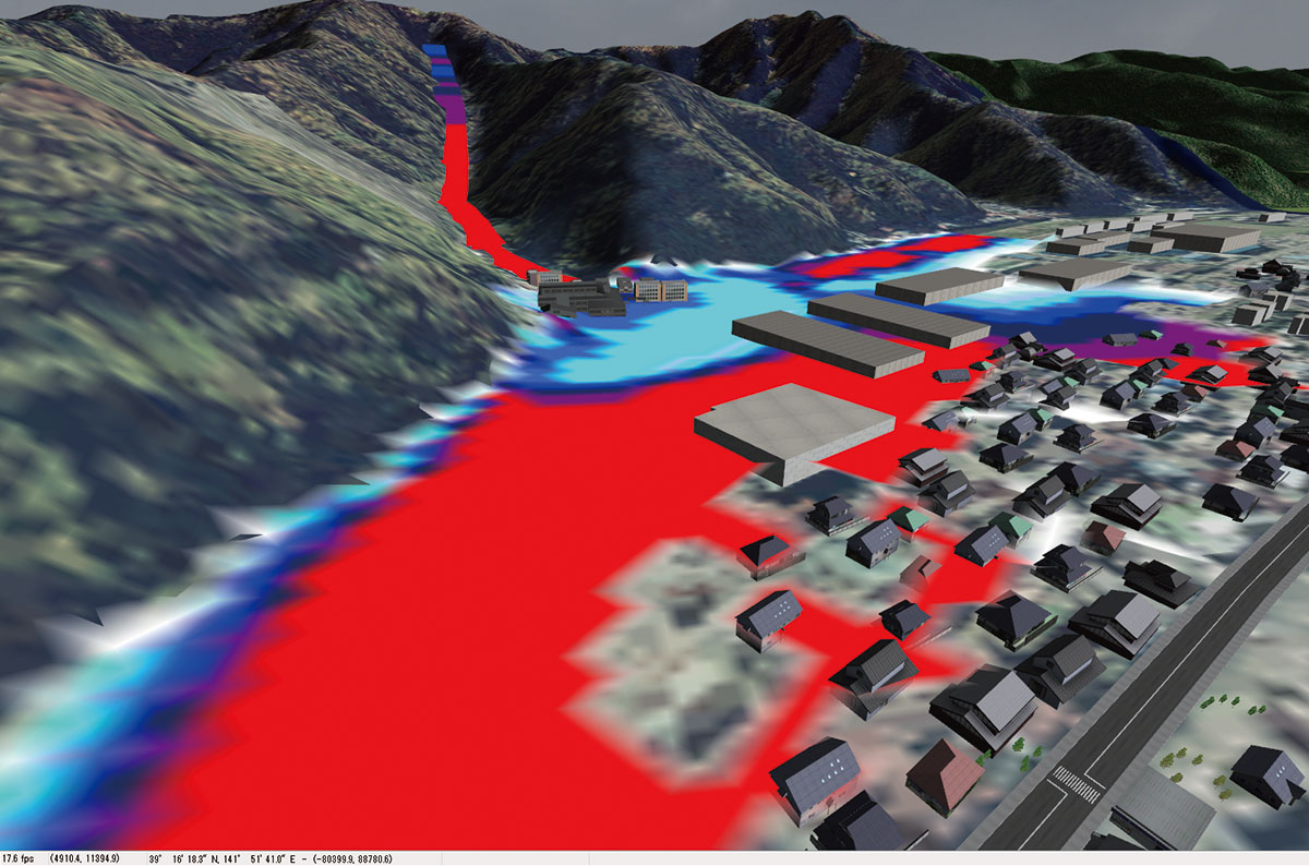
Disaster Prevention/Mitigation Simulation Visualizes analysis results of tsunami, debris flow, and fire
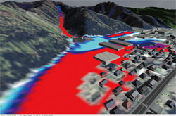
▲Debris flow VR

▲Evacuation drill VR
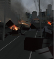
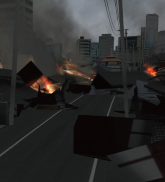
▲Collapse by earthquake / fire VR
Simulation 
▲Driving facilities install VR
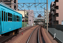
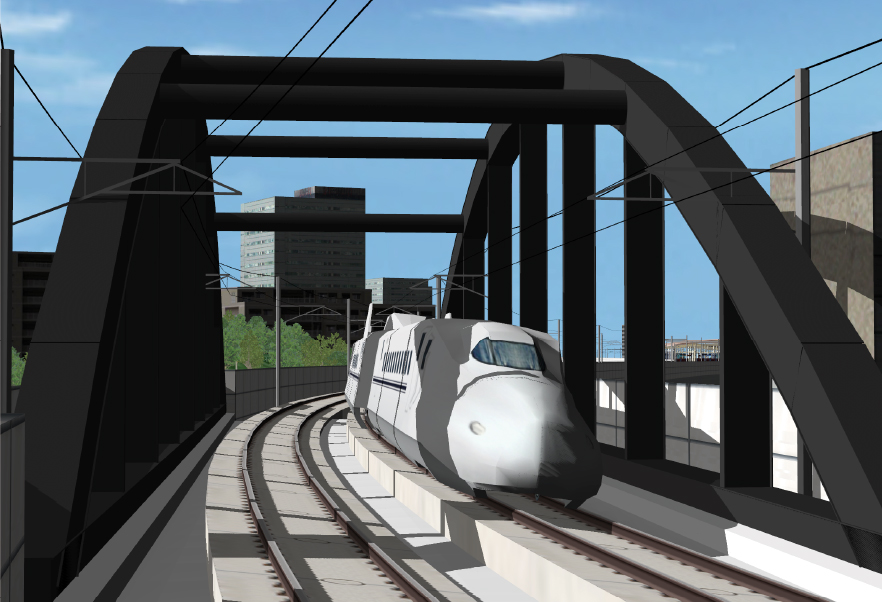
▲Railroad VR
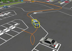
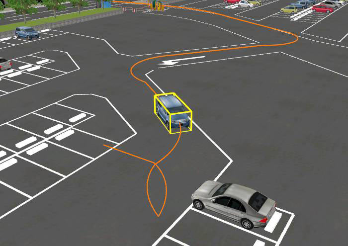
▲Parking lot / Vehicle trajectory VR
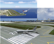
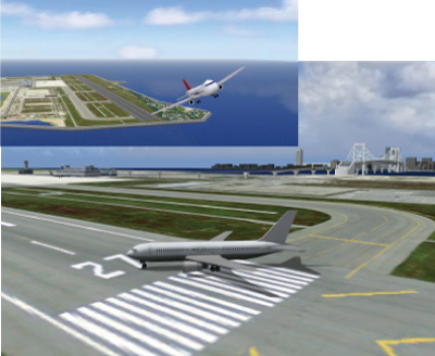
▲Airport VR
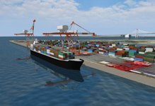
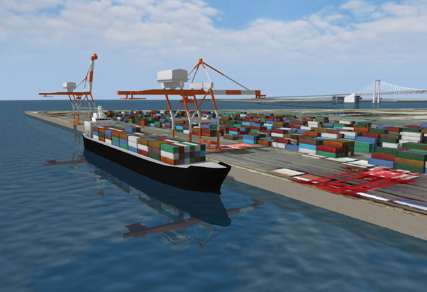
▲Harbor / Container ship VR
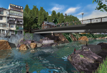
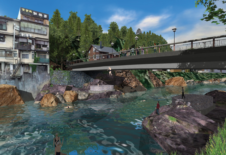
▲Landscape / Sightseeing VR


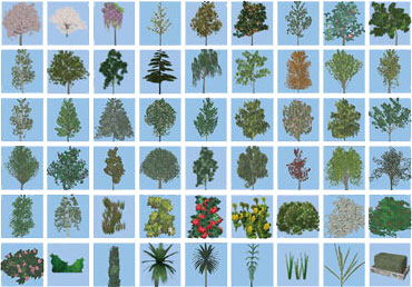
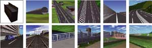
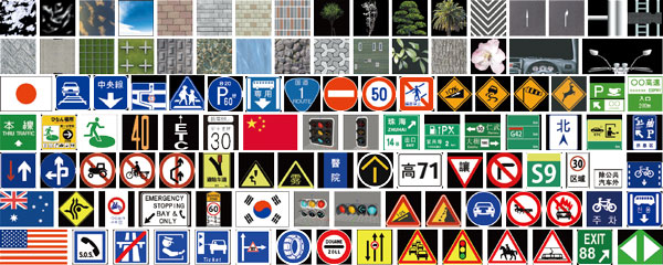
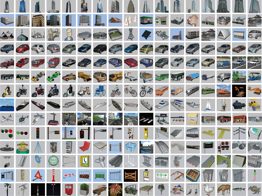
UC-win/Road DB
VR Model DB
-
VR Model/Internet Database
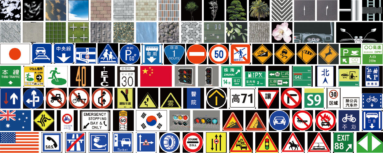
In addition to the standard data including 3D models and textures, extensive downloads are available directly from the UC-win/Road DB on the Internet.
Direct downloading from the product is available. * Free of charge under the subscription contract
The number of registered models (As of January 6, 2012)
●3D model: 3,378 ●Texture: 3,824 ●Section: 67 ●Sample data: 55
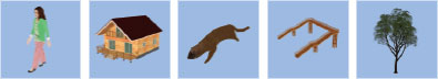
●VR model DB 3D 2D Tree 3D tree leaf / bark / flower 2D tree evergreen tree / evergreen lower tree/ evergreen shrub/
deciduous lower tree / deciduous shrub and tree / flowering
trees and shrub / ornamental foliage plantMD3 Character
Human modelcharacter / animal / human Vehicle / Equipment
Running modelroad vehicle passenger car / truck / trailer / cab / bus / taxi / bicycle /
motorcycle / special kind vehicle3D cockpit railway vehicle Shinkansen / utility railway / new traffic vehicle airport / harbor / river facility port facility / harbor signal equipment / river /
flood control facilityaviation / marine vessel, construction heavy duty equipment, temporary equipment Building / Facility /
Structure modelBuilding / House / Store / Steel tower office building (super high-rise) / (med to low-rise) /
building (low-rise) / condominium apartment /
general home / store /
market / industrial facility/public facility /
transmission towerrailroad / road structure bridge superstructure / bridge substructure / road structure /
gate pier / pedestrian bridge / traffic sign pole / markingrailroad / road facility bridge superstructure / alarm equipment / station /
street light / otherspark facility playground equipment / building / others others sign / traffic restriction / disaster / others Road / Traffic /
Traffic sign texturepaved road / railroad surface pavement surface / railroad surface / others banking / cut planting / concrete block / concrete blasting / others guardrail / curb / footpath bridge truss / girder bridge tunnel / intersection traffic sign indication sign / regulatory sign / guide sign / warning sign /
auxiliary sign / railroad sign
Overseas sign (Korea / China / U.S. / New Zealand / France /
Malaysia / U.K. / Thailand / Netherlands / Ireland / Vietnam /
Germany / India / Singapore / Spain / Columbia / Brazil /
Finland / Australia / Turkey / Lebanon / Poland / Portugal /
Sweden / Switzerland / Iceland / Italy / Austria /
Philippines / Taiwan)marking indication marking / regulatory marking / others /
Korean road marking / Chinese road markingbackground super high-rise building group / mid to low building group /
low-rise building group/ forest / fence / othersbuilding, river, cockpit, sky, flag, terrain, water surface, fire/smoke, others
Model examples
-
3D Model
It makes data creation more efficient by using various standard models. With this, setting up the model editing tool and movements of models is easy. It enables the loading of the structure models designed in UC-1 series or UC-win and import the 3D models with the textures created by other 3D tools as well.

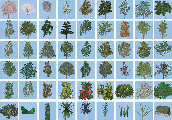
3D Tree
3D tree data only for UC-win/Road.
Including functions for various expressions such as leaves and branches fluttering in the wind and tree growing simulation.
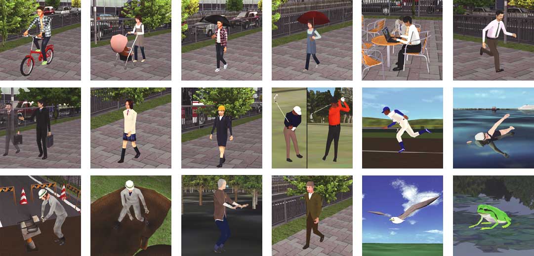
M3D Character

 Sample movie
FBX

Section
Textures such as a cross section form, a road surface, a pavement are available as it is.
Texture
Excellent default textures such as slopes, cuttings, road surfaces, pavements, walls etc. are available. Sky and terrains can be mapped as default, and many special textures such as trees and signs can be arranged according to their specified commands. The textures for cockpit inside vehicles are also available for use while driving.
Example
UC-win/Road VR data download (covering world heritage, etc.)

Construction Method
It supports textures for each construction method. (materials provided by Hirose Corporation)
*HIROSE&Co., Ltd has the copyrights of texture (photo image)
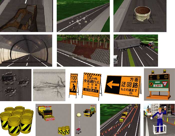
Disaster / Regulation
It supports the models / textures of road hazards.
(materials provided by Road Management Technology Center)
*This database is provided having permission from Road Management Technology Center.


UC-win/Road Standard Cost Estimate List
UC-win/Road Standard Cost Estimate List
-
■UC-win/Road Support System Standard Cost Estimate Standard
▼Estimated Price StructureEstimated price Direct personnel costs [ (Estimated distance A * Work unit (per km) B) + Option work unit C ] × Engineer work unit D Administrative costs Direct personnel costs * 120%
* If direct personnel costs are less than USD500, the minimum fixed administrative costs
shall be uniform at USD600General costs Technical costs(Field survey cost etc.), Express charges(25% extra charge for overtime
working etc.), software/hardware purchase costs, Apparatus rental/transportation,
Satellite photography costs, Transportation costs (actual cost), Work management costs
▼Breakdown of standard estimate
Estimated
distanceCorrection
coefficientRemarks Total extended
distance (km)Sandard cross-section 1.0 Four lane, Guardrail for divided road/pedestrian and
vehicular segregation, No edge-processingCross-sectional change
/ ONOFF-Ramp1.4 Transition area, Emergency parking bay, one-way grade,
On/off- rampGrade crossing 1.5 Depending on a scale of intersection
(exclusive of no processing)IC・JCT 1.7 Total application extended distance /
Using the outer spaces as a preconditionTunnel part・UP 1.0 Exclusive of mine- mouse special processing Bridge part 1.4 Same treatment as a cross-sectional change Construction zone
(Berm processing)1.2 Berm settings (including rounding) Others 0.5 Separate estimate A Subtotal (A) Estimated extension distance
Work Classification Breakdown Correction
CoefficientWork Unit Remarks Terrain information
(Man-day)Standard 50m mesh 1.0 (0.1-0.3) No terrain processing, one mesh block
(10km square ) is 0.1, two blocks are
0.3 and four blocks are 0.4Standard terrain editing 1.0 (0.1-1.5) Surrounding road, around 10m mesh,
Editing rate for the total extended distance.
Processing of tunnel entrance and underpassSpace base use 1.0 0.2 Aerial photo 1.0 (0.2-0.3) Photo image editing is estimated separately.
Pasting reference drawings in case that
accepted data has no plain linear information
but only drawings.DXF conversion 0.5 (1.0-3.0) Correction= multiple of 1.0, which is set
the standard for 200m of straight
road * the rate of total extended road.XML 1.0 (1.0-2.0) Using Road standard XML and LandXML
provided by a userDefinition of liner
(Man-day)IP calculation work 1.0 0.15 IP calculating with Calc_IP.exe developed by
Road technical support. IP calculation,
IP extraction and IP estimation work.IP input 1.0 0.3 When LandXML is provided, it is set
that IP =0.0, vertical section =0.1
and interval setting =0.1VC input 1.0 0.2 Section setting 1.0 0.05 Cross-sectional
definition
(Man-day)Cross-sectional definition 1.0 1.5 0.4 is counted when LandXML is used. Cross-sectional texture setting 1.0 0.2 3DModel ・Texture
(Man-day)Resolution level-Rough 1.0 1.0 Minimum adjustments with only
standard textures.Resolution level-Normal 1.0 2.0 Standard adjustments of models/cross
sections with standard textures.Resolution level-Excellent B 1.0 3.0 Advanced adjustments and creation in space
with based on the collected data or materialsResolution level-Excellent A 1.0 (3.0-5.0) Excellent performance, compared favorably
with live-action video.B Subtotal(B) Man-day per km
▲Resolution level-Normal
▲Resolution level-Excellent A
Work Classification
(Option)Breakdown Correction
CoefficientMan-day Remarks 3D model・texture
(Man-day)3D model 100 elements 1.0 Refer to the sample estimation as below.
A POV-Ray setting model is 1.2 times.
Including the improvement of vehicle
movement model, processing of the edge
of berm and model adjustment.MD3 model 1 body 3.0 Standard level of one human model creation.
Standard human model, standing and
no cloth changing.3D tree 2 types 0.8 Leaf and bark textures making are included Texture 5 textures 0.5 Intersection textures (Rotary and L- shaped)
are two times. Complexity is also considered.Work Classification
(Option)Breakdown Correction
CoefficientMan-day Remarks Settings and adjustment
of simulation (Man-day)Traffic setting 10 roads 0.5 Traffic flow settings. Root adjustments
in an intersection.
Linking with Tracks is 0.1.Signal control setting 1 intersection 0.5 A suit of settings such as traffic signal
model arrangements, stop points,
traffic controls, and phases.
Linking with Tracks is 0.1.
Intersection controls without
traffic signals are 0.25.A model of operation
and a WAY-P setting20P/20PT 1.2 Lane-changing function is included. Flight path setting 20PT 0.3 Man-day input is required for
routing of MD3Default/Before/
After settingBFR/AFT 0.5 Settings of Before/After. Or
arrangements of disaster model.Lake setting 50PT 0.5 Separate estimate for texture creation Lighting setting 10 lightings 0.5 Including bloom setting Script setting 0.7 20STEP is counted as 0.7 Man-day. Scenario setting Normal 0.5 1. Normal 0.5 Man-day per 1 event
Events are basically organized in order.
Events transition determination is
performed but the transition is not
included. An example of event
transition is collision determination.
Repeat trial is required in this case.Scenario setting Excellent 1.0 2. Excellent 1 Man-day per 1 event
Including events transition by advanced
condition determination.
Events in the scenario
include repeat processing.Context setting 5 types 0.5 Point cloud 0.1 Vehicle performance
setting0.5 Data linkage 0.5 Others, data setting 1.0 Planting, intersection processing,
model arrangements, POV-Ray adjustment,
simulation, panel setting,
context setting, road merge,
and other data adjustment.
A POV-Ray adjustment is included.
Input for each estimate is required,
depending on the volume of data.Work Classification
(Option)Breakdown Correction
CoefficientMan-day Remarks Output
(Man-day)Screen
outputA4 1 sheet 0.07 A3 1 sheet 0.1 AVI
output
(1 minute)Rough 1.0 No processing. Capture only. Normal 2.0 Medium resolution is provided with
simple simulation. High resolution is
provided with advanced simulation,
including compositing photographed images.Excellent 4.0 Editing and additional effects based on
a making scenario.Sound Sound setting Separately UC-win/Road settings Sound input Separately BGM Separately Guide Separately AVI
mergeNormal Separately Excellent Separately Perspective
view
creationRough Separately Reference: SXGA-1, 30,000, A3 laminating
Reference: A POV-RAY image file
(1024*768)Normal Separately Reference: UXGA-1, 50,000, A3 laminating
Reference: A POV-RAY image file
(1280*1024)Excellent Separately Reference: one WUXGA class-1, 100,000,
A3 laminating
Reference: A POV-RAY image file
(1600*1200)C Subtotal(C) Option Man-day
FORUM8 engineers standard work breakdown list Man-day unit cost per engineer Engineer A 10% USD51 Engineer B 30% USD121 Engineer C 40% USD131 Engineer 20% USD58 D Man-day unit cost(D) USD361
Direct personnel costs E Total E = (A*B+C)*D USD0
Administrative costs F Administrative costs(F) 120% of Direct personnel costs
* If direct personnel costs are less than USD500, the minimum fixed administrative costs
shall be uniform at USD600USD0
Costs Technical costs(Field survey cost etc.) Express charges(25% extra charge for overtime working etc.) Software & hardware purchase costs Satellite photography costs Apparatus rental and transportation Transportation costs (actual cost) Others G Subtotal of costs(G) USD0
Tax Tax(H)
Total Estimated Grand Total costs(E+F+G+H) USD0
■Approximate Estimate <Approximate Estimate per 1Km> 1. Standard cross-sectin, Low precision, Not subject to treat details of terrain,
No extra work= About USD2,100 2. Bridge, On/Off ramp cross-section, Standard precision, Not subject to treat
details of terrain, No extra work= About USD3,800
WEB Estimate Service >>https://www2.forum8.co.jp/road_est_en/
Standard estimation criteria and estimate examples
-
Check the estimated cost of 3D virtual reality simulation data creation on the web.
Breakdown
Direct personnel costs [(Estimated distance A×Work unit (per km) B) + Option work unit C] * Engineer work unit D Administrative costs Direct personnel costs * 120% Costs Technical cost, express charges, Software & hardware purchase costs,
Apparatus rental and transportation, Satellite photography costs,
Transportation costs (actual cost), Work management costsStandard estimation criteria and estimate examples Standard estimation criteria and estimate examples per 1km(Excel sheet) 
Bridge, On/Off ramp cross-section
Normal precision
Not subject to treat details of terrain
No extra work
Data creation cost About USD3,800 
▲Rough precision
Standard cross section
Rough precision
Not subject to treat details of terrain
No extra work
Data creation cost About USD2,100 
▲Excellent B precision
Bridge, On/Off ramp cross-section
Excellent B precision
Not subject to treat details of terrain
No extra work
Data creation cost About USD5,500
Order / Contact Us
Order / Contact Us
-
Inquiries about UC-win/Road
Contact us from Sales inquiry or email to ist@forum8.co.jp or forum8@forum8.co.jp


LOADING