
November 20, 2019
FORUM8 Co., Ltd.
| FORUM8 has released VR Design Studio UC-win/Road Ver.14 - Enhanced simulation and rendering functions. 360 degree video, object detection - |
FORUM8 Co., Ltd. (2-15-1 Konan, Minato-ku, Tokyo. President Yuji Ito. URL: http://www.forum8.co.jp/english/) has released 3D virtual reality software UC-win/Road Ver.14.
VR-Design Studio UC-win/Road whose first version was released in year 2000
is an advanced real-time simulation software based on 3D VR technology
which is now being for a wide range of applications including urban and
transport planning, vehicle development, and information system. The program
helps the easy creation of large 3D space and various simulations such
as sunshine, weather, traffic flow, and driving. It won the Software Product
of the year in 2002, and FORUM8 has enhanced the functions for each version
up.
The simulation and rendering functions have been improved in the latest
Ver.14.
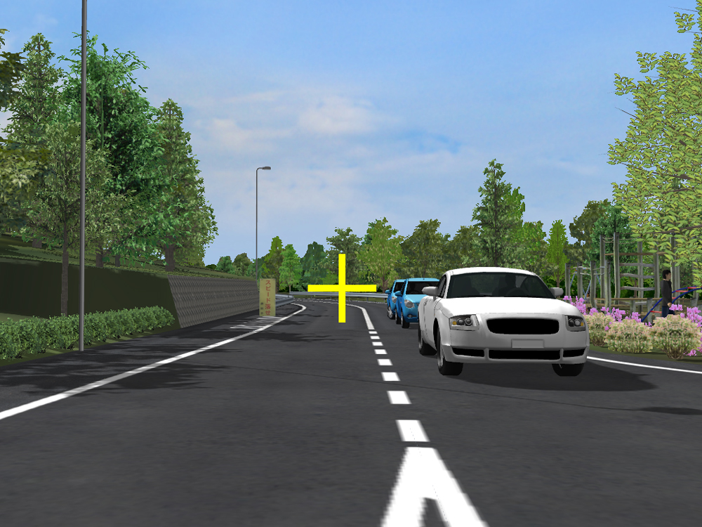
The Gaze Tracking Plug-in Option computes the direction of user's line
of sight from the measuring device and displays where the wearer is seeing.
By using the Object Detection Plug-in, object information detected in UC-win/Road
can be acquired and utilized. In addition, the program is now equipped
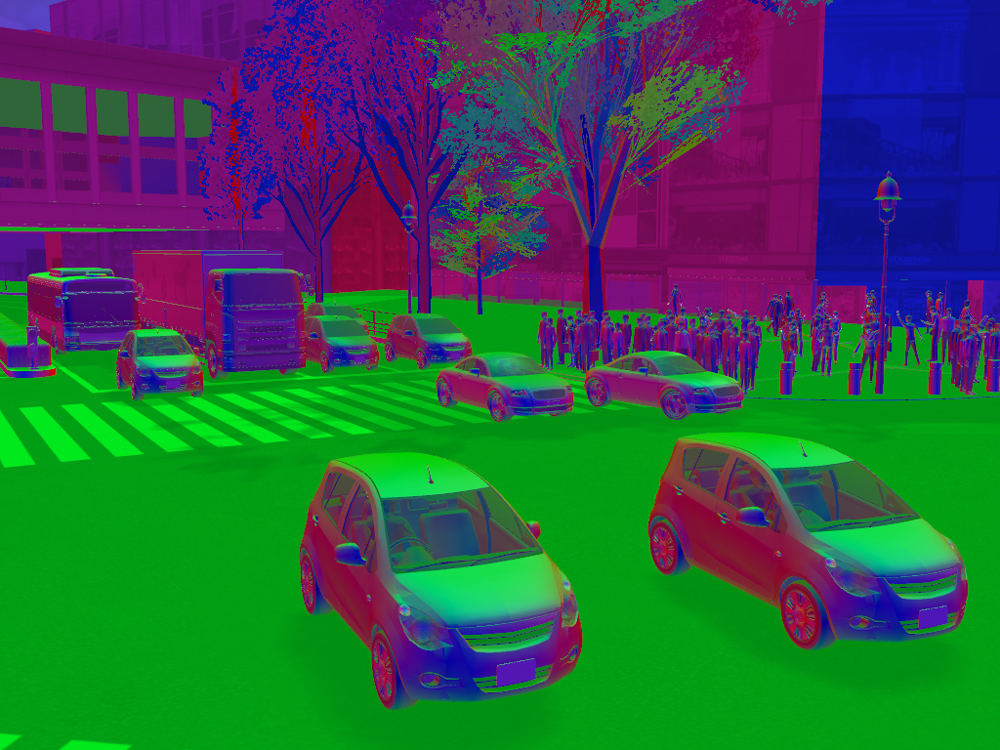
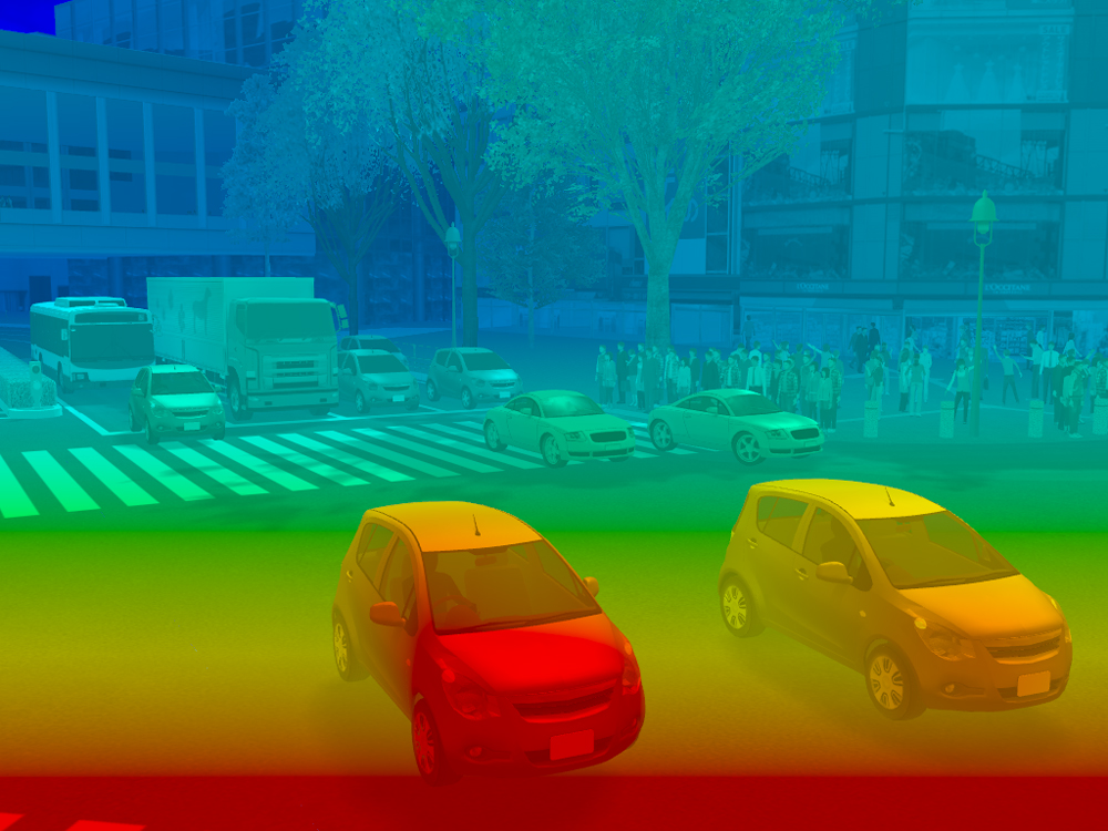
with the 360 degree rendering function and the rendering processing customization
function that enables coloring based on data of object type, drawing normal,
depth, object speed, and acceleration, etc.
Functions that can be utilized for advanced R&D in wide range of fields including autonomous driving, ADAS, and mobility have also been expanded. For example, plug-ins for the simulation real-time linkage and the VISSIM linkage are available now.
[UC-win/Road Ver.14 Revised contents]●Simulation linkage
・Gaze Tracking Plug-in Option
・Object Detection Plug-in Option
・Simulation Realtime Link Node.js linkage
・VISSIM Link Plug-in
●Rendering function
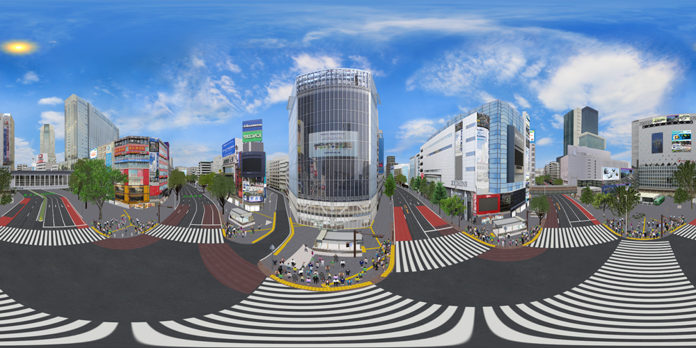
・360 degree video renderer
・Custom shader sample renderer: Coloring by object type, information of normal, and depth data
・The correction of distortion when importing GSI map
・Alpha blending of street map
・360 degree video on 3D video wall
 |
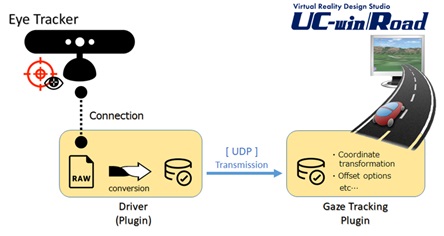 |
| ▲Draw the point where the subject is seeing in real time based on data received on eye tracker | |
 |
 |
 |
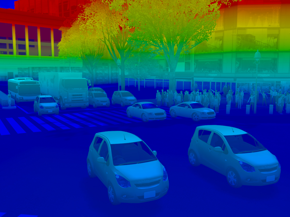
| Information of normal | Depth information | |
 |
 |
|
| Speed information | Information of height from ground |
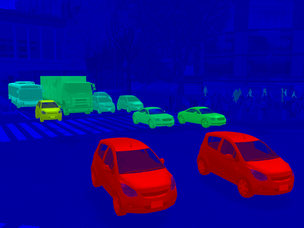
Segmentation by object selection |
| ▲Example of shader customization | ||
 |
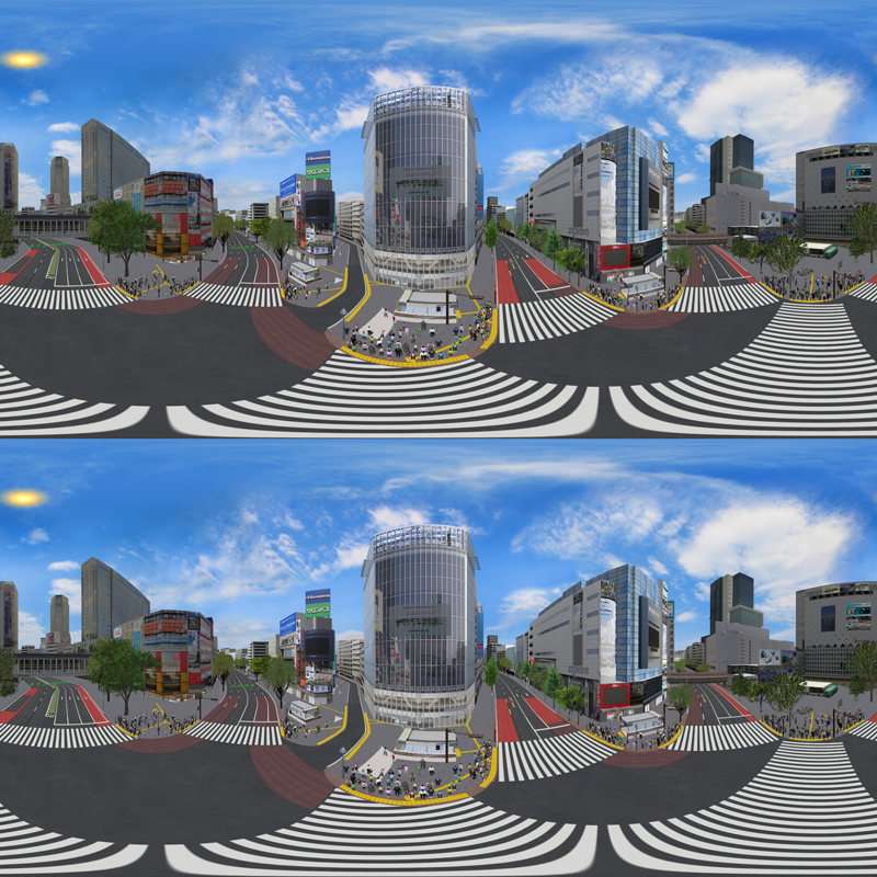 |
| ▲Monocular 360 degree video | ▲Stereo 360 degree video |
[Related Information]
▼VR Design Studio UC-win/Road Product Information
http://www.forum8.co.jp/english/uc-win/ucwin-road-e1.htm