Preface Preface
As one of the applications of 3D information in surveying and construction
field, 3D modeling of point cloud data, which is surveyed on site by using
high accuracy GPS-based mobile measuring device, is drawing attention.
In a FORUM8-conducted sample project, we used the data from Umi-hotaru
(sea firefly) parking area along the Tokyo Bay Aqua Line Expressway measured
using Mitsubishi Mobile Mapping System (MMS). In this page, we are going
to update you with the latest information on Point Cloud Data Plug-in option
which can import point cloud data into UC-win/Road.
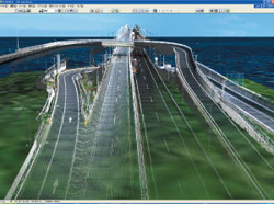
Sample project
Umi-hotaru is an artificial island along the Tokyo Bay Aqua Line Expressway.
Its complex structure, consisting of flyover ramps, a tunnel, a bridge
and a parking space, makes this structure a perfect example to illustrate
the benefits and setbacks. In this project, a VR model of the structure
was successfully produced after minor adjustments using a conventional
modeling tool.
- Data file (In case of Umihotaru, an excel file which has 17,000,000 coordinates)
- File format: X-coordinate, Y-coordinate, Z-coordinate (Height), R value,
G value, B value
 |
 adjustment with VR Mesh Reverse adjustment with VR Mesh Reverse |
Benefits and setbacks of using "point cloud" data
Advantage
- Accurately measure objects and roads in full 3D
- Makes it easier to understand the project
- The perfect way to validate data.
- Use in conjunction with CAD and Google Earth Measurement
Disadvantage
- More time consming
- Extra training may be necessary
- PC with larger capacity may be required
|
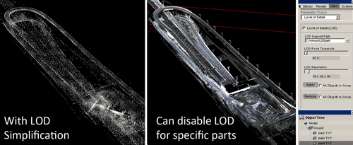
Point Cloud Data Plug-in option
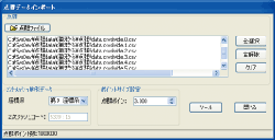
| As well as the import of point cloud data, Point Cloud Data Plug-in option
has many more features. This option enables you to import point cloud data
obtained using surveying tools, such as laser scanner, into the 3D VR software
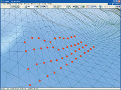
and display the imported data at a specified position. To convert the terrain
data, TIN data is generated from the laser-scanned point cloud data and
then terrain patch function can be used to model the terrain. Repositioning
of the point cloud data is possible by moving the point clouds sideways
or rotating them. For exporting data, you can export point cloud data to
Land XML data, so that the generated data can be used on other systems. |
|
Point Cloud Data Plug-in window |
 |
|
 |
| Screen shot of imported point cloud data |
|
generation of terrain TIN data, terrain modeling |
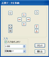 |
| position adjustment of point cloud data |
| N,S,E,W buttons |
: |
to move in the direction of North, South, East or West |
| UP,DN buttons |
: |
to move up or down |
| Rotation button |
: |
to rotate around the rotation axis |
The application examples of "point-cloud" data
- Use as reference points when creating roads in UC-win/Road
It can be used in combination with Mobile Mapping System as a processing
tool or a VR modeling tool
- Use for reverse analysis in VR model of UC-win/Road
"Point-cloud" data can be used for validation of VR model. For
example, it can be used to ensure accuracy when creating VR data, and also
for aging and deterioration diagnosis and differential analysis.
Mitsubishi Mobile Mapping System (MMS)
- MMS is a High Precision Mobile GPS Measuring Device. Locate the position
of objects using laser scanner and camera to create a highly accurate 3D
map of an urban area.
- MMS is equipped with three GPS aerials, an IMU, cameras and laser scanners
on the roof of the vehicle, and three DPS placed in triangle captures the
vehicle movement very accurately.
- With 100usec resolution, the accuracy of the data collection does not deteriorate
even when travelling at a higher speed. Up to five cameras and five laser
scanners can be connected to the system.
|