|
||||||
 |
|
|||||
|
||||||
|
||||||
|
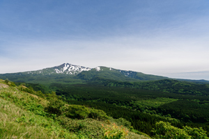
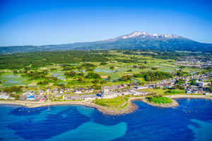
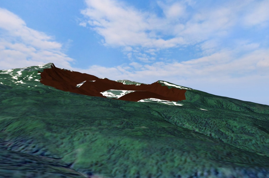
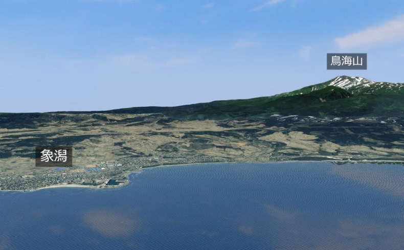
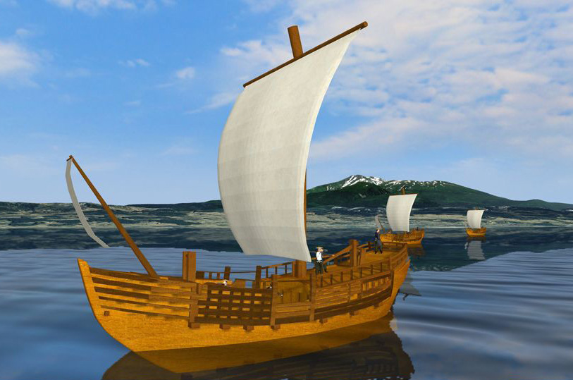
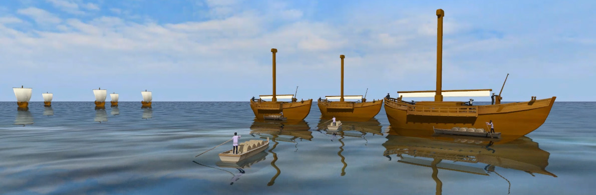
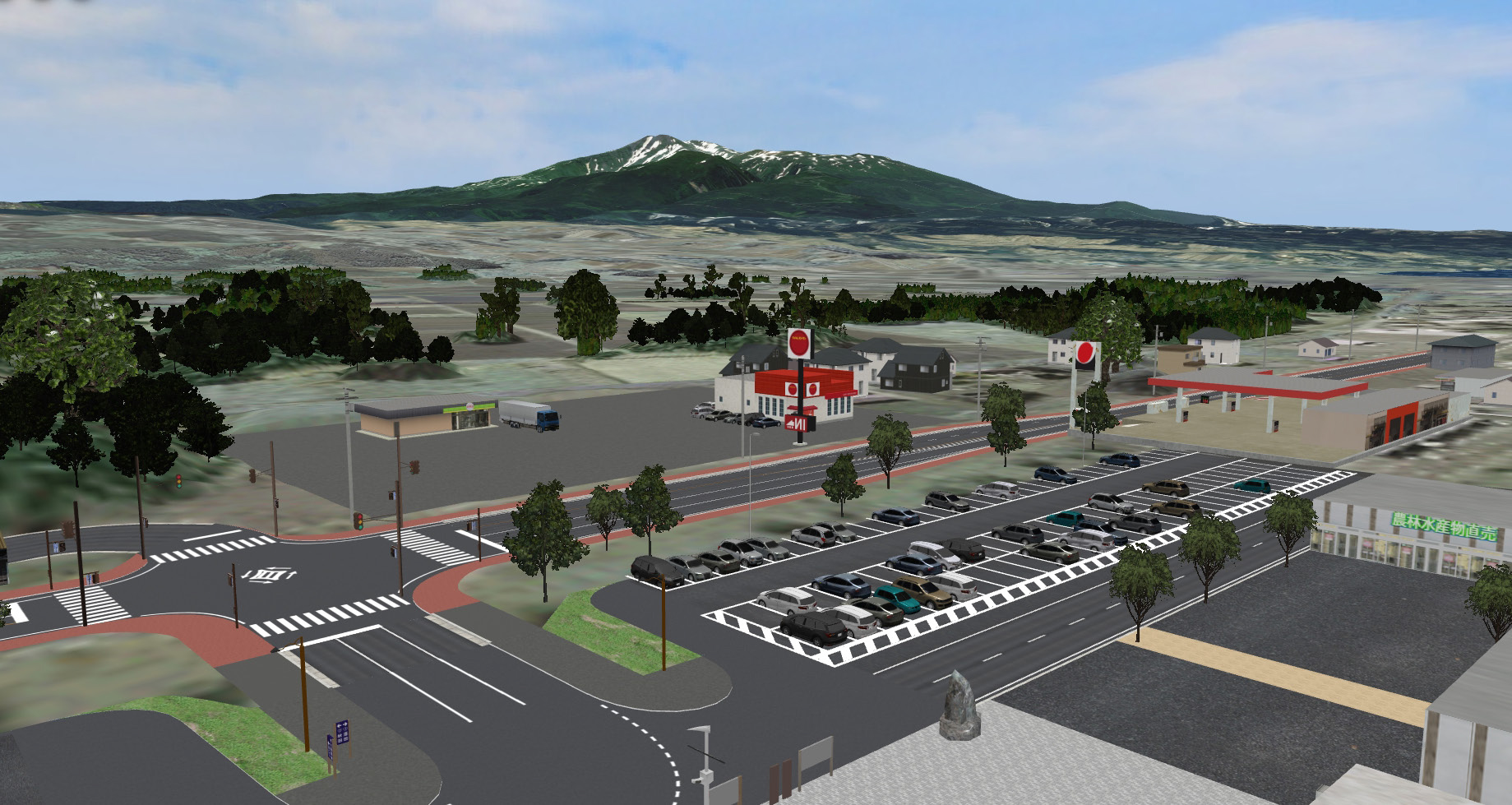
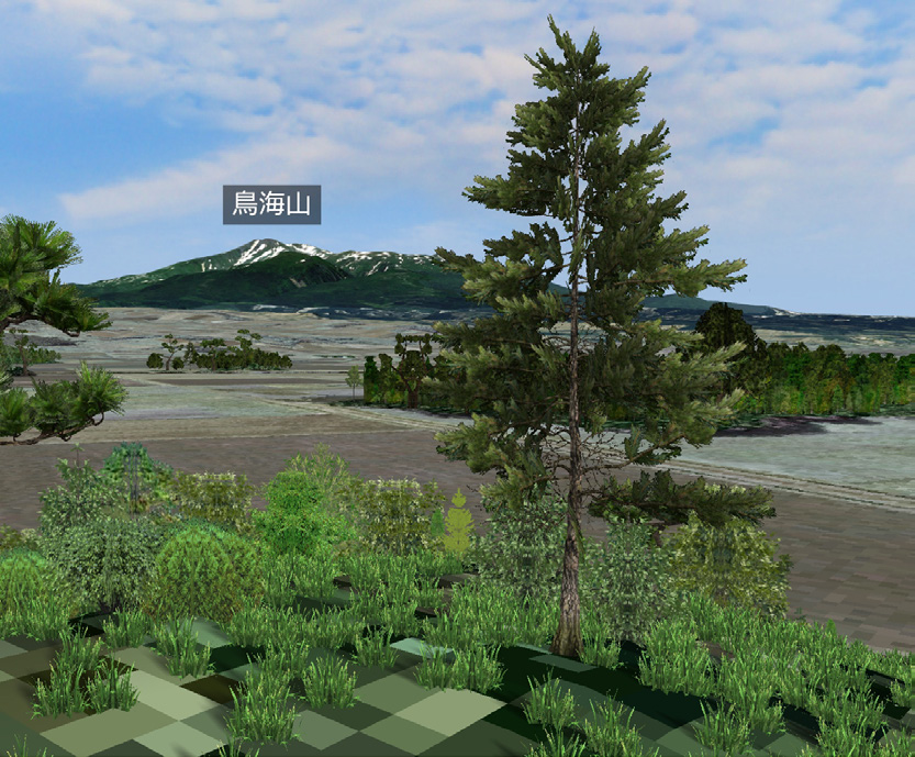
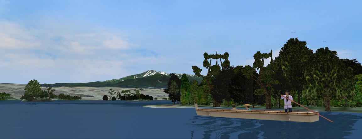
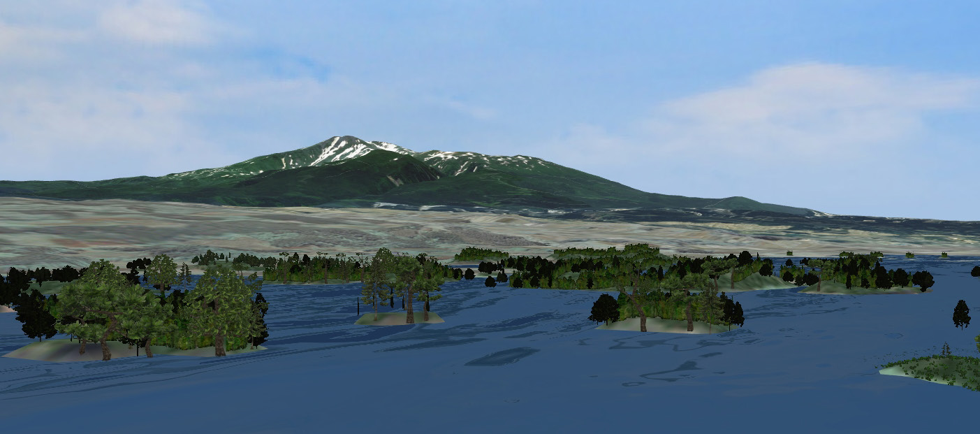
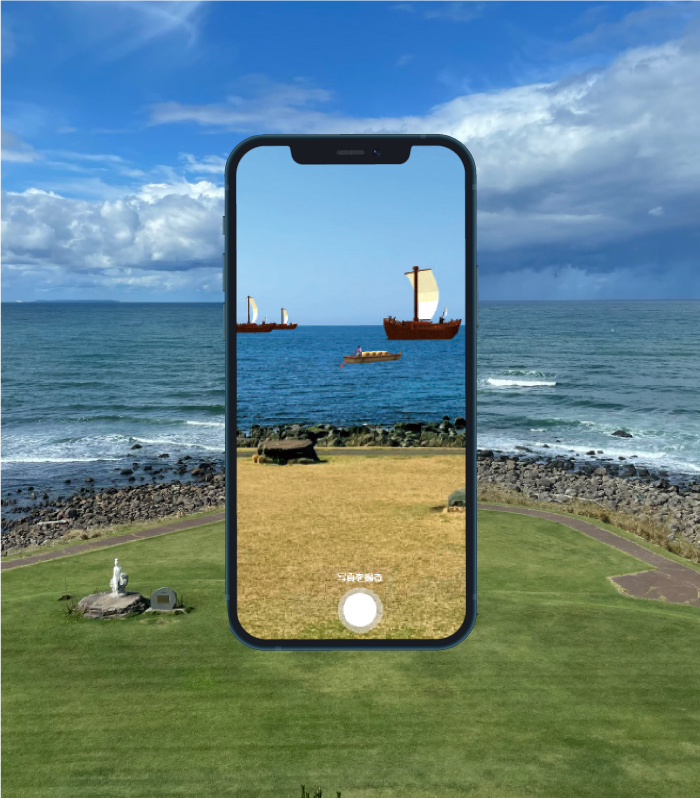
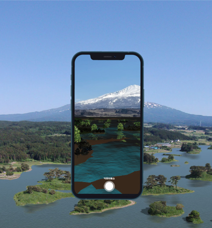
Meanwhile, Mr. Ichikawa, who had been thinking from early on that the city should apply digital technology to its administrative processes, promoted it upon becoming mayor. In such context, he had an opportunity to visit FORUM8's headquarters in Tokyo in 2020. There, he was exposed to a variety of VR solutions with UC-win/Road at the core and realized the high level of its technology and potential. He came up with the idea that Nikaho City could apply these technologies to representation of the sector collapse of Mt. Chokai and the transition of Kujuku Islands, which had long been a concern. This led to the budgeting of the project for the following fiscal year of 2021, he recalls. Mt. Chokai is considered to be formed by the volcanic activity about 600,000 years ago. The sector collapse and debris avalanche that occurred approximately 2,500 years ago (466 B.C.) caused about 6 billion tons of sediment to collapse from the summit. Some of it flowed over the coast into the Sea of Japan, bringing about the terrain to the current city area consisting of shallow sea and numerous small islands, which are similar to its present appearance. Later, after many years of sedimentation, the shallow sea became a lagoon, and trees grew on the islands, creating the original shape of Kujuku Islands widely known for their spectacular scenery. It is assumed that this is exactly what Matsuo Basho who visited the area in the 17th century and many other poets and haiku poets saw when they observed Kujuku Islands. However, the 1804 Kisakata Earthquake caused the area of Kisakata to be uplifted by about 2m. This caused the lagoon to become land. On the other hand, due to efforts to preserve the landscape opposing to the growing momentum for development that followed later, the nature and landscape of the Kujuku Islands of Kisakata has been preserved to this day with its numerous flowing mountains at the foot of Mt. Chokai and farms that fill the areas surrounding them, which are designated as a national natural monument. The city's initiative of this time aimed to make it easy for everyone to experience the regional landscape transition focused on Mt. Chokai and Kujuku Islands up to the present day through advanced AR/ VR technology. Creating AR Capable of Reproducing Kisakata from Sector Collapse of Mt. Chokai to Present, including Kitamae-bune (Cargo Vessels in the Old Days) In working on a project of creating AR contents about Nikaho City, firstly 3DVR of the current state of Nikaho City was created as its base. Then, the following process was reproduced on top of the VR of the current state: 1) The sector collapse of Mt. Chokai and the debris avalanche that occurred about 2,500 years ago brought about a shallow sea and numerous small islands. 2) These eventually transitioned into the scenery of Kujuku Islands, which have attracted people since ancient times and are most likely witnessed by Basho. 3) When the Kisakata Earthquake occurred in 1804, the lagoon was converted to land, looking like what it is today. At the same time, focus was put on the "Kitamae-bune," which played a major role in shipping on the Sea of Japan from the Edo period to the Meiji period. Konoura-minato, Mitsumori-minato, and Hirasawa-minato in the city are designated as Japan Heritage sites as ports of call for "Kitamae-bune". The contents also represent what the area looked like from the ships sailing by before the lagoon was converted to land. Among them, the outcome of the work-in-progress stage featuring the Kitamae-bune was also submitted to the "3D VR Simulation Contest on Cloud" at the FORUM8 Design Festival in November 2021, receiving the Honorable Judge Award Chiikizukuri Award. From April 29, an AR-based sightseeing service was launched. For example, when visiting the south observatory of the Nikaho Plateau, which is located at the southernmost windmill area of Nikaho Plateau with a 360-degree view of the area, anyone can easily experience AR by pointing a smartphone at the Japan Sea, Mt. Chokai, or Higashi-Chokai Caldera wall which is a trace of the sector collapse of the mountain etc.
Development to WebVR, with a View to Further Effective Use in the Fields of Tourism and Education "The next challenge for us is to make better use of what we have created this time," said Mayor Ichikawa. One of the projects underway is to enable people to have the same kind of experience as the AR-based tourism service, which can only be obtained by visiting the actual spot, through WebVR from their home PCs or smartphones connected to the Internet.
Key to Broad Applicability of AR/ VR is Imagination in Line with Regional Issues "Although our region had a reputation as a good place for having mountains and the sea, we were not able to provide information about them very successfully. However, Mayor Ichikawa realized the effectiveness of AR/ VR as a means of providing information after having an opportunity to use AR/ VR in the concerned work. He also mentions new possibilities in terms of visualization. He envisioned that this technique can be applied to town planning to show what kind of town it should be, or to creating scenes of predicted future while utilizing the city's resources. This should be helpful in leading to a more convincing explanation to the citizens. On the other hand, FORUM8's 3DVR technology, which until then had accumulated extensive records mainly in the field of infrastructure development, was introduced to the field of tourism. This experience made him convinced that there were no restrictions on the fields in which the technology could be applied. In that case, although FORUM8 makes suggestions such as "How about using it in this way?", it is important for the users to have ideas on how the users can utilize the FORUM8' technology as their own when provided by FORUM8. In other words, as long as the government spends taxes in doing a certain activity, it is not enough to just say "Let's do it because it looks interesting". The Mayor says that imagination is required to successfully match the project to regional issues. "AR/ VR can probably be used in any field, including education and welfare as long as we try to use it. Therefore, I think that if we make it a rule to imagine using AR/ VR in line with our own regional issues on a regular basis, we can make the most of this kind of technology." |
|||||||||||||||||||||||||||||||||
| (Written by Takashi Ikeno) (Up&Coming '23 New Year issue) |
|||||||||||||||||||||||||||||||||
|
||||
|
||||


