Calculation of Vehicle Trajectory, Trajectory Mapping
Vehicle Trajectory Mapping System Ver.4
Initial Release:2010.09.15 / Latest Ver.:2020.09.18
- Vehicle Trajectory Mapping System Ver.4
- USD1,730
- Vehicle Trajectory Mapping System
(Japan Std./Chinese Ver.) - USD1,730
Related Product
Parking Drawing System
UC-win/Road Parking Lot Plugin

Electronic
Delivery
SXF3.1
Program Overview
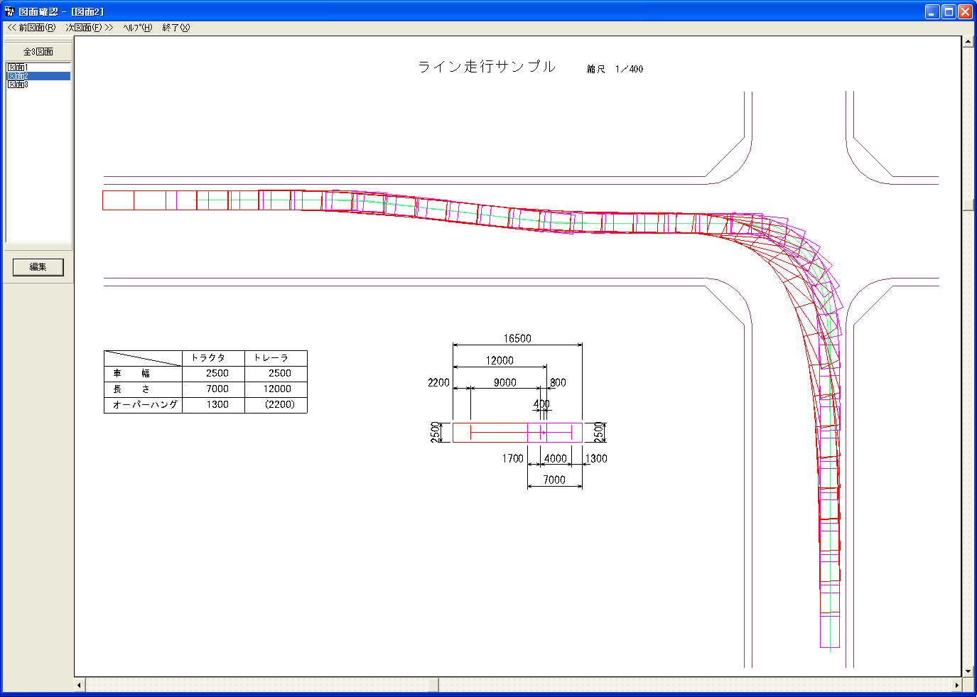
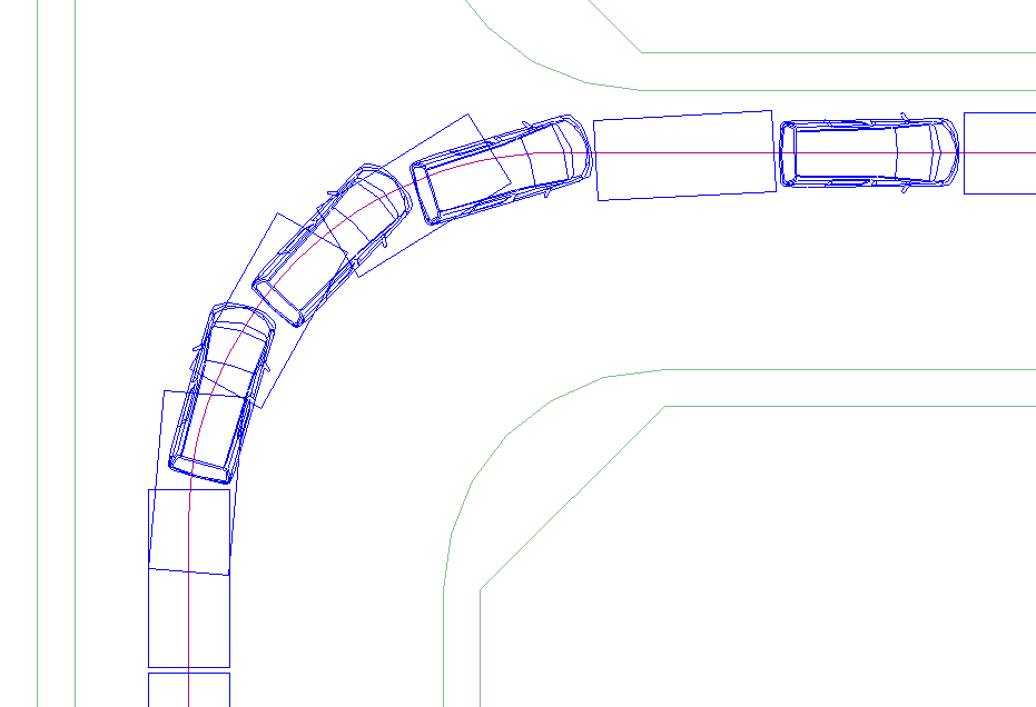
Based on the drawing theories written in each standard, this system calculates and illustrates the vehicle trajectories. Driving simulation on real and hypothetical driving routes can be realized and the vehicle trajectories can be drawn up efficiently, making it useful as a reference for when making decisions. Vehicle turning trajectory model that is required for the permission for passage of special vehicles can also be created.
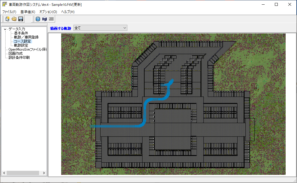
▲Main screen
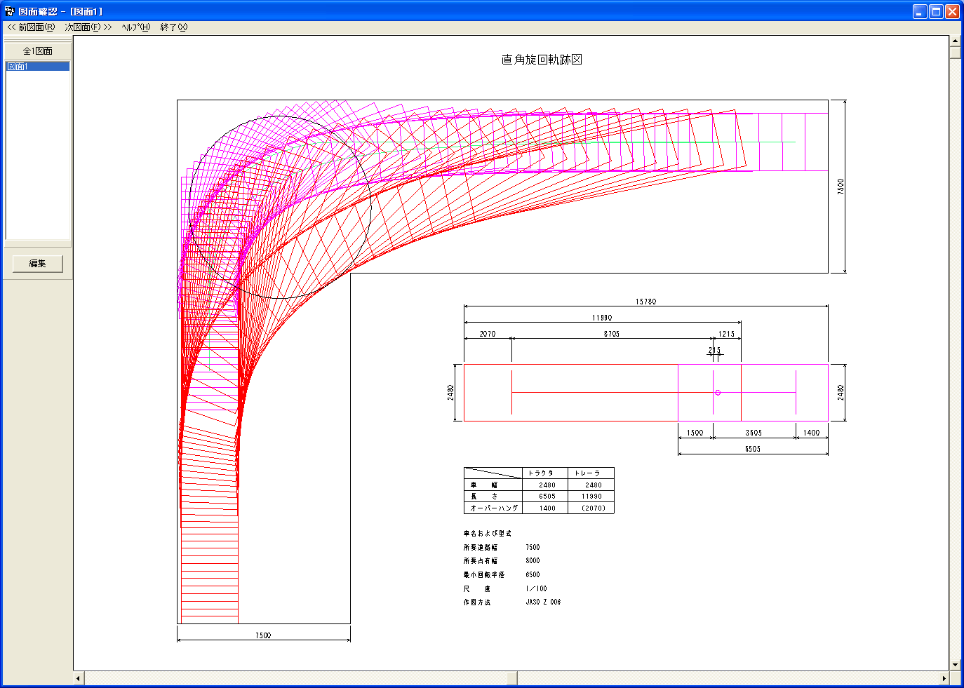
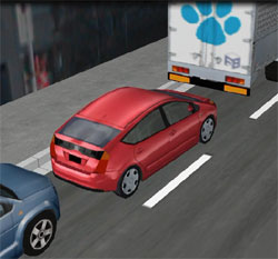
▲Drawing check
(for passage permission)
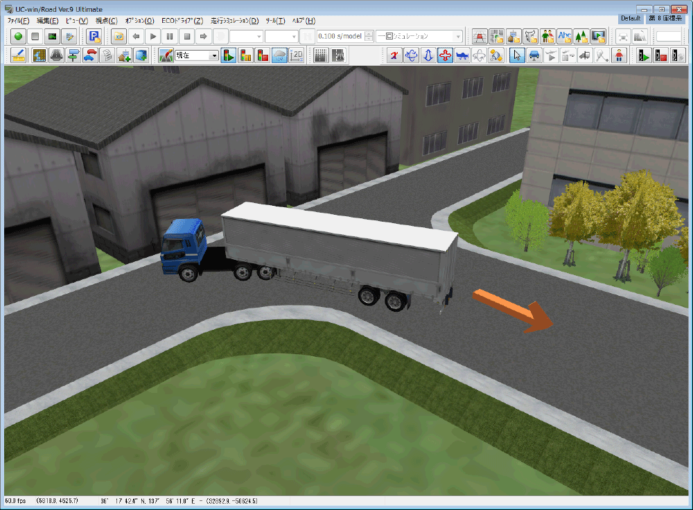
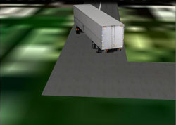
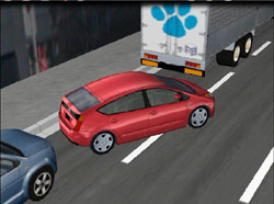
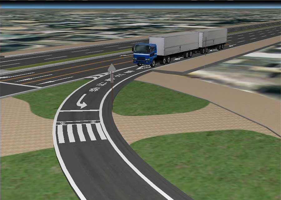
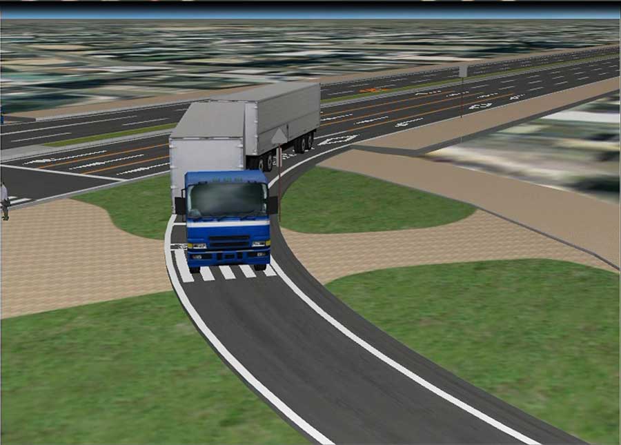
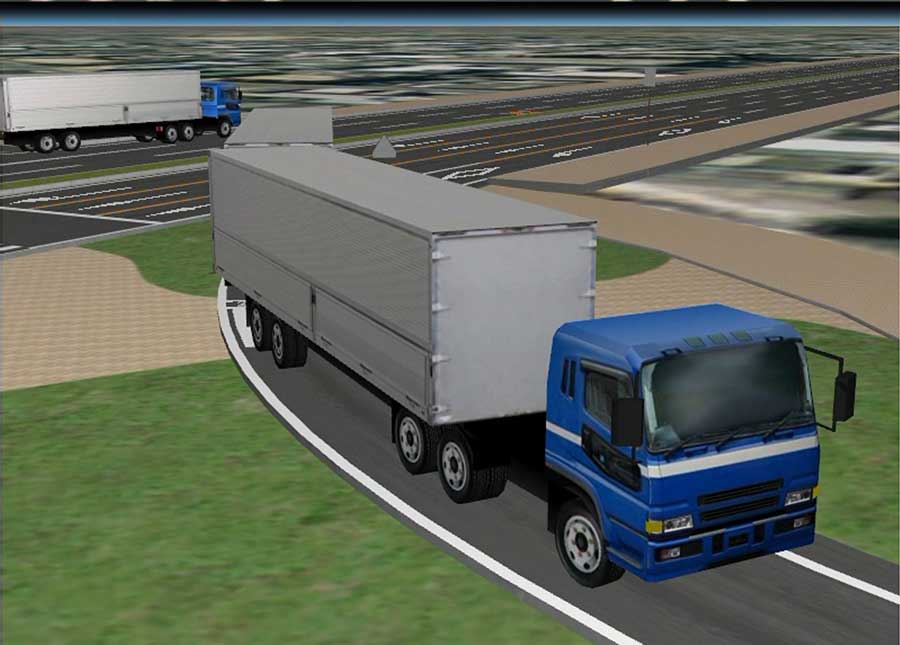
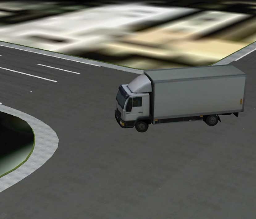
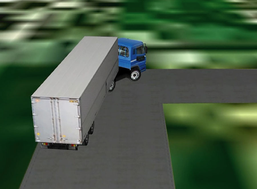
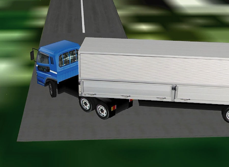
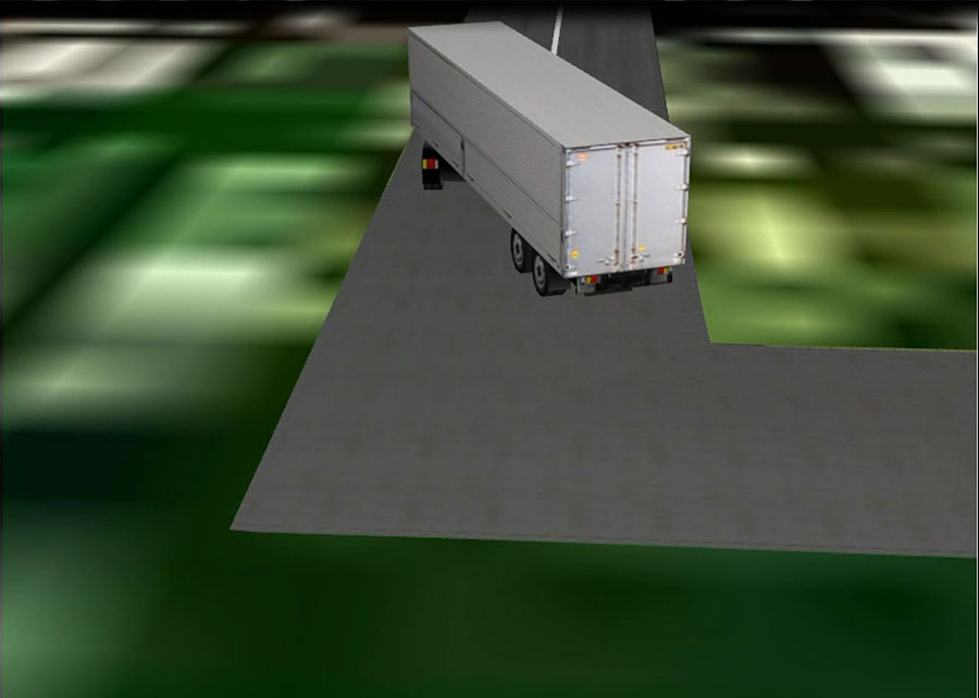
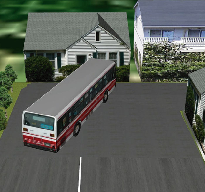
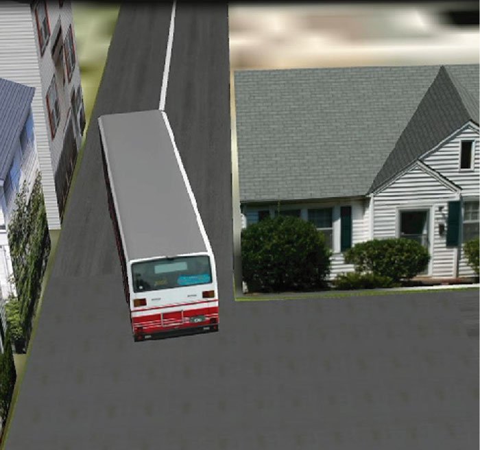
▲3D display in UC-win/Road
(semi-trailer's quick cut of the steering wheel)
Program Functions and Features
Coverage
-
This system can be used for the following vehicle types.
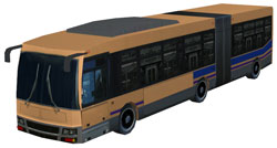
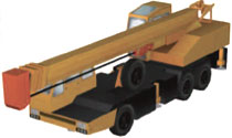
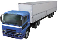
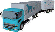
Vehicle type - Small vehicle : Small vehicle, mini truck - Ordinary type vehicle : Passenger vehicle, bus, small and medium sized truck, large sized truck,
dump truck and etc.- Crane vehicles : Truck crane, Crane truck - Semi-trailer : Supports up to triple trailers - Full trailer : Supports center axle type and Dolly type - Pole trailer - Articulated bus Driving styles
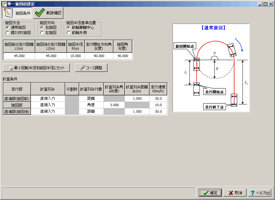
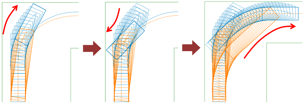
* Quick cut of the steering and combined driving are supported for "small vehicles", "ordinary type vehicle",- Single turn : Draw a single turn. For application of passage permission. - Route driving : Driving along the specified route - Quick cut of the steering : Driving forward and backward is combined, such as quick cut
and parallel parking- Combined driving : Driving that route driving and quick cut of the steering are combined
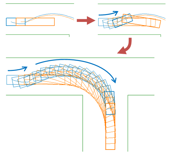
"crane vehicles", and "semi-trailer".Turn type - Regular turning : Turn in a certain radius - Clothoid turning : Turning considering the transition curve section - Stationary steering : Temporarily stopping at a corner and turning the wheel to minimize
the turning radiusRoute setting Create any driving routes as well as import CAD files (AutoCAD format and SXF format) Visual output As well as printing, exporting in DXF, DWG, P21, SFC, JWW, JWC, and PSX file formats (file format for
FORUM8's UC-draw) is possible.Misc. - Create trajectory map for application of passage permission (JASOZ006-92)
- Driving check
- Setting of relation between driving speed and turning radius
- Export of 3D simulation data file in OpenMicroSim format
- Setting of 3D models used in 3D simulation
- Driving path animation
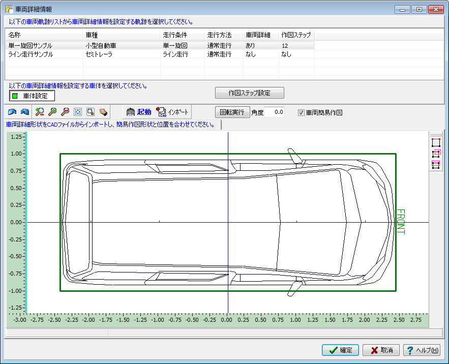
- If there is CAD data of vehicle shape, it is possible to create a drawing with the detailed vehicle shape.
- Quick cut of the steering by semi-trailer
- etc
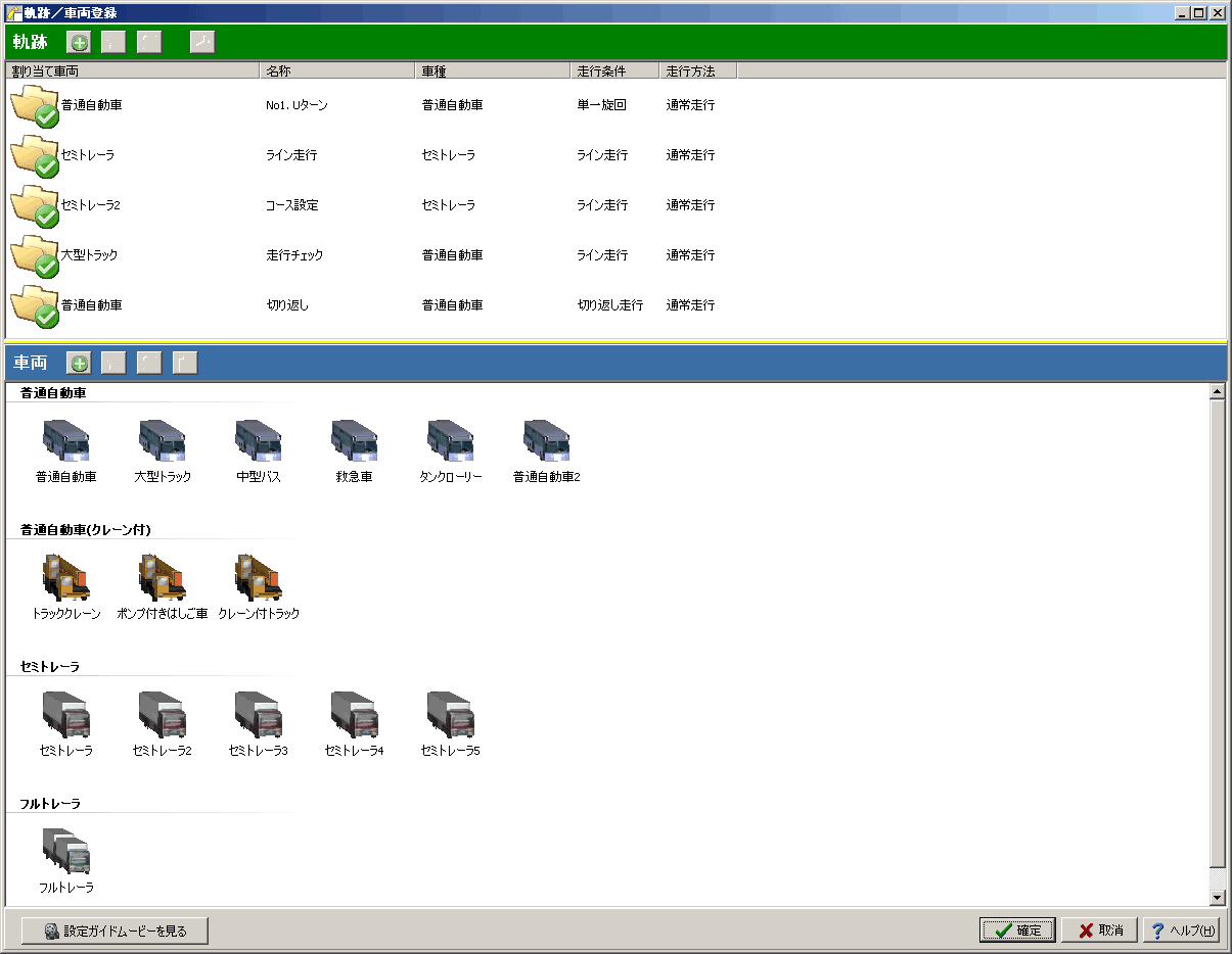
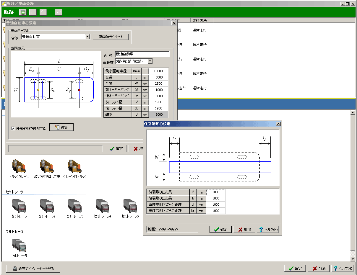
Easy registration of trajectory/vehicle
-
This system supports various types of vehicles including basic passenger vehicles and semitrailers as well as full trailers and crane vehicles. Moreover, any rectangles can be added separately to the vehicle, thus, enabling such examination as cases where there is overhanging cargo. In addition, since it is possible to assign multiple trajectories (as well as the vehicle allocated to them) in one data file, several cases can be examined at the same time for one route.
Small vehicle
Small vehicle, mini truck
Ordinary type vehicle
Passenger vehicle, bus, small and medium sized truck,
large sized truck, dump truck and etc.

Articulated bus
Crane vehicles
Truck crane, Crane truck
Semi-trailer
Supports up to triple trailers
Full trailer
Supports center axle type and Dolly type
Pole trailer
Route Configuration and Driving Check Function
-
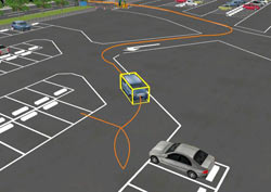
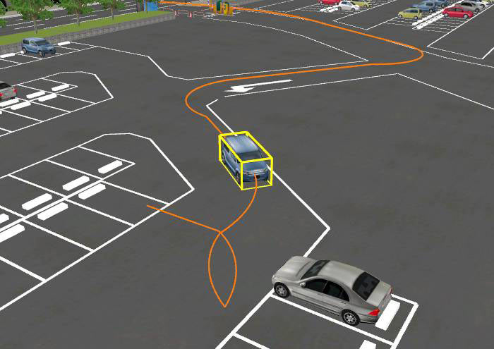
Driving routes can be created simply and smoothly using the mouse or directly inputting of coordinates. Existing CAD drawing can also be imported for driving route creation (CAD files can be created using the image files from the SXF generation tool). Moreover, driving check can be carried out configuring the contact detection line on the driving route.
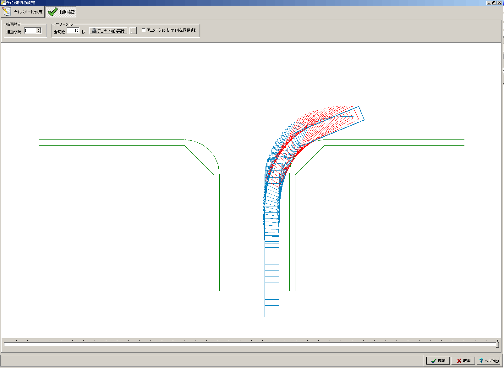
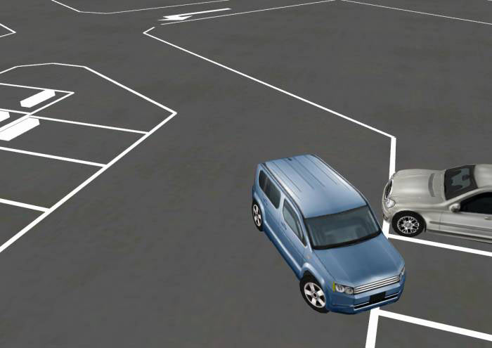
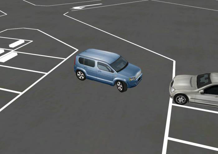
▲Driving check (Red represents where there was a contact)
Import a drawing as background image and export overlaying with vehicle trajectory
-
A function to overlay vehicle trajectory on images in Vehicle Trajectory Mapping has been added. In the previous version, operation was sometimes slow when importing large CAD data for course setting. The new version of the program has a function to convert large CAD data into images and output the images with the trajectory overlaid. The PC operation will be fast by importing the least lines when loading CAD data as image. In addition, since the program also supports the import of ordinary images, the trajectory can be overlaid on images created from VR data or imported satellite photos to make it easier to visualize the trajectory for study.
▲Set an image for the main screen background
tricentric circle (UC-Draw)
-
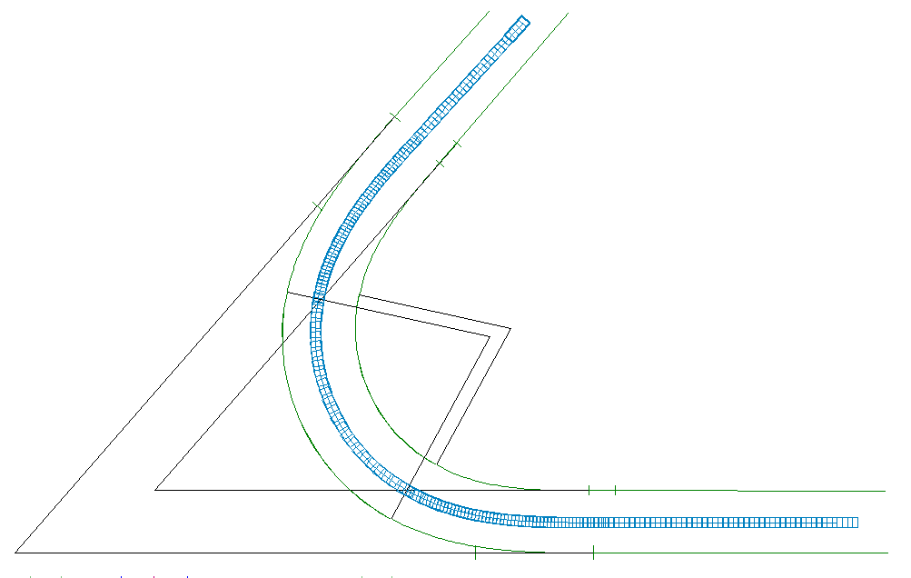
By importing a CAD file created with the function of FORUM8's UC-Draw to create a tricentric circle, it is possible to check trajectory in intersection and draw a trajectory map.
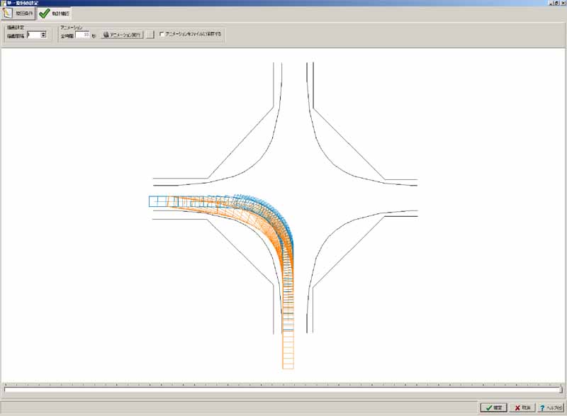
▲Trajectory map made by using the tricentric circle creation function of UC-Draw
Export coordinates of vehicle trajectory
-
Coordinate values for each step of the vehicle's trajectory such as 4 corners of the vehicle, axle center position, etc. can be output. The position of the vehicle at each calculation pitch can be obtained numerically, and when combined with the "automatic adjustment function for calculation increments", this function is useful for examining contact judgments and stopping at predetermined positions, etc. Coordinate values can be output as a regular spreadsheet or as a CSV file.
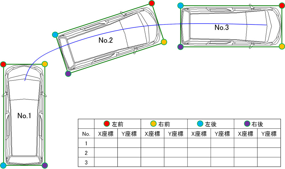
▲Output coordinate values for each vehicle
Automatic adjustment of calculation increments
-
This function automatically sets the calculation division width so that the calculation pitch within a section is constant. By setting the calculation pitch at equal intervals, it is possible to draw trajectories at regular intervals, facilitating the examination of the trajectory.
Drawing output (for application of passage permission)
-
Since the trajectories can either be printed out or be exported to various CAD files, they can be edited using the software that the user is most comfortable with. Vehicle turning trajectory model that is required for the permission for passage (form: JASO Z 006-92) can also be created.
▲Visual output (required for the permission for passage)
▲Visual output (with course setting)
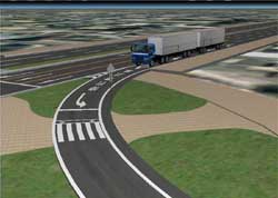
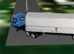
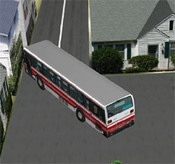
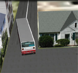
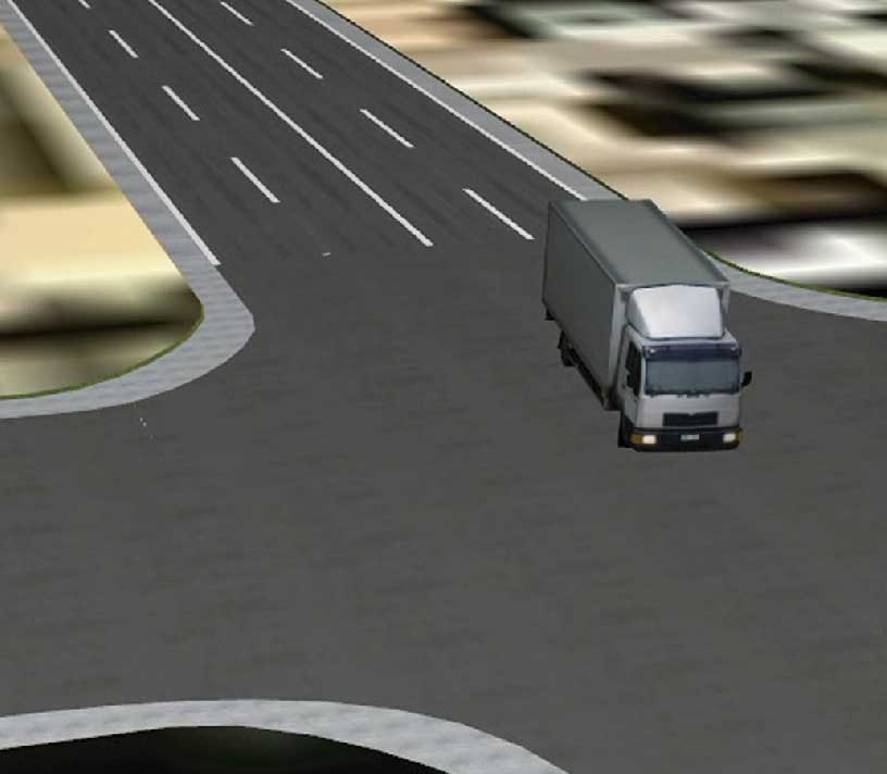
3D simulation
-
Linkage with UC-win/Road
This product allows producing OpenMicroSim file for the 3D simulation.
(>> UC-win/Road Micro Simulation Player)
You can reproduce the trajectories in 3D simulation by importing these files by UC-win/Road.
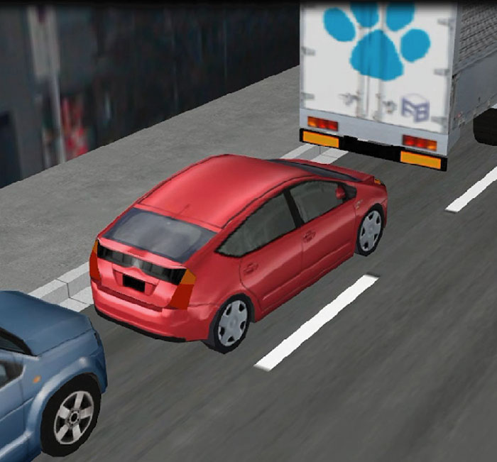
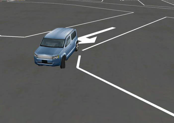
●VR simulation sample of vehicle trajectory 


1. Single turn 


2. Right angle turn 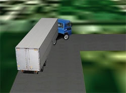
3. Quick cut of the steering wheel 
4. Parallel parking 
5. Combined driving (line driving + quick cut of the steering) 


Standards, regulations and reference literature
- Reference literature
-
- 道路構造令の解説と運用, 平成16年2月, 社団法人日本道路協会
- セミトレーラ及びフルトレーラの直角旋回軌跡図の様式(JASO Z 006-92), 社団法人自動車技術会
- 旋回軌跡による隅角部の設計について(土木研究所資料), 昭和54年1月, 旧建設省土木研究所道路部道路研究室
- 輸送マニュアル 2008年度版, 2008年, 社団法人日本橋梁建設協会 社団法人鉄骨建設協会
- クロソイドポケットブック 改訂版, 社団法人日本道路協会
Price
Product Price
-
■Product Price
Product Price Vehicle Trajectory Mapping System Ver.4 USD1,730 Vehicle Trajectory Mapping System (Japan Standard / Chinese version) USD1,730 ■Price of Floating License
Paying 40% of the product price allows anyone to use the product on any PC anywhere in the world.
Product Price Vehicle Trajectory Mapping System Ver.4 USD692 Vehicle Trajectory Mapping System (Japan Standard / Chinese ver.) USD692
Price of Subscription Service Contract
Price of Subscription Service Contract
-
■Support information
-Software upgrade -Technical inquiry (Email, Tel)
-Download service -Maintenance and update notifications via email
* We are sequentially making a transition from the maintenance-support service to [Subscription Service] from April 1, 2016 in order to enhance support for diverse product usage and to reduce license management cost.
Product Subscription cost
of first yearSubscription cost
of subsequent years
(annual cost)Subscription (Vehicle Trajectory Mapping System Ver.4) Free USD692 Subscription (Vehicle Trajectory Mapping System
(Japan Standard / Chinese ver.))USD692 Subscription (Vehicle Trajectory Mapping System Ver.4 Floating) USD968 Subscription (Vehicle Trajectory Mapping System
(Japan Standard / Chinese ver.) Floating)USD968
Price of Rental License / Floating License
■Rental license : Short term licenses available at a low price
■Rental floating license : After web activation, anyone can use the products on any PC anywhere in the world.
■Rental access : You can increase the number of licenses you own and use these additional licenses for a specific period of time (1 month to 3 month) at your discretion. We will later send you an invoice based on your usage log. The advance application is 15% off of the regular rental license price. Please place an order from User information page.
*Rental / Floating Licenses were introduced on September 2007 to enhance user experience and convenience of our products.
*Duration of Rental / Floating Licenses cannot be changed after starting these services. Re-application is required to extend the rental and floating license duration.
Rental license / Rental floating license
-
■Rental License
Product 2 month 3 month 6 month Vehicle Trajectory Mapping System Ver.4 USD778 USD916 USD1,124 Vehicle Trajectory Mapping System (Japan Standard / Chinese ver.) USD778 USD916 USD1,124 ■Rental Floating License
Product 2 month 3 month 6 month Vehicle Trajectory Mapping System Ver.4 USD1,297 USD1,539 USD1,903 Vehicle Trajectory Mapping System (Japan Standard / Chinese ver.) USD1,297 USD1,539 USD1,903 Academic Price
An Academic License can be provided for educational purposes and used by teachers, lecturers, academic researchers, and students.
Academic Price
-
Product Academic Price Vehicle Trajectory Mapping System Ver.4 USD1,384 Vehicle Trajectory Mapping System (Japan Standard / Chinese ver.) USD1,384 Version Update History
Version Update History
-
The version upgrade and revision upgrade (without charge) contents are listed as following.
Vehicle Trajectory Mapping System Ver.4 Version Release date Update contents 4.00.00 20/09/18 - Support of outputting vehicle trajectory overlaid on background images
- Each coordinate values of vehicle trajectory can be exported.
- Automatic adjustment of calculation increments is supported.
- Support for drafting and drawing the center of the rear axle
Product Operation Environment
Product Operation Environment
-
OS Windows 10 / 11 CPU * Environments that meet the system requirement of the OS and operate
without any problems.Required memory (including OS) * Environments that meet the system requirement of the OS and operate
without any problems.Required disk capacity About 300MB or more (for installation and operation) Display (resolution) 1024×768 or greater is recommended
Only [Small Font] font size is supported.Input data extension F6V File export For F8 export editing tool: TXT, HTM, PPF, DOC, PDF, JTD, JTDC
Drawing: SXF, DWG, DXF, JWW, JWC
Image: 3DSLinkage with other programs <Import> Drawing (SXF, DXF), UC-Draw <Save>UC-win/Road(3DS)
Order / Contact Us
Order / Contact Us
-
■ Inquiry
Contact us from Sales inquiry or email to ist@forum8.co.jp or forum8@forum8.co.jp
Sample
▲ Main window
▲ Registration of trajectory/vehicle
▲ Vehicle specification setting

▲Vehicle specification setting (semi-trailer)
▲ Vehicle specification window
▲ Drawing creation reflecting vehicle specification
▲ Trajectory setting (single turn)
▲ Trajectory setting (quick cut of the steering)

▲ Driving check
▲ Driving check (Red trajectory indicates the collision)
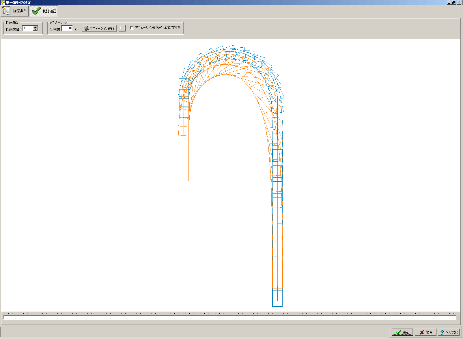
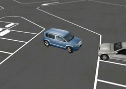
▲ Single turn

▲ Quick cut of the steering
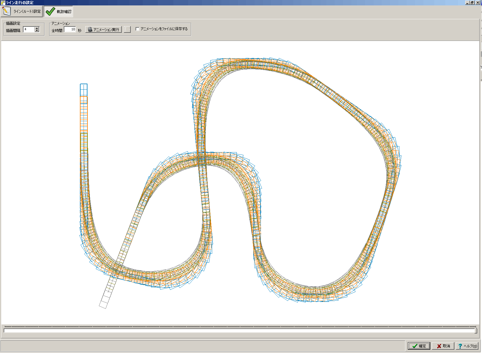
▲ Line driving
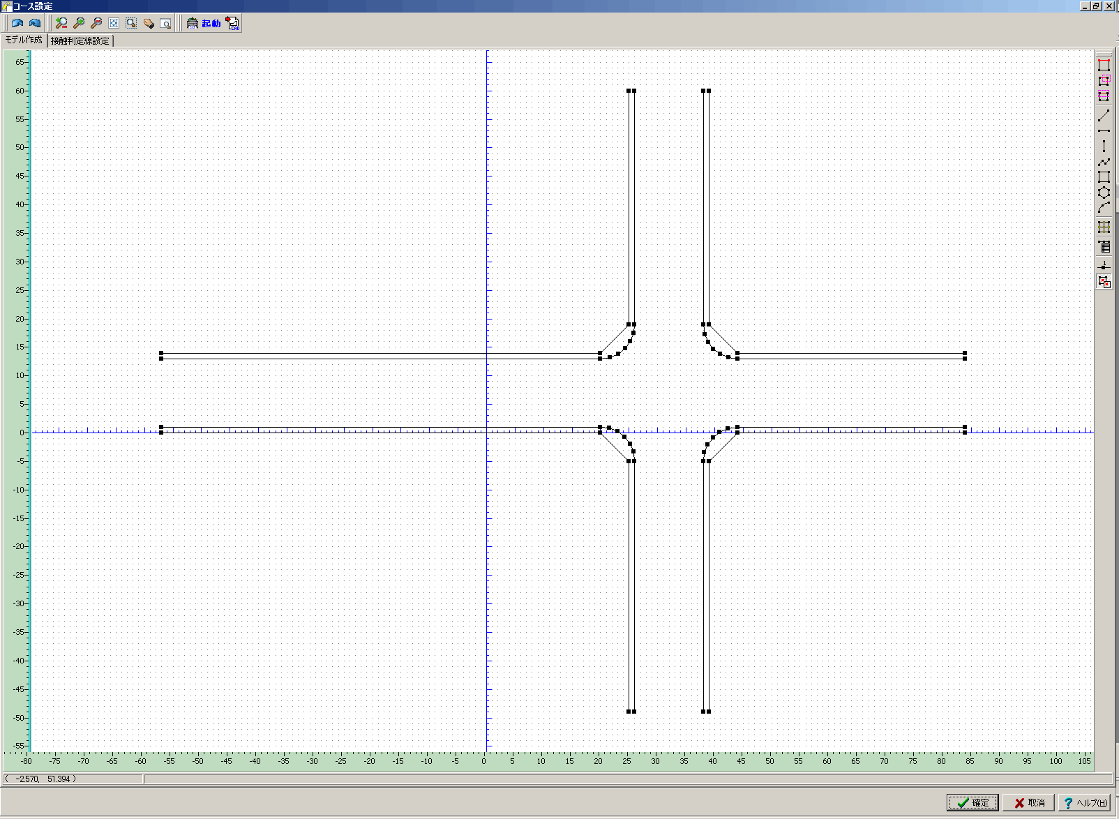
▲ Course setting
▲ Trajectory of a semi-trailer going backwards
▲ 3D visualization using UC-win/Road
(quick cut of the steering by semi-trailer)
▲ Trajectory of quick cut of the steering by semi-trailer
▲ Trajectory of normal turn (clothoid curve)
(The course is made with UC-Draw)
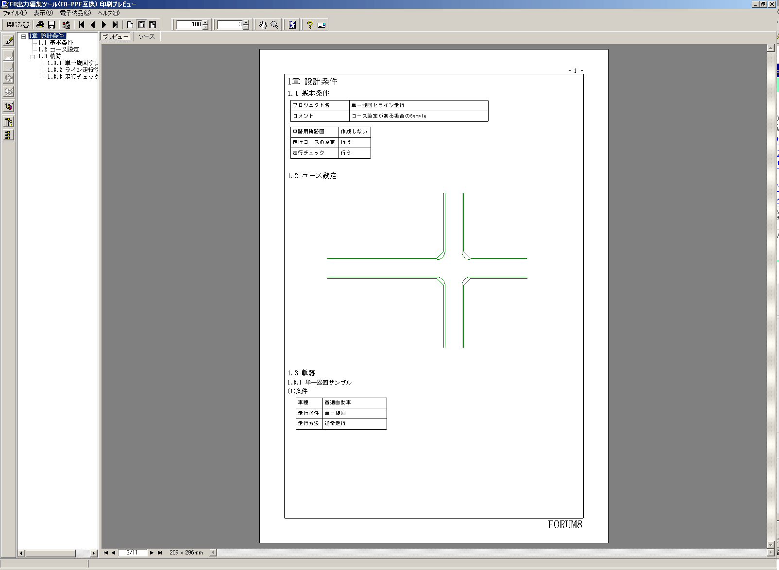
▲ Print preview
Drawing creation
▲ Visual output (required for the permission for pasasge)
▲ Visual output (with course setting)
▼Single turn and route driving ( 10P, 109KB ) |
▼Quick cut of the steering wheel ( 5P, 61KB )  |
Q&A(製品評価や導入の際に役立つQ&Aです)
- 製品の特長は?
-
本製品は、下記「適用基準および参考文献」に記されている作図理論に基づいて、車両の走行軌跡を計算・作図するシステムです。想定した路線や既存の路線に対する走行シミュレーションや車両軌跡の作図が簡易かつ効率よく行え、道路構造を決定する際の参考資料等として利用することができます。また、特殊車両通行許可申請に必要な車両旋回軌跡図を作図する機能もサポートしております。
【適用基準および参考文献】- 道路構造令の解説と運用,、平成16年2月、 社団法人日本道路協会
- セミトレーラ及びフルトレーラの直角旋回軌跡図の様式(JASO Z 006-92)、 社団法人自動車技術会
- 旋回軌跡による隅角部の設計について(土木研究所資料), 昭和54年1月、旧建設省土木研究所道路部道路研究室
- 輸送マニュアル 2008年度版, 2008年、社団法人日本橋梁建設協会 社団法人鉄骨建設協会
- クロソイドポケットブック 改訂版、 社団法人日本道路協会
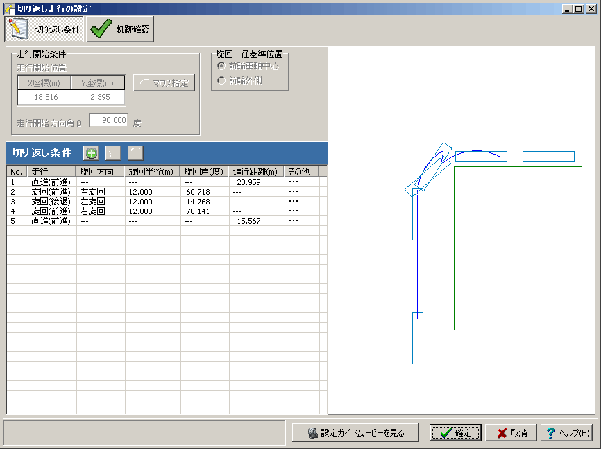
- 前進と後退が含まれる軌跡の作成方法は?
-
走行条件を「切り返し走行」として軌跡を作成してください。「切り返し走行」の設定方法につきましては製品ヘルプおよび[切り返し走行の設定]ウィンドウから見れます設定ガイドムービーをご参照ください。
- UC-win/Roadにより軌跡をシミュレーションするには?
-
本製品にて軌跡をOpenMicroSimファイルを保存し、UC-win/Roadのマイクロシミュレーションプラグインで読み込むことにより、走行軌跡を3Dで確認することができます。 操作例を、「Vehicle Trajectory Mapping SystemとRoadの連携例.pdf」に記載しておりますのでご参照ください。
- 車両の諸元を入力する際に参考となる資料はないか?
-
該当車両が明確にわかる場合はメーカーにお問合せ頂くのが一番ですが、一般的な諸元を知りたい場合は「自動車ガイドブック、 日本自動車工業会」等の資料が参考になるかと思います。
