3D/VR Simulation Contest on Cloud starts with the award winning VR Design Studio UC-win/Road software. The main event of the FORUM8 design festival is the competition between international and domestic contestants to see who can create the most advanced VR simulation using VR Design Studio UC-win/Road. A general public online vote has also been implemented since 2011. This year is surely going to be exciting!
Results Announcement
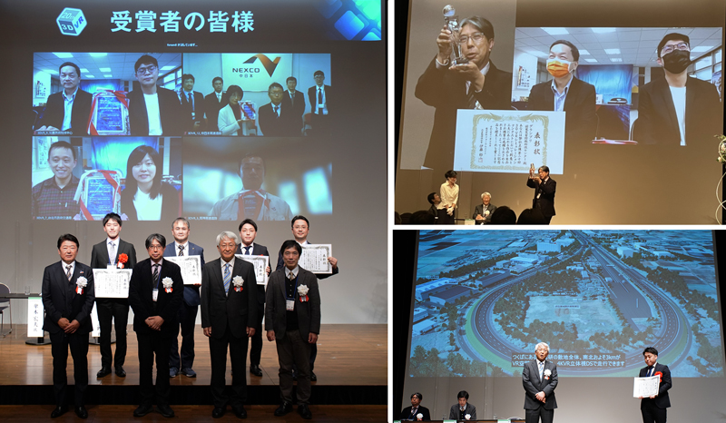
After general voting and careful consideration by juries, Grand Prix, 2nd Prize (Excellence Award), Idea Award, Essence Award, and 3 Honorable Judge Award have been decided.
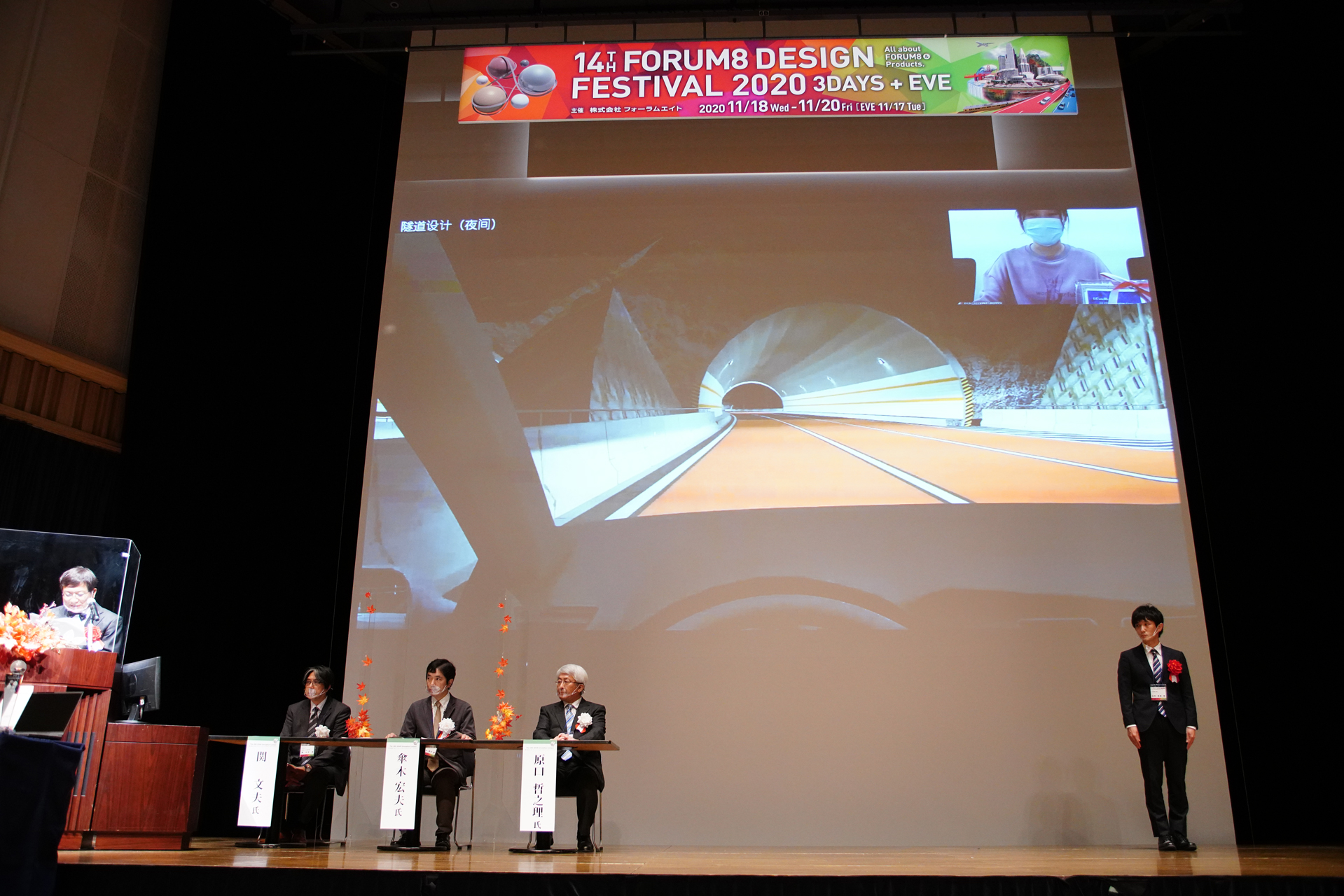
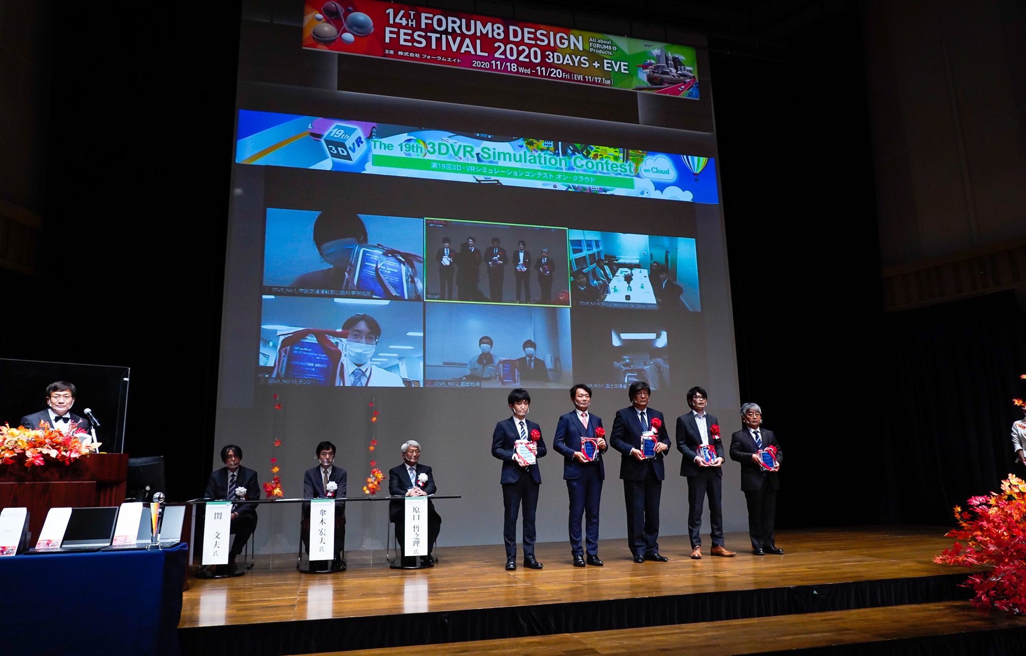
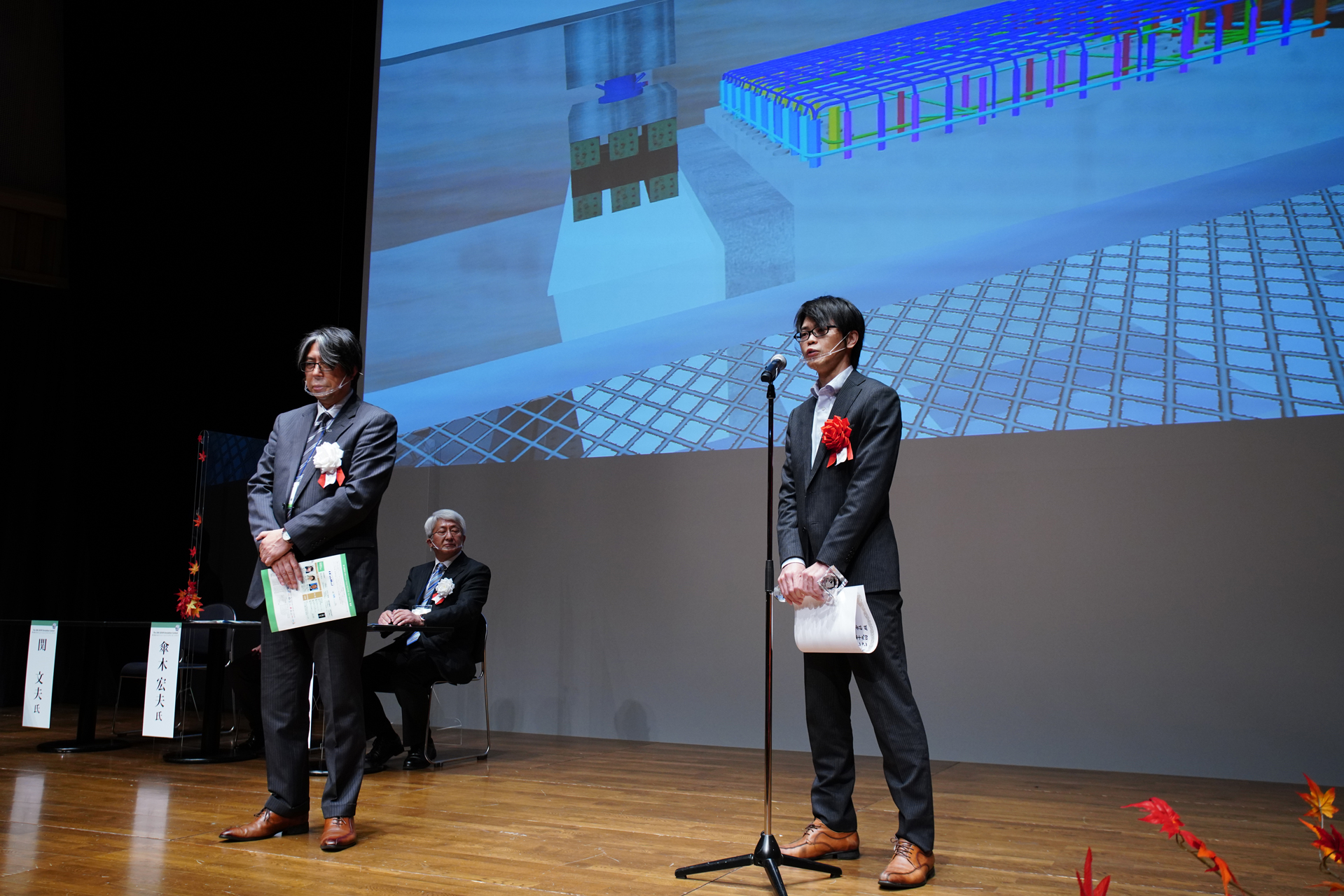
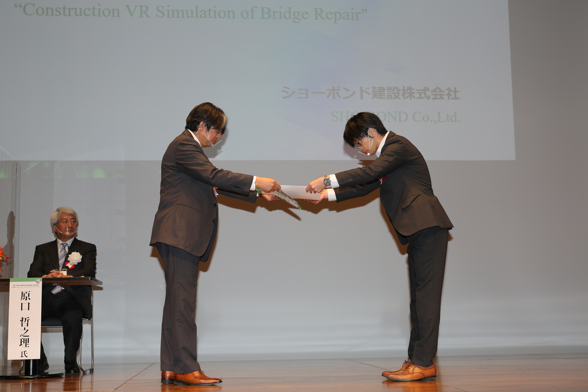
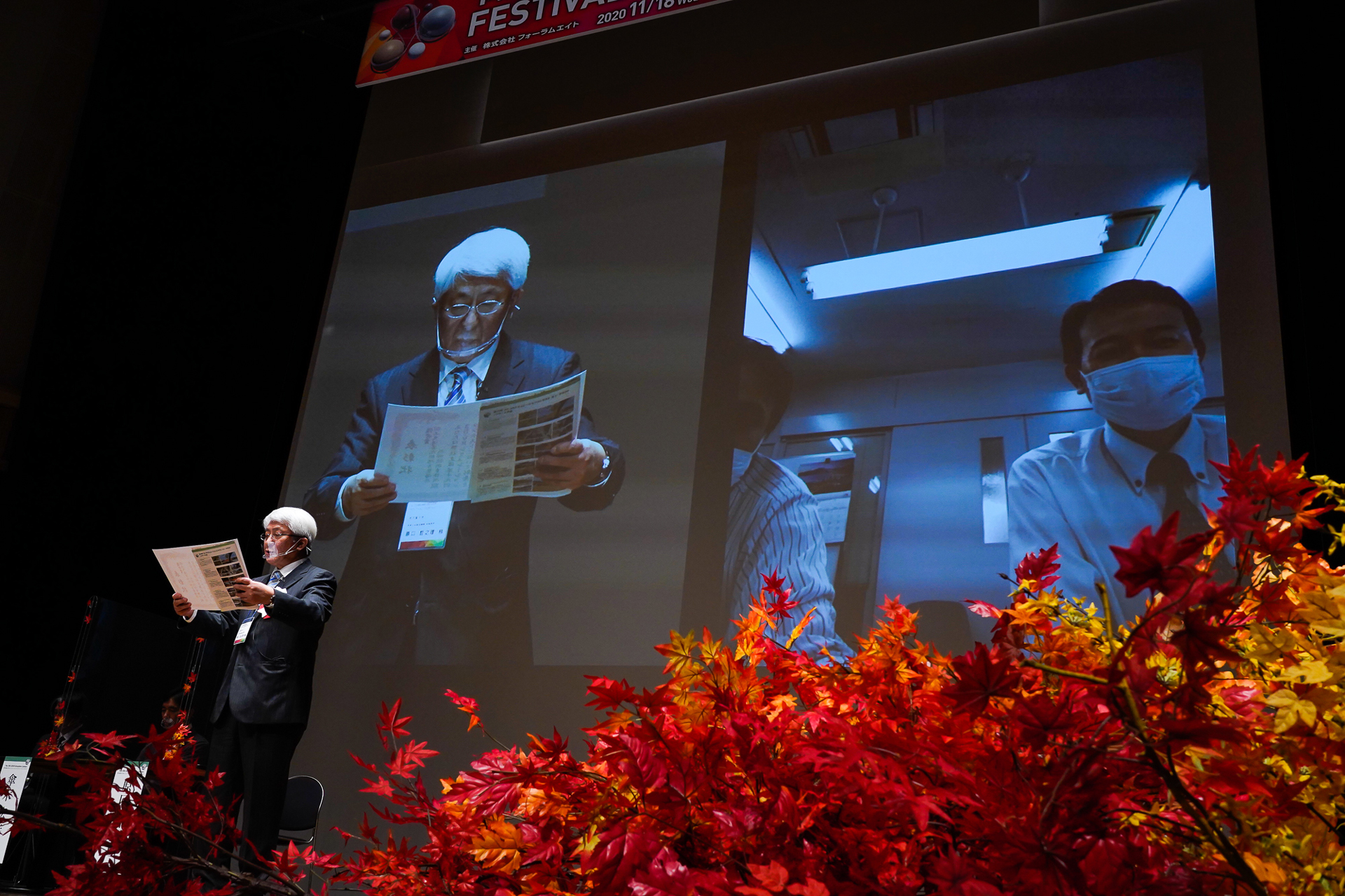
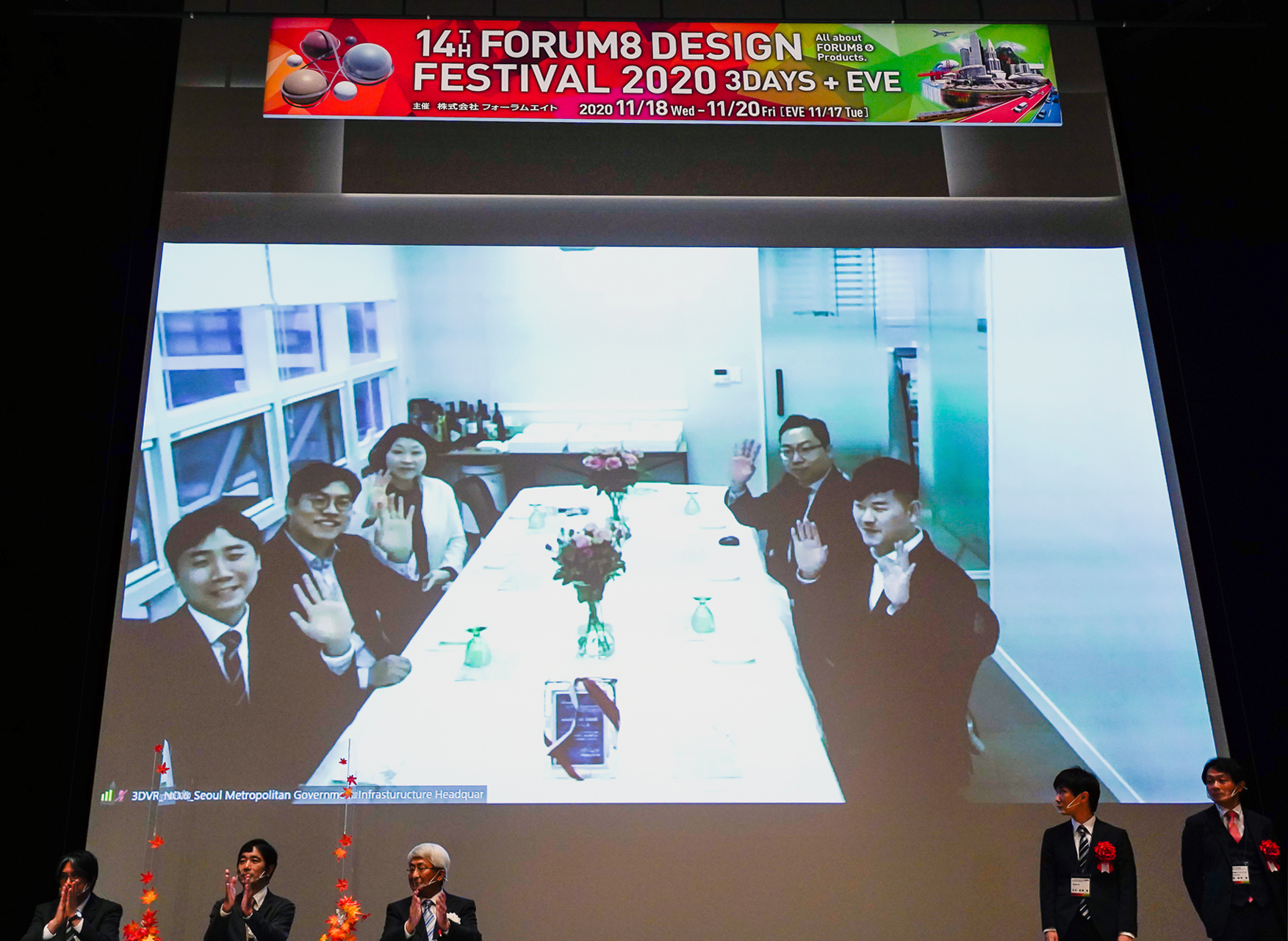
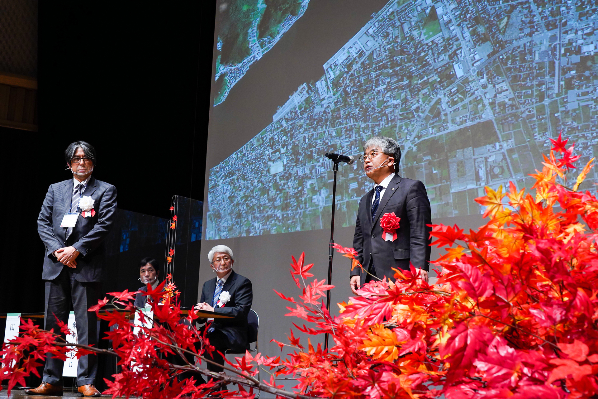
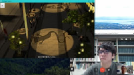
The Awards Ceremony was held at Shinagawa Intercity Hall and online on November 17th, 2021.
-
▲Awards Ceremony
(Nov. 17th 2021 at Shinagawa Intercity Hall and Online) -
-
▲Movie of awarded works
-
 Grand Prix
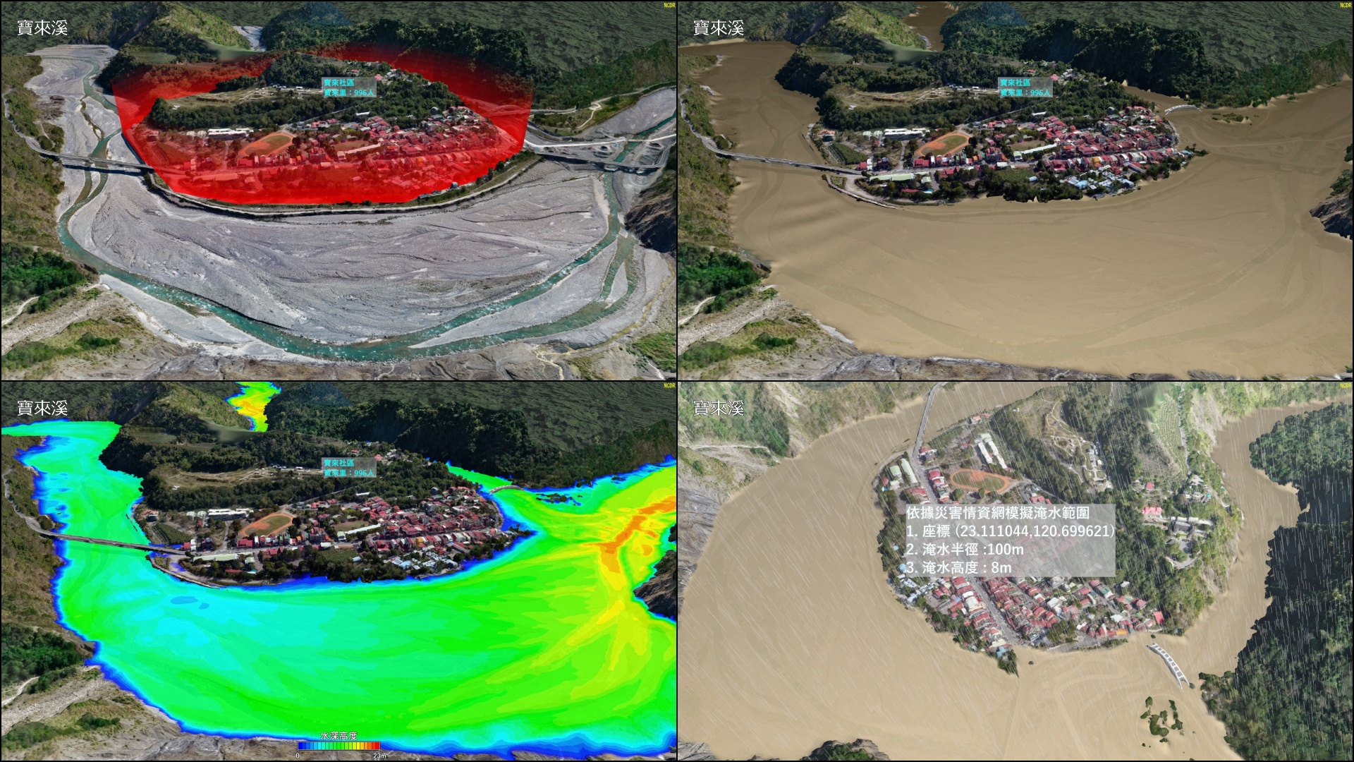
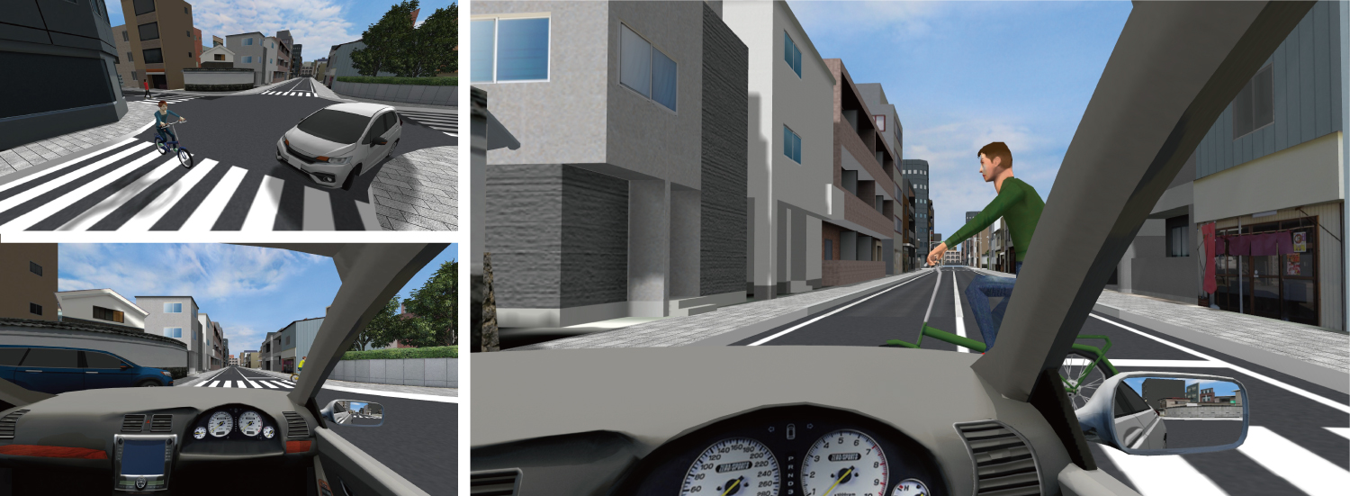
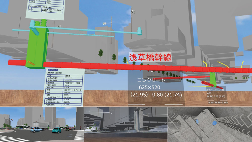
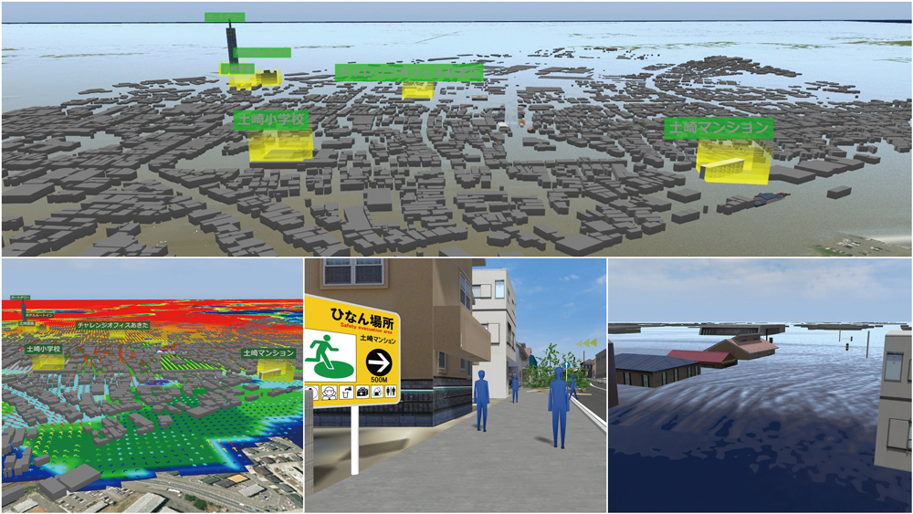
National Science & Technology Center for Disaster Reduction (Taiwan)
Creation of Disaster Scene Using VR And Display of Flood Simulation Analysis Data
To improve the effectiveness of disaster prevention drills, VR is employed to help the flood exercise platform of an existing disaster information website to visualize flood simulations. It simulates the damage caused by river flooding based on the 3D terrain models such as Laonong River, Qingshui River, and Baolai River in Taiwan, and the flood warning system developed by the Center. The VR data is open to the public on VR-Cloud with a 360-degree video.Watch This
Run the animation "Baolai" to see a simulation of the flooding of Baolai River (Baolai Hot Springs, Kaohsiung City). In addition, water depth contours are also visualized by combining 3D terrain models generated from photos shot from UAV with inundation analysis data. It is possible to see the flooded area, evacuation shelters, and the locations of police stations and fire departments, plus the image of how they can all be used in evacuation drills.
-


-
2nd Prize (Excellence Award)
MAEDA CORPORATION
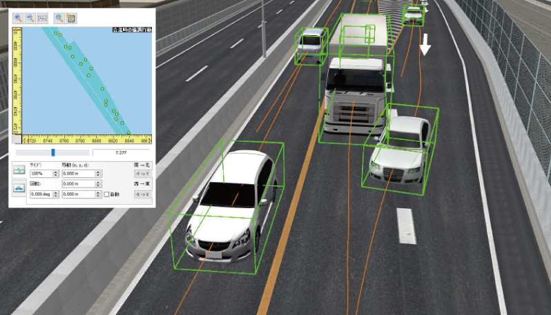
Soil Transport Planning Using Traffic Simulation Analysis
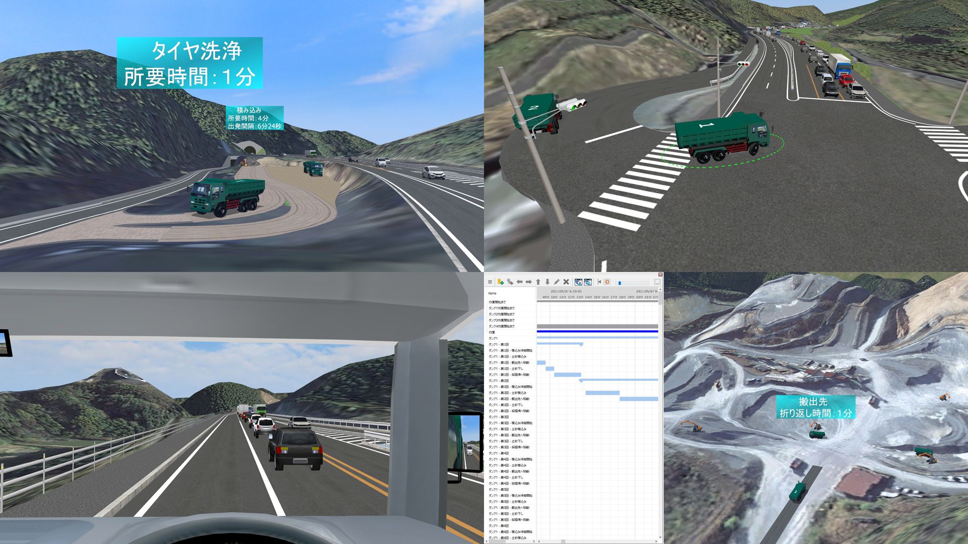
 In order to formulate an optimal vehicle allocation plan for transporting soil at a construction site, a dump truck operation was simulated based on the amount of earth transported and a survey of the amount of traffic. The actual road and traffic conditions were reproduced in the VR space, and the operation cycle, including loading and tire washing, was verified using the 4D simulation. The data was effective for preliminary discussions, construction planning, and safety measures.
Watch This
By executing the scenario "Dump Truck Operation Image", viewers can see the simulation of a dump truck in operation with a graph displaying a series of operations performed by the truck tracked over time thanks to the 4D function implemented in the software. The scenario "Dump Truck Operation Simulation" is a simulation that was actually used for validation, and it shows the actual operations of the dump truck including the factors that affect its operation such as waiting time and traffic conditions (no viewpoint is set).
-
2nd Prize (Excellence Award)
Central Nippon Expressway Company Limited
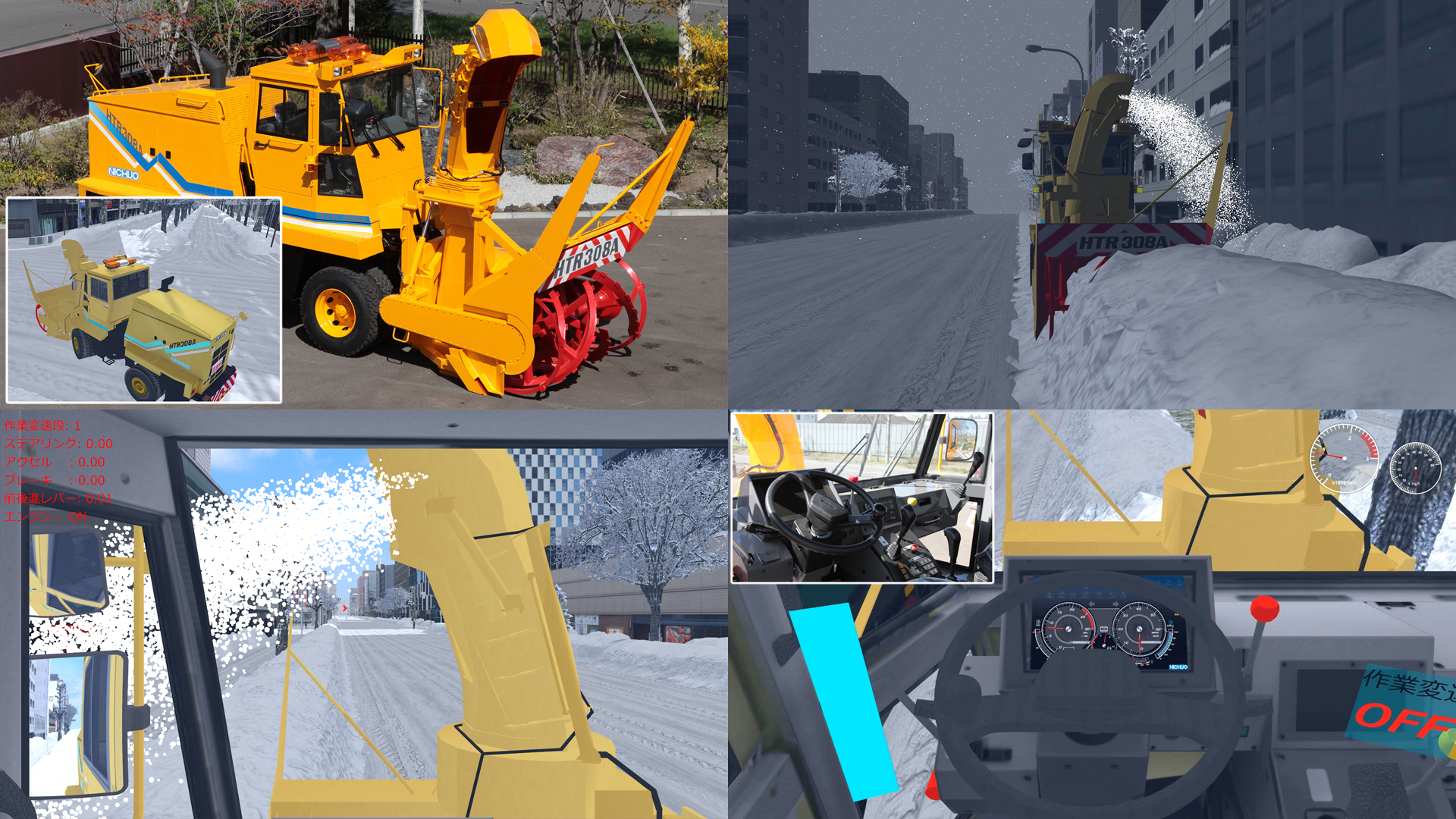
Simulator for Highway Snow Removal in Echelon Formation
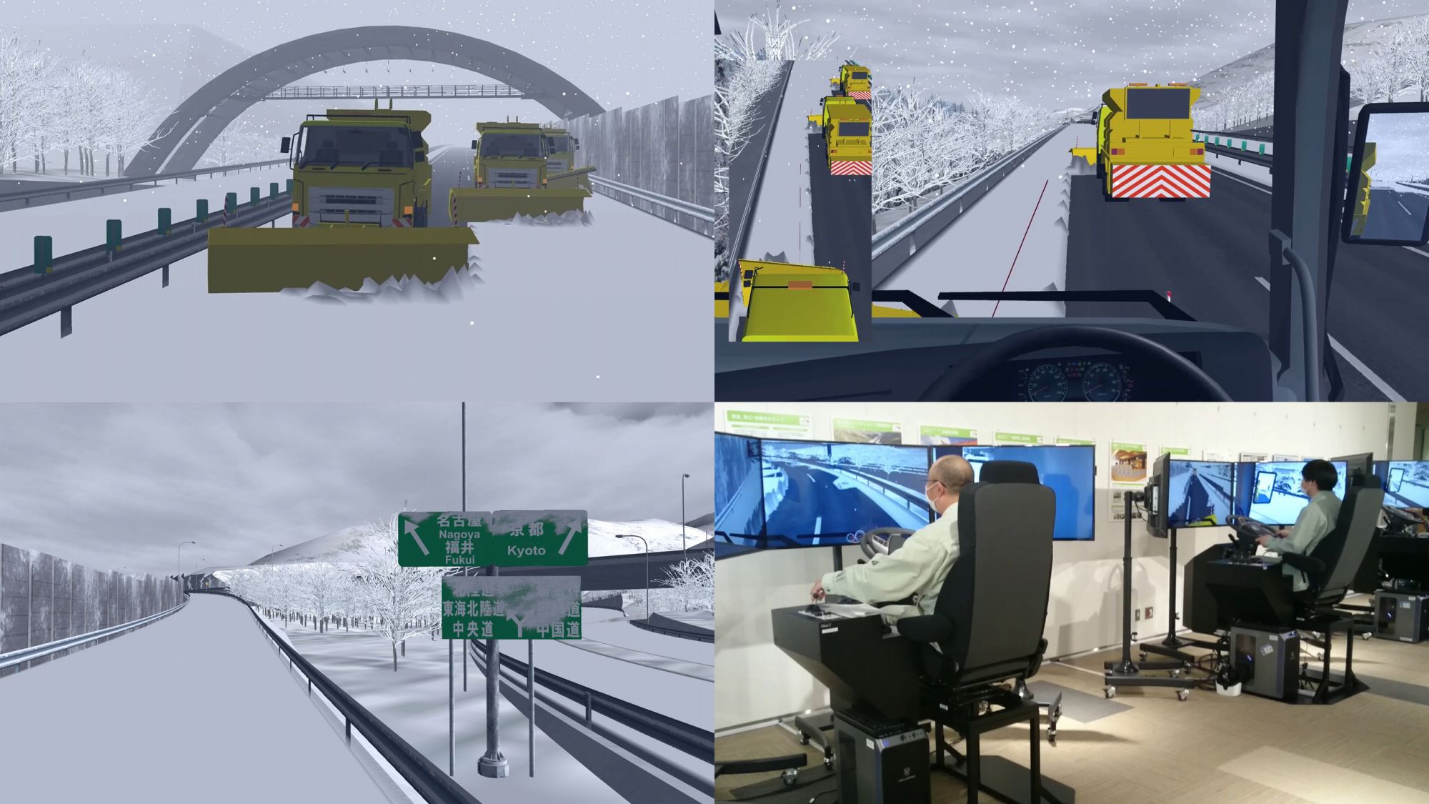
 A training simulator has been developed for the purpose of training snow removal vehicle operators. In order to provide training with a realistic environment similar to that of a real vehicle, the simulator reproduces the road environment of an expressway and can perform necessary diagnoses such as accuracy of vehicle position and distance to the vehicle in front. The three simulators work together to simulate snow removal in the echelon formation, but it is also possible to train for one person by using automatic control of the other vehicles.
Watch This
The data describes a vast snowy landscape on the Meishin Expressway, and the weather can be switched by selecting the context. By running the scenario "Simulation Overview", it is possible to see the simulation with the snow removal simulator. In the "Driving Experience Scenario", you can drive the snowplow vehicle to experience its departure from the base and driving on the main lane.
-
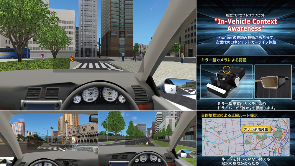
 Idea Award
Department of Transportation,
Taipei City GovernmentBus Driving Simulation System for Traffic Safety Promotion
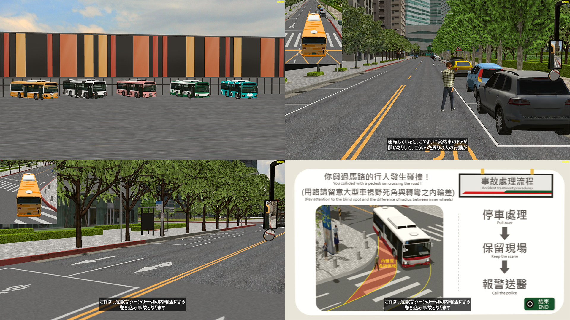
 This system simulates the driving conditions of a bus, and subjects can understand the difference in vision between the driver of a bus (large vehicle) and those of other vehicles and pedestrians by comparing the bus driver's visual angle with an overhead view from outside the vehicle. In addition, subjects can also recognize the blind spots and inside wheel differences of large vehicles, which will help them to avoid dangerous spots in real situations, and will lead to a reduction in traffic accidents.
Watch This
Run the "Explanatory Scenario" animation to see the aims of this system, the view from the driver's perspective, and an example of an accident. The "Bus Driving Simulation" animation shows the sequence of events when you actually try driving a bus with this system. (The operation proceeds automatically.)
-
Essence Award
Akamatsu Co., Ltd.
First in Shikoku! "Akamatsu Hybrid Expo"
toward New Normal Era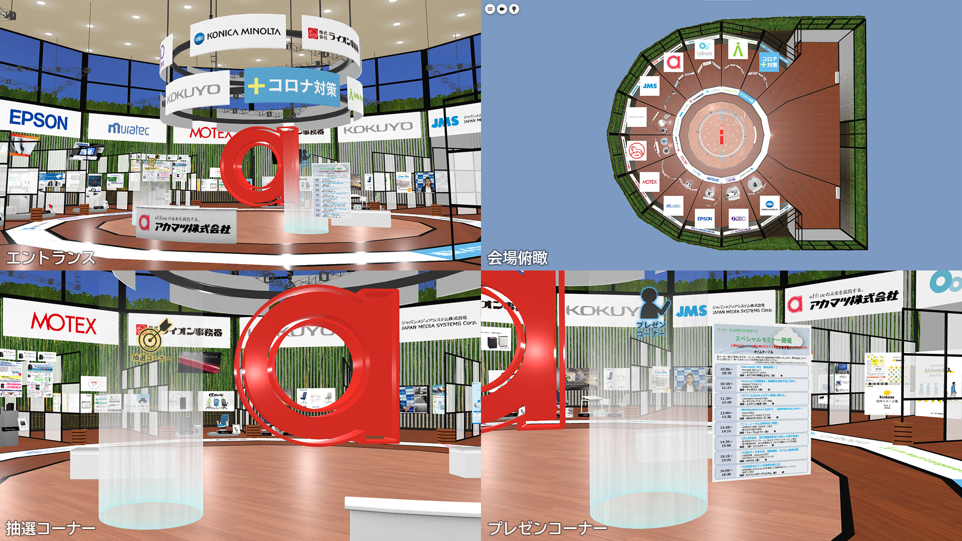
 Shikoku's first live and virtual hybrid exhibition was held. In a virtual venue using F8VPS, visitors could browse documents, watch promotional videos, and view products, mainly office automation equipment and subscription products. A seminar corner by exhibitors, a lottery, and a questionnaire were also included, and a total of more than 1,000 people accessed the exhibition over the two days, making it useful for sales promotion.
Watch This
The project can be viewed on F8VPS. You can see each exhibition booth by controlling the viewpoint in the menu in the top left corner, or switch to an overhead view to see the shape of the venue, which resembles the logo. You can move around the exhibition freely and see 3D models of products, panels and catalogues. You can also run a script to move from the entrance to each exhibition booth and view the PR videos.
-
Honorable Judge Award Design Award (Prof. Fumio Seki)
Hanshin Expressway Company Limited
VR to Announce Safety Measures on
Hanshin Expressway Route 1 Loop Line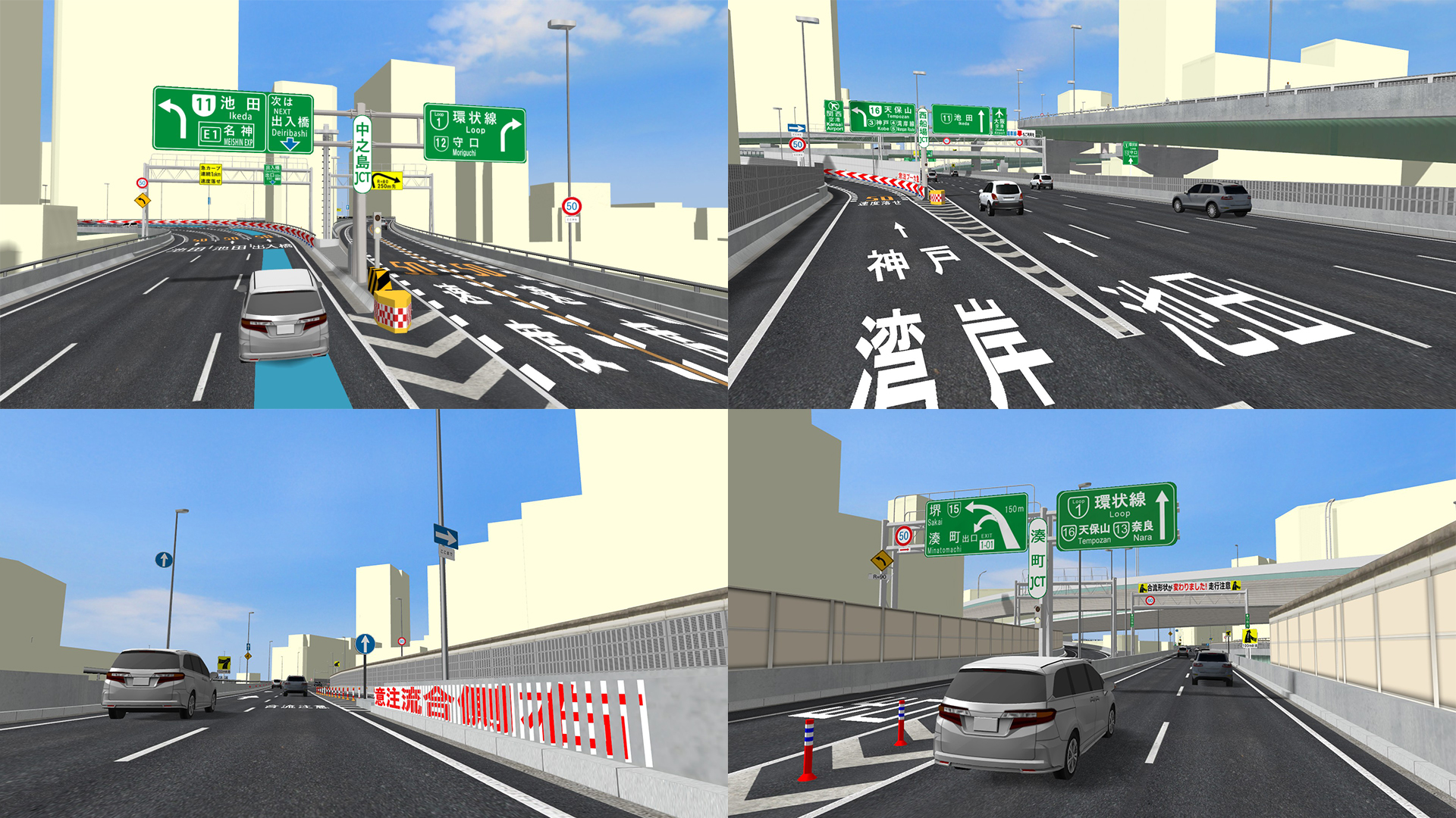
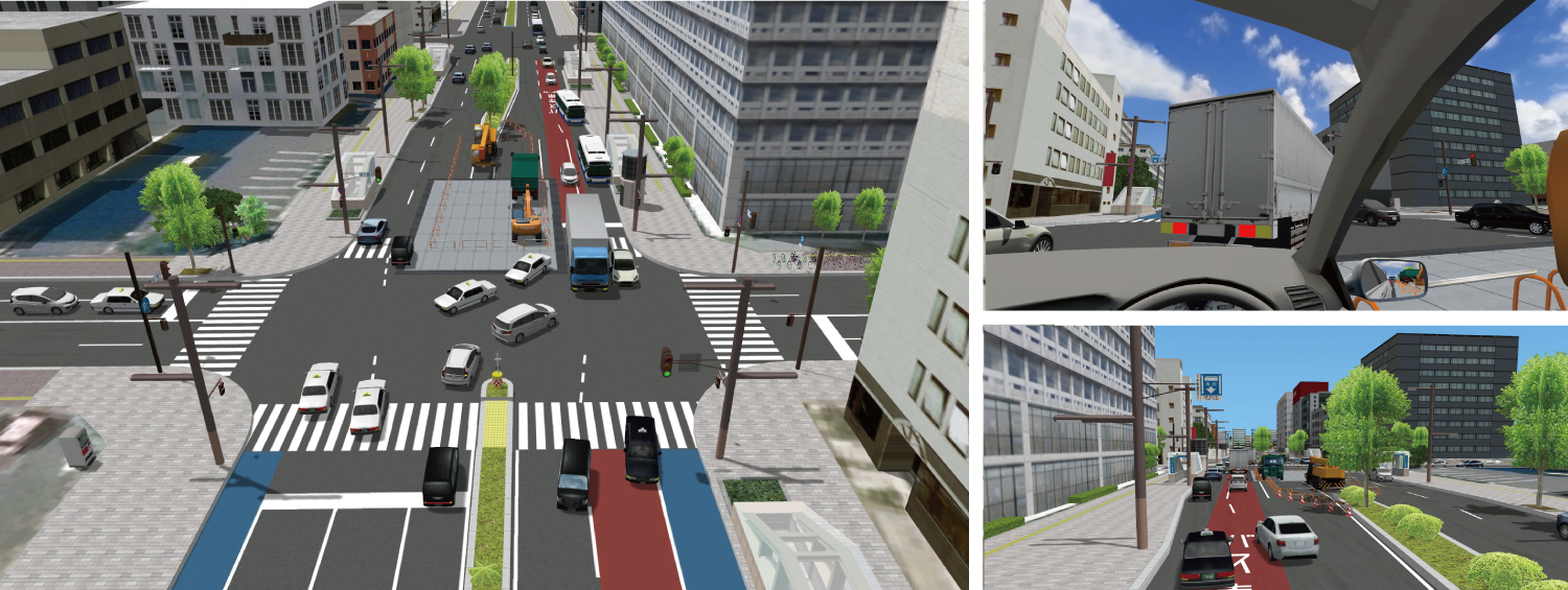
 For the Hanshin Expressway Route 1 Loop Line, where many traffic accidents occur due to its complicated merging points and junctions, VR data was created for the new guidance signs and junctions to be installed by the renovation together with the current state. It covers the road from the Minatomachi JCT to the Nakanoshima JCT, and will be used as a public relations tool to inform users the changes and cautionary information such as improved guide signs, lane lines for smoother merging, and pavement coloring, etc.
Watch This
By executing the animation "Whole view", it is possible to check the current situation and the improvements proposed as a countermeasure while flying over the renewal construction section. The "Merge Section-1" animation shows the location where the road merges with the Sennichimae line at the Minatomachi JCT, and the "Merge Section-2" animation shows the location where the road merges with the Sakai Line, allowing viewers to compare the current situation and proposed improvements from the perspective of the driver. Finally, in the animation "Branch", viewers can see the proposed improvements to where the road branches off, including lanes and guidance displays for the Deiribashi exit at the Nakanoshima JCT, where many drivers have taken the wrong way.
-
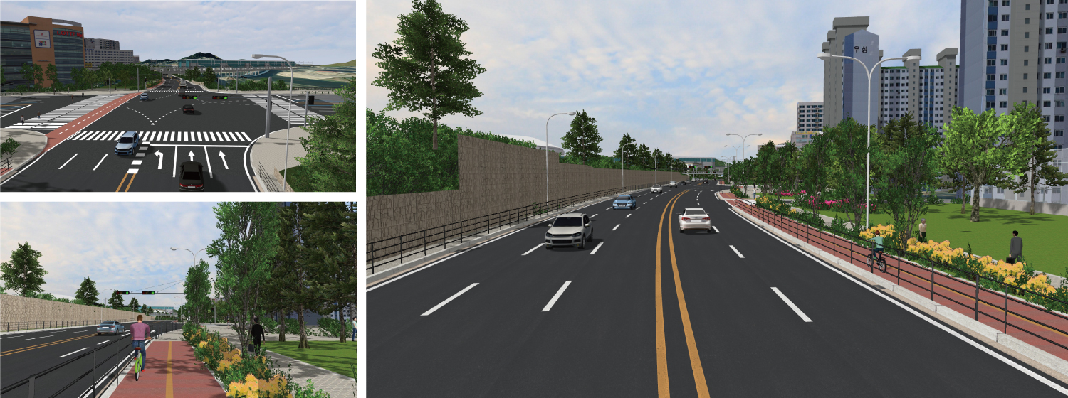
Honorable Judge Award Chiikizukuri Award (Community Development Award) (Mr. Hiroo Kasagi)
Nikaho city / NIHON TECHNOS CO., LTD.
VR Simulation Reproducing Kitamaebune
in Nikaho City
 The aim of this data is motivating people to visit Nikaho City. The city has many cultural assets related to Kitamaebune, which are recognized as a Japanese Heritage Site. The data recreates the scenes of Kitamaebune ships off the coast of Nikaho City that sailed in the Edo and Meiji periods. Viewers can also experience VR navigation from a viewpoint overlooking Mt. Chokai. For the future, developments of VR sightseeing experience using F8VPS before visiting the city and AR to experience the past collapse of Mt. Chokai are planned.
Watch This
This animation recreates the scene of a Kitamaebune sailing through the Sea of Japan. The animation "Kitamaebune Simulation" shows the scene of the ship sailing and the magnificent view of the mountain in the backdrop seen from the ship.
-
Honorable Judge Award Traffic simulation Award
(Prof. Tetsunori Haraguchi)National Institute for Land and Infrastructure Management (NILIM), Ministry of Land, Infrastructure, Transport and Tourism (MLIT)
Cutting Edge of Infrastructure DX Research -
Virtual NILIM and 4K VR Simulator -
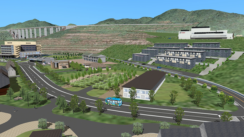
 As part of the infrastructure DX promotion, the entire site of the National Institute for Land and Infrastructure Management (NILIM), which measures up to 3 km from north to south, has been reproduced in VR. In addition to reproducing the exteriors of many facilities and test tracks for publicity purposes, a large 4K VR stereoscopic Driving Simulator has been installed as a platform for inter-departmental researches. This VR information is available on F8VPS, where visitors can take a virtual tour of the site and watch videos of experiments.
Watch This
By executing the "Virtual NILIM and 4KVR Simulator" script, you can see the driving scene on the large 4KVR stereoscopic DS, the VR space where the institute's site is reproduced, and the outline of the VR NILIM. In the VR space, various experimental facilities, a banked test track that enables high-speed driving, and a public road bridge crossing a vast site are recreated.
-
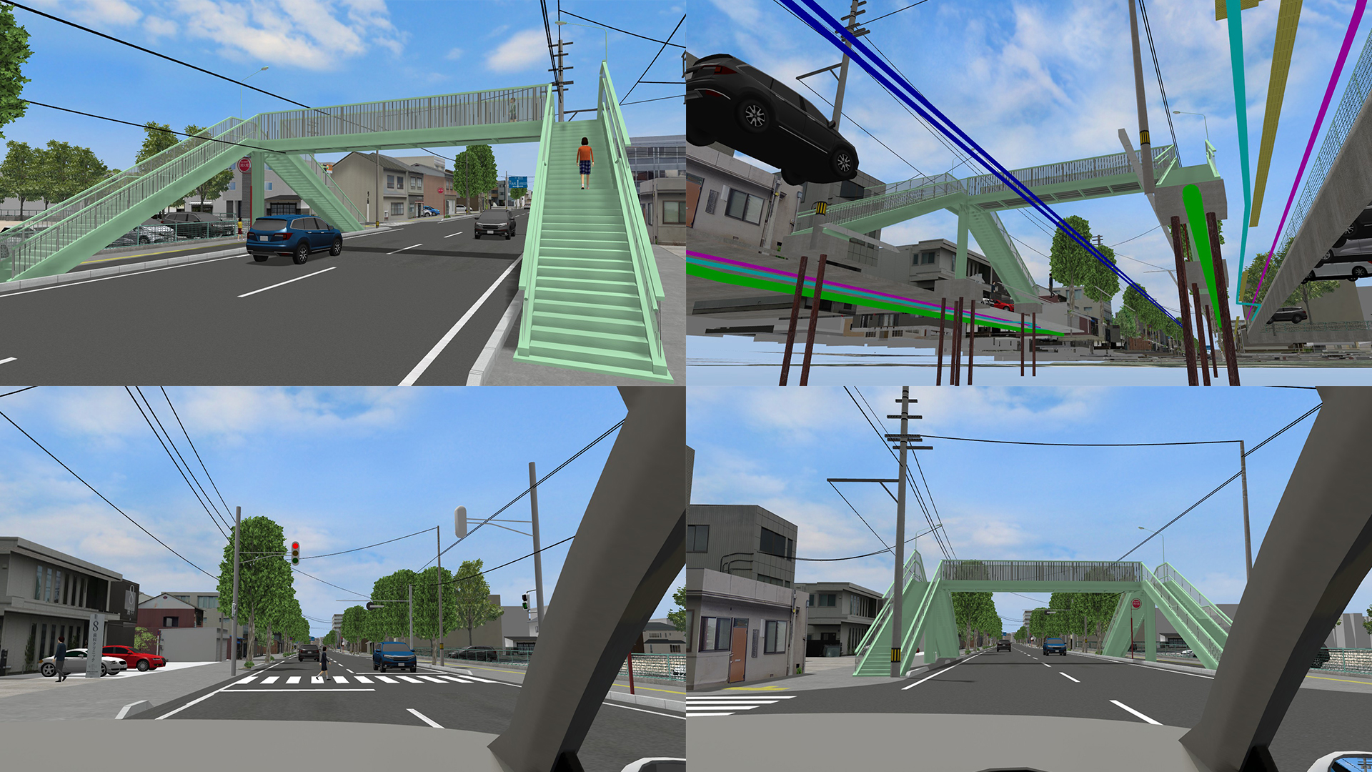 The pedestrian bridge in front of the elementary school is deteriorating and needs to be improved. Since most of the users of it are elementary school students and it is also used by many local residents to cross the street, the installation of pedestrian signals after the removal of the pedestrian bridge was considered. In this data, the current situation and the proposed plan are created, and the visibility of the new traffic signals against the existing signals is simulated from the driver's perspective.
Watch This
By executing the animation "Overview", viewers can see the current condition of the pedestrian bridge and the new traffic signal system proposed as a new alternative for pedestrians to cross the road. The number of children using the bridge, traffic flow, and signal indications are based on actual measurements, and even the underground objects such as the foundations and buried pipes that need to be dealt with when removing the pedestrian bridge are represented in detail. It is possible to check a series of issues to be discussed with the police, such as the visibility of traffic signals in close proximity, the location of street trees, and vehicle entrances and exits.
-
Nomination Award
Research Institute of Highway Ministry of Transport (China)
VR Simulation of Traffic Safety on
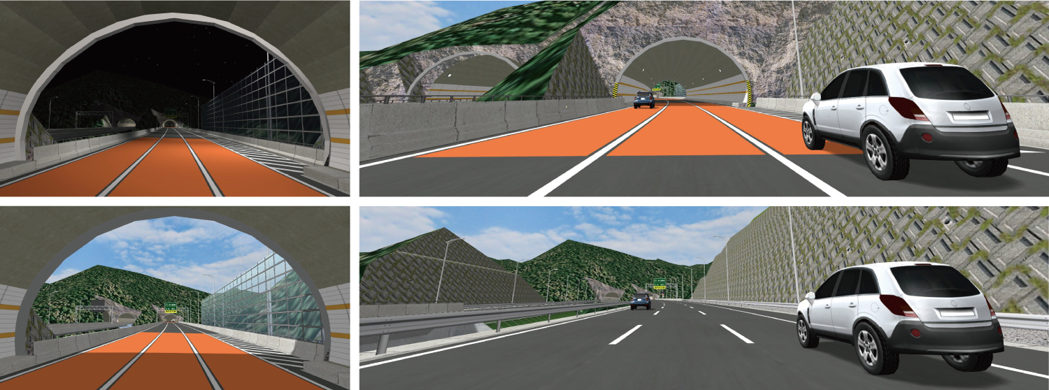
Expressways in High Mountain Areas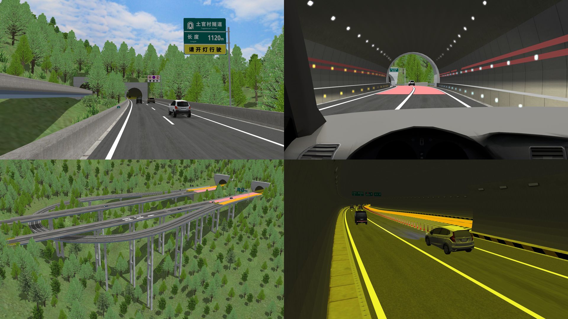 VR data for an expressway project in the high mountain area. More than 95% of the 30km-long continuous downhill consists of bridges and tunnels, and half of the bridges are interchanges and U-shaped junctions. In addition, there are entrances and exits inside the tunnels. In this work, the safety of the driving environment under this specially structured road is verified using VR, including the color of the pavement, the guidance of the signs, and the improvement of the safety facilities.
Watch This
This data shows the safety measures taken on a highway through rugged terrain, such as special interchanges, tunnel entrances and exits, and branches. To see an overview, run the "Traffic Safety Measures" animation or the "Tiger Leaping Gorge Entrance and Exit" scenario. Other scenarios allow viewers to see the road from the driver's perspective during autonomous driving mode and to drive manually.
-
Nomination Award
University of Seoul
Research for Preferred type of Autonomous Driving
 To help develop autonomous driving algorithms, a study to find the driving patterns preferred by autonomous vehicle drivers was conducted. Four autonomous driving scenarios with different driving patterns on the same route were created, and the subjects were asked to choose the best scenario, which can be used to set variables such as TTC, distance to the vehicle in front, acceleration/deceleration, and lane change frequency.
Watch This
To help develop autonomous driving algorithms, a study to find the driving patterns preferred by autonomous vehicle drivers was conducted. Four autonomous driving scenarios with different driving patterns on the same route were created, and the subjects were asked to choose the best scenario, which can be used to set variables such as TTC, distance to the vehicle in front, acceleration/deceleration, and lane change frequency.
-
Nomination Award
T-NET JAPAN Co., Ltd.
Survey VR Training Simulation
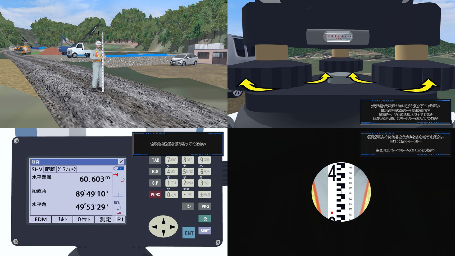 This is a VR simulation for training of surveying work using TS and other equipment, including contents allowing trainees to learn the flow from installation to measurement and the operation procedures of the equipment. VR-Cloud enables training via the Internet, which is useful for employee training under the COVID-19 situation.
Watch This
This data represents the work flow of the training for using a surveying equipment. The scenario "Concept of Surveying" shows an overview of the VR training, and in the "Leveling" and "Traverse Surveying" scenarios, viewers can experience the actual training. It is also possible to see what the equipment looks like by selecting the equipment name in context.
-
Nomination Award
Solar Kanamori
Plan of Small Hydroelectric Power Plant
at Chigawa River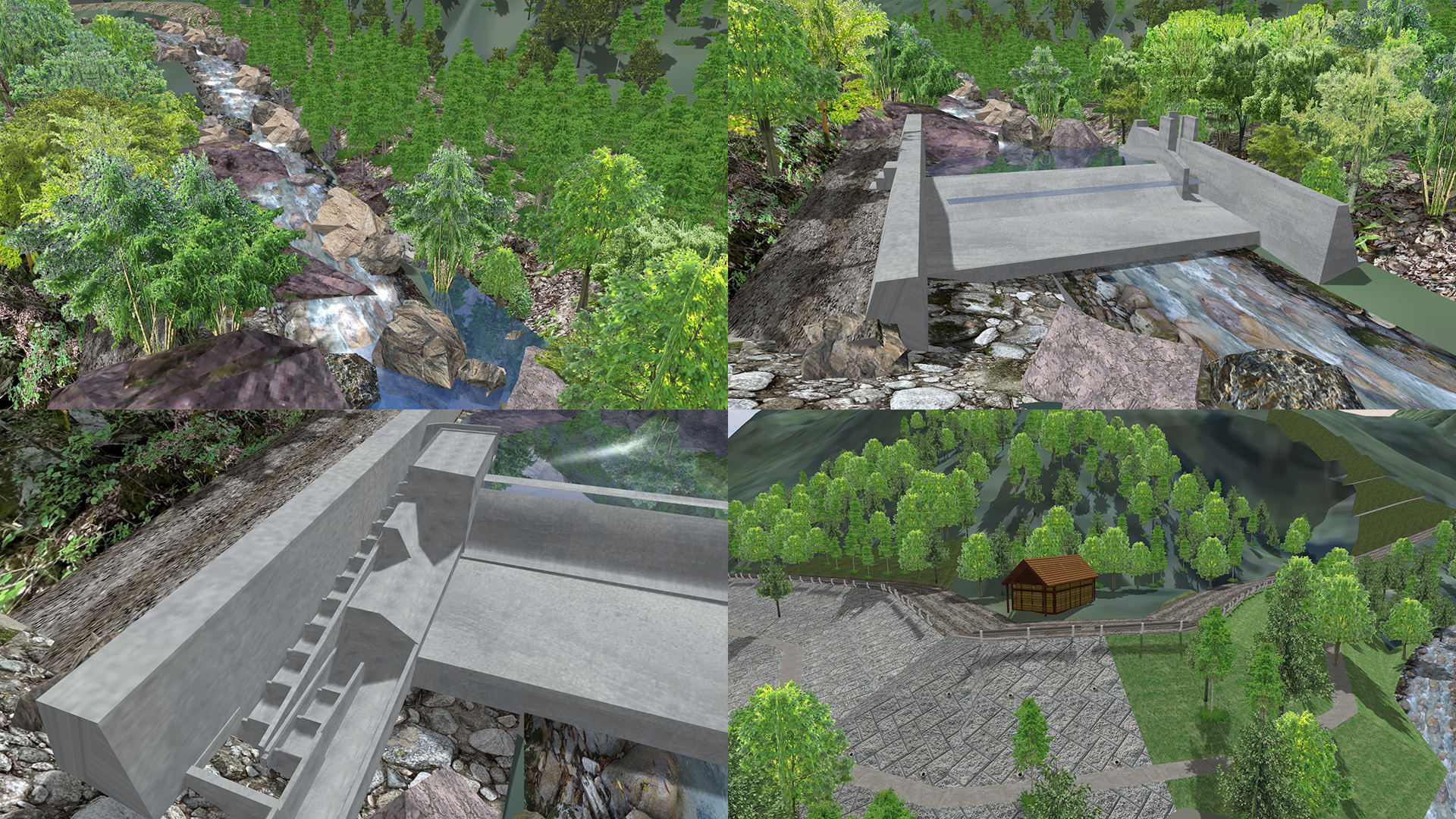 This VR was created to help explain a small hydroelectric power generation project in the upper reaches of the National Azumino Park at the foot of the Northern Alps to the fishermen's association. It was hard to represent natural objects such as forests, rocks, and the flow of the river. The data is visualized by combining DNA survey and literature survey with videos.
Watch This
Run the animation "Chigawa River Small Hydropower Project" to see the overview of the proposed small hydropower plant upstream of the Chigawa River. The data includes the characteristics of the area, the development plan for the water intake dam, the proposal to not set up a fishway, and the environmental measures during construction. You can also see the images of the current canyon, both proposals of construction with and without the fishway, and the power plant at the confluence".

Overview
Event Schedule
- Deadline for Application
Fri. October 15th, 2021
- Nomination Work Screening
Fri. October 26th, 2021
FORUM8 Tokyo Headquarters
- General Voting Period
Fri. November 5th - Sun. November 14th, 2021
Cloud Voting
- Award Winners Decision
Tue. November 16th, 2021
FORUM8 Tokyo HeadquartersUsing a combination of online voting and the judges opinions awards are decided. (Judges 70%, General vote 30%)
- Announcement and Award Ceremony
Wed. November 17th, 2021
Shinagawa Intercity HallFORUM8 Design Festival 2021
20th 3D・VR Simulation Contest on Cloud Awards Announcement and Award Ceremony
Juries
-

Jury ChairProf. Fumio Seki
Professior, Civil Engineering Department
Faculty of Science and Technology,
Nihon UnveristyAfter graduating the department of science and engineering, Nihon University, he joined Design Planning office for civil design of Taisei Corporation and has been engaged in design etc. for road structure, river, harbor and lecture etc. Appointed in the current position since 2011.
-

Mr. Hiroo Kasagi
NPO Community Development Studio
RepresentativeDirector of Japan Society for Impact Assessment, director of Laboratory of Autonomy Problem, part-time instructor of Nagano University, CEO of Kizakiko Hot Spring Development Co., Ltd. Councilor of Omachi Kita high school. Author of some books. Won the prize of Minister for the Environment for his activity of global warming in 2005.
-
Prof. Tetsunori Haraguchi
Visitng Professor,
Organization for Future Society Creation,
Nagoya UniversityWorked at Toyota Motor Corporation, and engaged in vehicle product power evaluation through driving. Moved on to the vehicle dynamic performance/chassis technology area until 2002. Next was future vehicle standards and development until 2011, and since 2012 a research at Nagoya University on future Scoiation Creation.
Application Requirements
- Application Criteria / Submission Conditions
1. VR data created through UC-win/Road (5 minute script required).
2. Overview of data explainging contents and operation in a brief format
* Data must be on media such as a CD-ROM, DVD format.
- Awards
- ■Grand Prix ■Excellence ■Special Awards (Idea/Essence) ■Honorable Judge Award ■Nomination
※No duplicate awards
- Deadline for Application
Fri. October 15th, 2021
* Nominees for this event will be decided on Tue. October 26th, 2021
- Destination of Submission
Please tell your contact person of FORUM8 staff and send it to him/her.
- Copyright of Submitted Work
-
The copyright of the VR data of the winning work belongs to the applicant.
Although the submitted data will not be distributed, FORUM8 will edit and process output images, videos, etc. for the data, works and deliverables produced by the author, and will make external presentations, research presentations, sales activities, As a public relations activity, you have a secondary license right such as publication/introduction on media such as HP, public relations magazines, books, magazines and newspapers.
- Inquiries for the application
Please tell your contact person of FORUM8 staff
or e-mail at ist@forum8.co.jp
Awards / Prizes

Grand Prix
Trophy, Certificate, Prize (Laptop, SSD, etc.), Gift Card
2nd Prize
(Excellence Award)Certificate, Prize (Laptop, drone, etc.), Gift Card
Idea / Essence Award
Certificate, Prize (Tablet, laptop, etc.), Gift Card
Honorable Judge Award
Certificate, Prize(Action Camera, drone, etc.), Gift Card
Nomination Award
Certificate, Gift Card
* Details of prizes will be posted when they are decided
Product Info
![]()
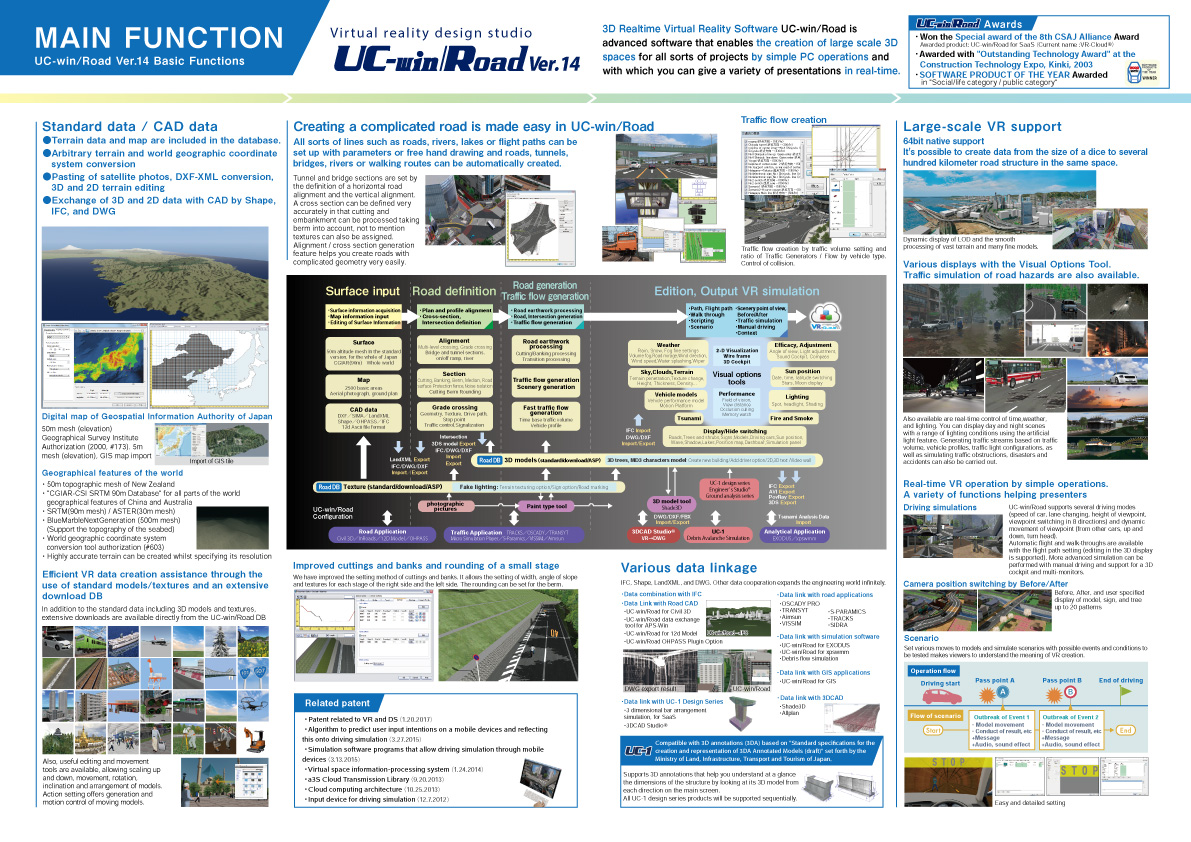
3D real-time virtual reality software UC-win/Road is an advanced software that can create 3D large-scale space of various projects by simple PC operation and can perform various real-time simulations.
Product info
UC-win/Road Basic Functions
![]()
VR-Cloud® is a consensus building solution which uses 3D and VR on a cloud server. With only internet access environment, even thin client would be able to operate the VR space by web browser.
Product info
VR-Cloud® Ver.6 Collaboration
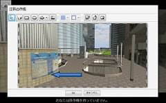
A full-featured VR cloud system that enables advanced communication between clients and VR. Implementation of shared content management. 3D bulletin board, landscape evaluation, conference support for multiple users. Equipped with annotation and photo functions.
▲Content viewer
▲3D icons
▲Annotation function
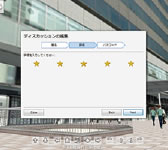
▲Landscape evaluation
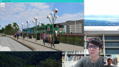
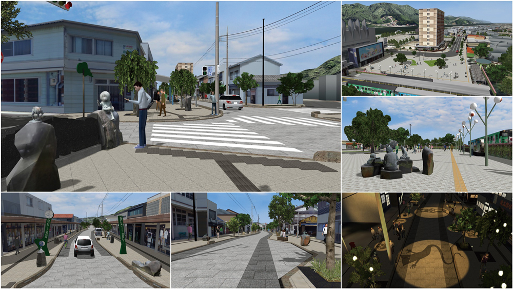
Case study: "Mizuki Shigeru Road x VR-Cloud® Ver6.1"
Provided by Tomohiro Fukuda laboratory of environment and energy engineering, Graduate school of Osaka University
In a renewal plan of Mizuki Shigeru Road promoted in Sakaiminato city, VR data of the concrete plan is created and shown to persons concerned and citizens for PR and a consensus building of the design plan. The VR-Cloud® is used for a remote design meeting by sharing the data.
Past Award Winners
Every year we explore various fields from civil engineering/construction, to driving/traffic simulations, to even town planning. In a recent years we have noticed a change in an organizations focus to autonomous driving research, disaster prevention scenarios, education, and medical care.
-
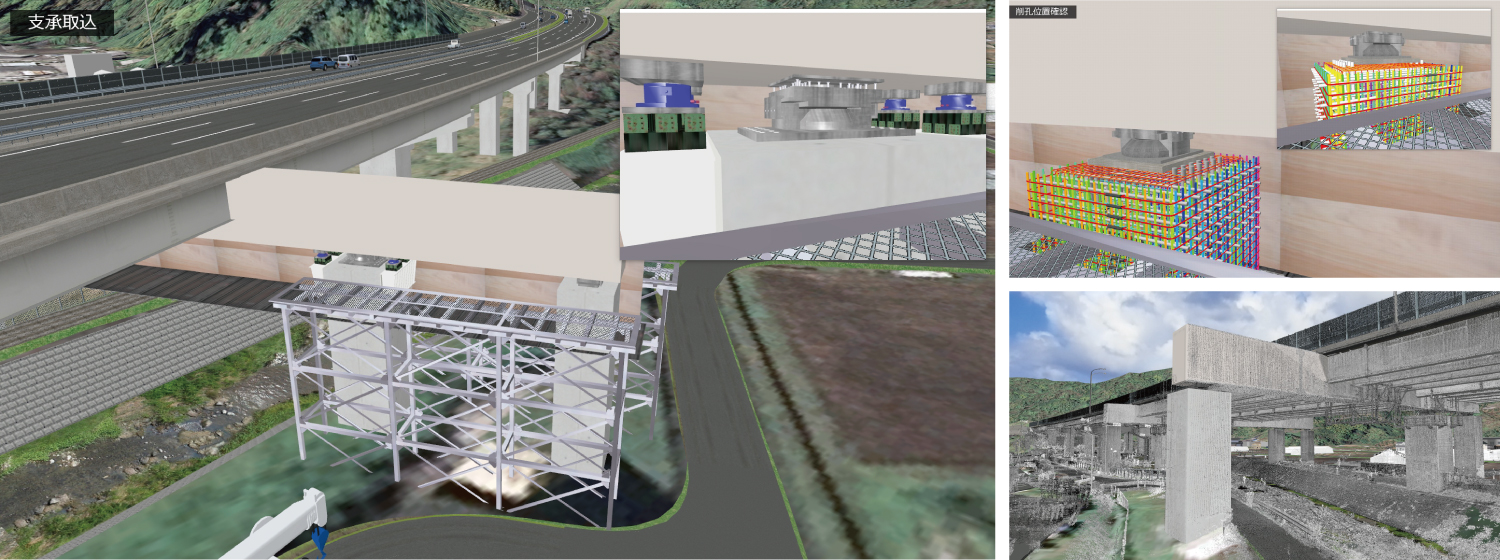 In order to improve workability, it is important to accurately grasp the on-site situation and reflect it in the plan. This time, we collected point cloud data before the construction work, and modeled the parts accurately from the design drawings to express the on-site conditions. Then we expressed the assumed construction contents and examined the workability.
 -
19th 2nd Prize (Excellence Award)
Simulator for remote control training
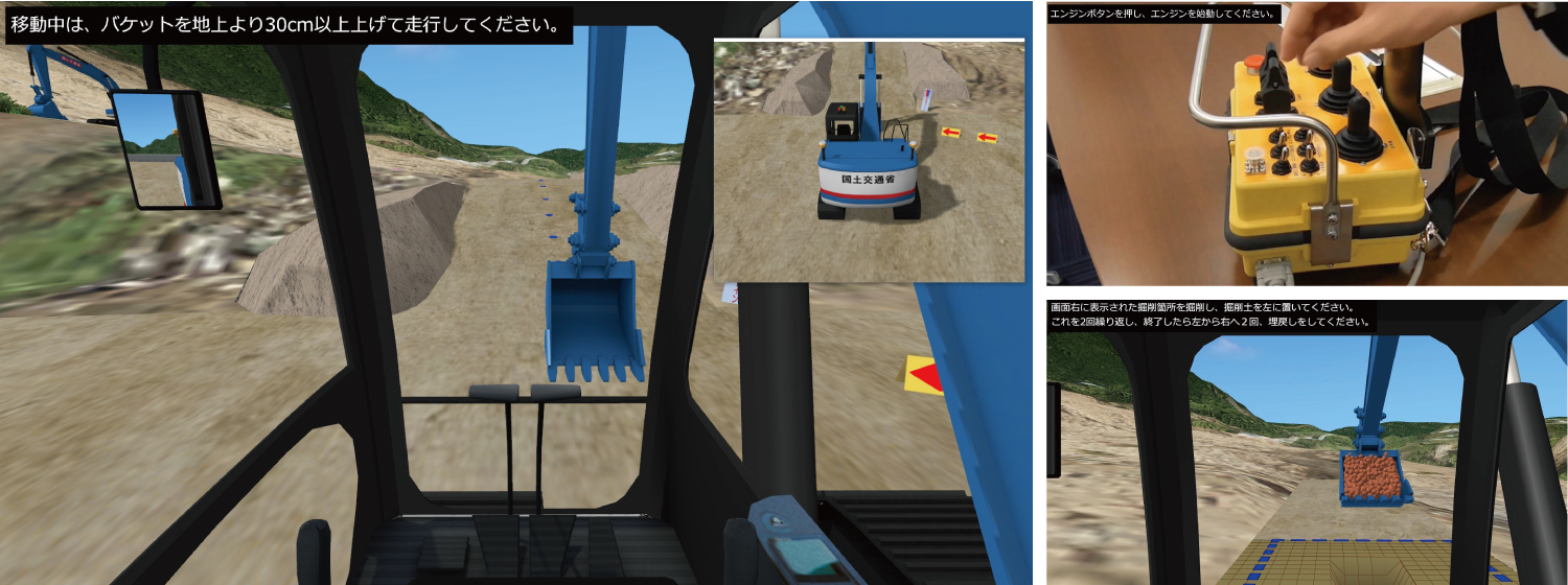 Building a reconstruction of the area around Aso Ohashi, which collapsed due to the 2016 Kumamoto earthquake.The photo data is an aerial photograph of the actual disaster site, so that the damages caused at that time can be understood. Using this VR data, we are constructing a remote control training simulator for compact type backhoe for the purpose of initial response in the event of a disaster by connecting a remote operation controller.
 -
-
19th Essence Award
Seoul Metropolitan Government Infrastructure Headquarters
Road design for "Changing western highways to urban roads" by VR
-
19th Honorable Judge Award Public design Award
A complex facility like a plaza where everyone gathers
-
19th Honorable Judge Award Chiikizukuri Award (Community Development Award)
Effective construction plans in road improvement
-
19th Honorable Judge Award Traffic simulation Award
Traffic restriction simulation due to intersection construction
-
-
19th Nomination Award
Research Institute of Highway Ministry of Transport China
Environment simulation assessment on tunnel lighting
-

Historical Awards
-
-
-
18th Honorable Judge Award Advanced Award
Hanshin Expressway Company Limited
Hanshin Expressway Vehicle Trajectory Simulation
-
-
-

-
16th Idea Award
Limited Association of Pipeline Data Utilization
Combination of 3D models from Pipeline Survey Data
-
-
-
-
15th Honorable Judge Award
Akita Industrial Technology Center / Akita University
Tsunami Rapid Evacuation Education System
-
-
-
-
9th Honorable Judge Award
Directorate general for Kobe city planning
Consensus building and simulation of Kobe City

-
19th 3D VR Simulation Contest (2020)
-
- [Grand Prix (Highest Award)]
SHO-BOND Holdings Co., Ltd.
- "Construction VR simulation during bridge repair"
- [2nd Prize (Excellence Award)]
Kyushu Technical Office, Kyushu Regional Development Bureau, Ministry of Land, Infrastructure, Transport and Tourism
- "Simulator for remote control training"
- [Idea Award]
Denso Corporation
- "VR data for driving reaction test"
- [Essence Award]
Seoul Metropolitan Government Infrastructure Headquarters
- "Road design for "Changing western highways to urban roads" by VR"
- [Honorable Judge Award]
Sakaiminato City
- "A complex facility like a plaza where everyone gathers Sakakiminato Civic Center (provisional name)"
Mitsui Consultants Co., Ltd.
- "Examination of effective construction plans in road improvement projects"
IWATA CHIZAKI Inc.
- "Traffic restriction simulation due to intersection construction in Sapporo"
- [Nomination Award]
Chuo Sekkei Inc.
- "Smart IC and VR driving simulation"
Research Institute of Highway Ministry of Transport
- "Environment simulation assessment on tunnel lighting"
TOHNICHI Co., Ltd.
- "Consideration on scenery of viaduct on Route 414"
- [Grand Prix (Highest Award)]
-
18th 3D VR Simulation Contest (2019)
-
- [Grand Prix (Highest Award)]
TUMS Urayasu Hospital
- "Safety driving diagnosis simulator"
- [2nd Prize (Excellence Award)]
East Nippon Expressway Company Limited
- "VR experience type training system"
- [Idea Award]
NICHIJO CORPORATION
- "Snow blower simulator"
- [Essence Award]
Kyoto Kogakuin High School
- "DS simulation of speed hump markings at Honmachi dori street"
- [Honorable Judge Award]
Hanshin Expressway Company Limited
- "Vehicle trajectory simulation on Hanshin Expressway"
National Science and Technology Center for Disaster Reduction (Taiwan)
- "Scenario construction and VR display of 3D environmental design VR software"
KEIKAN SEKKEI TOKYO Co., Ltd.
- "Bridge light-up simulation along Meguro River"
- [Nomination Award]
FUKUCHIGUMI Inc.
- "VR of BOX construction at Ajyagawa"
Toho Development Co., Ltd.
- "VR simulation of social infrastructure planning"
Iwakura Hospital
- "Driving determination and reaction diagnosis simulator"
Denso Corporation
- "Simulator reproducing the feeling of driving in Shinagawa city"
National University of Kaohsiung (Taiwan)
- "VR for urban planning in Cijin Island"
- [Grand Prix (Highest Award)]
-
17th 3D VR Simulation Contest (2018)
-
- [Grand Prix (Highest Award)]
Hokkaido Railway Company
- "VR simulation for Hokkaido Shinkansen Sapporo station design and construction"
- [2nd Prize (Excellence Award)]
Tho.La.Consulting
- "3DVR of Winding tower in Shime mining factory and Related facilities (in 1964)"
AKISHIMA LABORATORIES (MITSUI ZOSEN) INC.
- "VR data for ship operation simulator"
- [Idea Award]
Central Police University Republic of China (Taiwan)
- "Safety driving simulator for university students"
- [Essence Award]
Hitachi Construction Machinery Co., Ltd.
- "Autonomous driving simulation of mining dump truck"
Kanagawa Construction Bureau, Metropolitan Expressway Company Limited
- "VR simulation of evacuation from Metropolitan Expressway Yokohama Kita line"
- [Honorable Judge Award]
Tendaishu Kyououzan Monjuin Enyuuji
- "Test VR data for projection mapping on Enyuuji Temple"
Denso Corporation
- "Dual drive EPS system simulator"
Kyoto Kogakuin High School
- "VR data utilized for Nanase River renovation plan"
- [Nomination Award]
Mitsui Consultants Co., Ltd.
- "High resolution satellite photos applied to VR building and terrain models"
Hyundai Motor Group
- "Testing of ADAS function of Vehicle-in-the-Loop system using UC-win/Road"
Wuhan University of Technology
- "Evaluation of road markings for speed reduction on Wuhan Yangtze Great Bridge"
DOROKOGYO Co., Ltd.
- "VR construction management - utilization of 3D in paving work -"
- [Grand Prix (Highest Award)]
-
16th 3D VR Simulation Contest (2017)
-
- [Grand Prix (Highest Award)]
Meiwa Sky Support Co., Ltd.
- "Education training of Haneda Airport by VR simulator"
- [2nd Prize (Excellence Award)]
Keisuke Ijiri office
- "Reproduction of the tramway line and its surroundings in Omuta city"
Korea Transportation Safety Authority
- "Mobile type safety education experience 4D VR simulation"
- [Idea Award]
Kanro Jyoho Katsuyo Yugen Sekinin Jigyo Kumiai (Limited Association of Pipeline Data Utilization)
- "Integration of 3D models from sewerage pipe line investigation data"
- [Essence Award]
University of Seoul
- "VR for research on the effects of digital signage on driving operation and driver performance"
- [Honorable Judge Award]
Kisarazu City
- "A redevelopment proposal based on a model of the maritime area in Kisarazu city"
Fushimi Technical High School in Kyoto (Kyoto Kogakuin High School)
- "A proposal for the emergency planning using VR of a huge earthquake"
PIONEER CORPORATION
- "HMI VR cockpit simulation during autonomous driving"
- [Nomination Award]
Sagae Survey Civil Engineering Co., Ltd.
- "A proposal for the initial improvement of the government-designated historic site of the ruin of Aterazawa Tateyama castle in Oe, Yamagata using 3D point cloud data"
Mitsui Consultants Co., Ltd.
- "i-hazard map PROJECT -Proposal of the next generation i-hazard map concept-"
- [Grand Prix (Highest Award)]
-
15th 3D VR Simulation Contest (2016)
-
- [Grand Prix (Highest Award)]
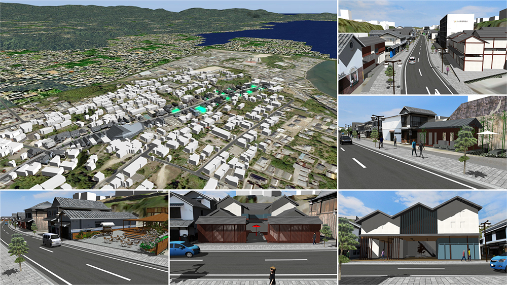
Sakaiminato City
- "Mizuki Shigeru Road in Sakaiminato City"
- [2nd Prize (Excellence Award)]
Fushimi Technical High School in Kyoto
- "Fushimi Technical High School, alma mater that is passed down the generations"
- [Idea Award]
Korea National Disaster Management Institute (NDMI)
- "Evacuation training and experiment in the chemical industry precinct by using walking VR simulator"
- [Essence Award]
Mitsui Consultants Co., Ltd.
- "Facility planning of a ski field considering user's viewpoint"
- [Honorable Judge Award]
Denso Corporation
- "Experience simulation of ADAS features"
Akita Industrial Technology Center / Akita University
- "Education system of rapid evacuation from tsunami"
Arcbazar
- "Works expression in Obama Center Competition"
- [Nomination Award]
Tongji University
- "Departing and gathering traffic simulation of large traffic core"
Sumitomo Mitsui Construction Co., Ltd.
- "Simulation of bridge girder construction via overhang construction technique"
Iwasaki CO., LTD.
- "Society infrastructure VR - production improvement by CIM"
- [Grand Prix (Highest Award)]
-
14th 3D VR Simulation Contest (2015)
-
- [Grand Prix (Highest Award)]
Kitsuki City, Oita Prefecture
- "Kitsuki City jokamachi (castle town) future proposals"
- [2nd Prize (Excellence Award)]
Tho.La.Consulting
- "VR for Rebuilding Ruins"
- [Idea Award]
Mitsui Consultants, Kansai Branch
- "Using VR to Communicate to the Locals Over Debris Avalanche Countermeasure"
- [Essence Award]
Fushimi Technical High School in Kyoto
- "Repair simulation in Higashi Takase river 2015"
- [Honorable Judge Award]
Awaji City Hall, Hyogo Prefecture
- "Dream Zone - Creating the Town You Want to Return! - Awaji City Yumebutai Sustainable Park, Compact City Project"
Mitsumi Electric Co., Ltd.
- "Smart Technology Concept Simulation"
RIOH
- "Underground rapid road design project"
- [Nomination Award]
SOZOTECH
- "The landscape VR simulation of The Town with Fishing Port"
Transport for NSW, Centre for Road Safety In collaboration with University of Wollongong / SMART Infrastructure Facility (scenarios)
- "CITI (Cooperative Intelligent Transport Initiative) project"
Nagoya University
- "Nagoya City Street VR Simulation -Shaping a Green Mobility Society - "
Qingdao Municipal Engineering Design Institute, China
- "Design of the cloverleaf interchange"
- [Grand Prix (Highest Award)]
-
13th 3D VR Simulation Contest (2014)
-
- [Grand Prix (Highest Award)]
TOYOTA MOTOR CORPORATION
- "Cooperative ITS Driving Simulator"
- [2nd Prize (Excellence Award)]
Fushimi Technical High School in Kyoto
- "Simulation for environmental upgrading around Higashi Takase river"
- [Idea Award]
Nisso Industries Co., Ltd.
- "QuikDeck Promotion VR Data"
- [Essence Award]
UTMS Society of Japan
- "DSSS Experience VR Data"
- [Honorable Judge Award]
atelier DoN
- "Residential Building Design VR Simulation for N House"
SOZOTECH
- "Construction VR Simulation for the bridge replacement"
Sanyu Eng. Ltd
- "Onuma Floating Istands landscape simulation"
- [Nomination Award]
Doshisha University
- "Driving support agent VR simulation"
ITS Bordeaux La CUB & BMIA
- "G'EduCom in Bordeaux"
Michael Baker International
- "Redlands California Flood Analysis Project using VR"
Tokyo Metro Co., Ltd.
- "Tokyo Metro Simulator"
- [Grand Prix (Highest Award)]
-
12th 3D VR Simulation Contest (2013)
-
- [Grand Prix (Highest Award)]
Iwasaki CO., LTD.
- "VR Simulation for Traffic Regulation to Divert Traffic During Night Construction"
- [2nd Prize (Excellence Award)]
Qube Ports and Bulk
- "Driver Training and Assessment System of PCC (Pure Car Carrier) Simulator"
Pacific Consultants Co., LTD.
- "VR Simulation that uses Tsunami/Evacuation Analysis Results"
- [Idea Award]
TS TECH Co., Ltd.
- "VR Simulator for Experiencing an Intelligent Driver's Seat"
- [Essence Award]
Graduate School of Osaka University
- "VR Model of Osaka's Underground Shopping Mall"
- [Honorable Judge Award]
University of Seoul
- "The Use of VR Simulation to Evaluate Safety of a New Type of Road (2+1) as well as Drivers' Behavior"
SOZOTECH
- "VR Simulation for an Urban Expressway with U-Turn Road"
Noda Engineering Co., Ltd.
- "Proposal of a New Engineering Method for Installing Single Track Railway Bridges"
- [Nomination Award]
Korea Transportation Safety Authority(TS)
- "Proposed Improvements on Special Traffic Safety Status Investigation in Republic of Korea"
ORIENTAL CONSULTANTS Co., Ltd.
- "VR was used to promote safety and use of the Narita Smart Interchange, which consequently streamlined business!"
Virtual Simulation and Training Inc.(VSAT)
- "3D VR Training Environment for Automobile Driver"
HAGIWARA ELECTRIC CO., LTD.
- " VR Simulator for Dangerous Scene Assessment Used in the Discipline of In-Vehicle ADAS "
- [Grand Prix (Highest Award)]
-
11th 3D VR Simulation Contest (2012)
-
- [Grand Prix (Highest Award)]
TOYOTA Motor Corporation
- "Project for sharing system of compact EV vehicle using VR simulation"
- [2nd Prize (Excellence Award)]
Kyushu-orient Servey&Design Co., Ltd.
- "Simulation for a landscaping plan using point cloud data"
BMIA (France)
- "Training system for tunnel administrator via VR"
- [Idea Award]
Keisuke Ijiri
- "Restoring the Oomuta street car in 1952 and the town along its railroad"
- [Essence Award]
Iiyama city Construction channel department City planning section/Section for maintening the surrounding of the station of Shinkansen bullet train
- "Simulation for urban planning in front of Hokuriku Shinkansen "Iiyama station""
- [Honorable Judge Award]
Nishitetsu C.E. Consultant Co., Ltd
- "Aiming for "Alleviating traffic jams in the original route especially near railroad crossings and narrow bridges""
JEITA (Japan Electronics and Information Technology Industries Association) Car Electronics Commitee / Car Electronics Promoting Comitee
- "Experience simulator for ITS spot service"
Material Hakuba Co., Ltd.
- "Simplified assessment for landslide extraction in the south of Nakatusna"
- [Nomination Award]
Korea Transportation Safety Authority
- "Improving the intersection which has a lot of accident and analysing the effect using DSLog"
Kusakabe Electric & Machinery Co., Ltd.
- "Simulation for pipe plant facility"
Fukui National College of Technology
- "Simulation for landslide disaster in Suzawa district of Shinshiro city, Aichi prefecture"
- [Grand Prix (Highest Award)]
-
10th 3D VR Simulation Contest (2011)
-
- [Grand Prix (Highest Award)]
Japan Railway Construction, Transport and Technology Agency
- "System for checking the position where equipments are installed"
- [2nd Prize (Excellence Award)]
Vehicle Information and Communication System Center
- "VICS Driving simulator"
- [Idea Award]
TOEI Company, Ltd
- "Kamen Rider, cyclone racing simulator"
- [Essence Award]
Amlux TOYOTA Co., Ltd
- "ITS driving simulator"
- [Development Award]
Graduate school of University of Tokushima
- "Bicycle simulator"
- [Honorable Judge Award]
Tatsumi Architects & Engineers
- "Simulation for improving the route taken by students going to and from school"
Roads and Traffic Authority of NSW (RTA)
- "3D VR modeling of the Hunter Expressway"
Asahi Sokuryo Sekkei Co., Ltd
- "VR simulation for consensus creation in the traffic nodes improvement project"
- [Nomination Award]
City of Nedlands (Australia)
- "3D VR modeling of Black Spot Project"
Graduate School of University of Tokyo
- "Comparative approach to visibility of signboards using VR simulation"
- [Grand Prix (Highest Award)]
-
9th 3D VR Simulation Contest (2010)
-
- [Grand Prix (Highest Award)]
Faculty of Policy Studies, Kansai University
- "Proposal of underground installation of Hanshin expressway and improved city using VR"
- [2nd Prize (Excellence Award)]
East Nippon Expressway Co., Ltd
- "Highway driving simulator system"
- [Idea Award]
Faculty of Engineering, Gunma University
- "Debris avalanche simulation"
- [Essence Award]
Abley Transportation Consultants Limited(New Zealand)
- "STRIDING AHEAD! Modeling Unpredictable Pedestrian Road Crossing Behavior"
- [Development Award]
SK Energy Co., Ltd. (Korea)
- "A publicity drive simulator for EV and charging system in SmartGrid"
- [Honorable Judge Award]
Asunaro Aoki Construction Co., Ltd
- "VR simulation for the proposal of the ground facilities construction"
Korea Transportation Safety Authority(Korea)
- "VR simulation of the crosswalk construction planning for the prevention of traffic accidents"
Directorate general for Kobe city planning
- "VR utilization for consensus-building toward landscape formation of design city, Kobe"
- [Nomination Award]
Seoul National University (Korea)
- "VR simulation in disasters using P-SIM(Pedestrian flow simulation)"
Taisei Engineering Co., Ltd
- "VR data utilization and DS driving analysis system"
FUJICON PRIANGAN PERDANA, PT(Indonesia)
- "BANJAR Water Park"
- [Grand Prix (Highest Award)]
-
8th 3D VR Simulation Contest (2009)
-
- [Grand Prix (Highest Award)]
Metropolitan Expressway Company Limited
- "VR Data for Ohashi Junction of Metropolitan Expressway"
- [2nd Prize (Excellence Award)]
Korea Road Agency (Korea)
- "VR simulation of Design Change of Korea Namhae Highway"
- [Idea Award]
Noda Engineering Co., Ltd.
- "Simulation of Railway Bridge Beam Construction Work"
- [Essence Award]
Graduate School of Informatics Kyoto University
- "Simulation of Traffic in Kyoto City"
- [Overseas Award]
Ourston Roundabout Engineering, Inc.(USA)
- "VR Data of Roundabouts in US 41 Project"
- [Honorable Judge Award]
Hosei University
- "Proposal of Reproducing Environmentally-friendly Waterland City Hino"
Beijing Water Cube Digital Technology Co.,Ltd. (China)
- "VR Project of Beijing Guomian Group (Jingmian Second Factory)"
Nishitetsu C.E.Consultant Co.,Ltd
- "Creation of Road Which Is Suitable for Aso Kuju National Park"
- [Nomination Award]
Temasek Polytechnic (Singapore)
- "Road Monitoring System"
GTSM Inc. (Korea)
- "Transfer VR simulation at Junjon Service Area in Korea"
Shanghai Chikushi Construction Design Co., Ltd. (China)
- "VR Simulation of Pedestrian Behavior at Pedestrian Bridge Construction"
- [Grand Prix (Highest Award)]
-
7th 3D VR Simulation Contest (2008)
-
- [Grand Prix (Highest Award)]
National Agency for Automotive Safety & Victims' Aid
- "Simulated driving diagnosis system using CG simulation"
- [2nd Prize (Excellence Award)]
Osaka University, Graduate School of Engineering, Division of Sustainable Energy and Environmental Engineering
- "Sakai City Oshoji LRT Project VR data"
- [Idea Award]
Noda Engineering Co., Ltd.
- "Erection of construction girders for underground passageway construction in train stations"
- [Essence Award]
Daido Institute of Technology, Department of Civil Engineering and Environmental Design
- "VR utilization case in educational curriculum"
- [Overseas Award]
CION Media Company (Turkey)
- "AFRICA_SUDAN Project"
- [Honorable Judge Award]
Busan Regional Construction & Management Office (Korea)
- "Sancheong-Sudong VR Simulation"
Taisei Engineering Co., Ltd.
- "Simulation of an evacuation in an aging society using 3D VR"
Arizona State University(USA)
- "Digital Phoenix Project by UC-win/Road III"
- [Nomination Award]
Asahi Kasei Construction Materials Corporation
- "EAZET construction VR Simulation"
Haihe River Water Conservation Commission, Ministry of Water Resources (China)
- "3D Exhibition of North Grand Canal Ecological Rehabilitation"
Shanghai T.E.F Building Safety Consulting Co.,Ltd (China)
- "Evacuation Simulation of Hongqiao Traffic Network Center Building"
Tsinghua Sware Software Hi-Tech Co. Ltd. (China)
- "Shenzhen Yantian Port modern distribution center"
- [Grand Prix (Highest Award)]
-
6th 3D VR Simulation Contest (2007)
-
- [Grand Prix (Highest Award)]
Kanagawa Construction Bureau, Metropolitan Expressway Company Limited
- "Ishikawa-cho Junction Simulation"
- [2nd Prize (Excellence Award)]
National Institute for Land and Infrastructure Management, Ministry of Land, Infrastructure and Transport / Highway Industry Development Organization
- "SMARTWAY 2007 VR Simulation"
- [Idea Award]
Meijo University, Faculty of Science and Technology, Department of Information Engineering
- "Driving Ability Measurement for Senior Citizen VR Simulation"
- [Essence Award]
Meishi Road Buresau, Chubu Regional Bureau, Ministry of Land, Infrastructure and Transport
- "Asuke By-pass Road Simulation"
- [Overseas Award]
Nepoch Consultant Co., Ltd.
- "Qingdao JiaoZhou bay Tunnel Project"
- [Honorable Judge Award]
Huyo architect office Co., Ltd.
- "Katsunuma Station Square Park Simulation"
Arizona State University
- "Digital Phoenix Project by UC-win/Road II"
Civil and Environmental Engineering , Faculty of Engineering and Design, Hosei University
- "Hosei University around Ichigaya Campus VR Simulation"
- [Grand Prix (Highest Award)]
-
5th 3D VR Simulation Contest (2006)
-
- [Grand Prix (Highest Award)]
Kanagawa Construction Bureau, Metropolitan Expressway Company Limited
- "Simulation carried out at the Daishi junctionand ventilation place"
- [2nd Prize (Excellence Award)]
Bureau of Construction Tokyo Metropolitan Government Minami Tama Higashibu Construction Office/ Japan Bridge & Structure Institute, Inc.
- "Machida city, Aibara-Tsuruma line simulation"
- [Idea Award]
China Shanghai Institute of Waterways
- "The Simulation of Ecological Restoration of Yunnan Province Erhai Lakeside Area"
- [Essence Award]
Nihon University College of Science and Technology Department of Transportation Engineering and Socio-Technology
- "The VR simulation for the landscape comparison of International avenue transit mall"
- [Overseas Award]
China Nepoch Consultant Co. Ltd
- "2010, Shanghai international exhibition central axis simulation"
- [Grand Prix (Highest Award)]
-
4th 3D VR Simulation Contest (2005)
-
- [Grand Prix (Highest Award)]
Ministry of Land, Infrastructure and Transport, Shikoku Regional Development Bureau, Matsuyama Rivers and National Highway Bureau
- "Matsuyama belt highway"
- [2nd Prize (Excellence Award)]
CRISEN TECHNOLOGY CO., LTD.
- "China : Tientsin Haihe bridges project - Cifeng bridge design study"
- [Overseas Award]
Korea Highway Corporation Basis Soft,Inc
- "Korea : Dong Hong Cheun - Yang Yang highway project."
- [Idea Award]
NISSEI EBLO INC.
- "Metropolitan underground infrastructure model"
- [Grand Prix (Highest Award)]
-
3rd 3D VR Simulation Contest (2004)
-
- [Grand Prix (Highest Award)]
Road Management Technology Center
- "Road Management Support System by using Virtual Reality(VR)"
- [2nd Prize (Excellence Award)]
Metropolitan Expressway Company, Tokyo Building Bureau, Related Street Division
- "Landscape simulation for street planning"
Japan Highway Public Corp.,Tokyo Construction Bereau, Chiba Construction Office / Daiichi Fukken
- "Ken-Ou-Dou (Chiba) VR simulation"
- [Runner-up]
Taisei Engineering Co., Ltd.
- "Simulation of additional construction of tollbooth in expressway JCT/ramp"
- [Grand Prix (Highest Award)]
-
2nd 3D VR Simulation Contest (2003)
-
- [Grand Prix (Highest Award)]
Central Nippon Expressway Company Limited Tokyo Office, Atsugi Work Office
- "Sagami Longitudinal Expressway Ebina JCT/CG Model"
- [2nd Prize (Excellence Award)]
Ministry of Land, Infrastructure and Transport, Chube Regional Bureau, Hokusei National Highway Office
- "Route1 Hokusei Bypass"
Taisei Corporation / Fuji International Speedway Co., Ltd
- "CG model of Fuji Speedway"
Yachiyo Engineering Co., Ltd Osaka branch office
- "Simulation for the street improvement project in Otsu city"
Bellwood Design System Co., Ltd
- "Hill-crest in eastern area, HSST"
- [Grand Prix (Highest Award)]
-
1st 3D VR Simulation Contest (2002)
-
- [Grand Prix (Highest Award)]
Ministry of Land, Infrastructure and Transport, Chubu Regional Bureau, Tajimi Office of Sabo and National Highway
- "Tokai Ring Expressway"
- [2nd Prize (Excellence Award)]
Nippon Koei Co., Ltd Osaka branch office
- "Kushimoto bridge and Miyuga loop bridge"
East Japan Railway Company Research & Development Center of JR East Group
- "Construction work of train station's roof"
Toda Corporation
- "Presentation document on temporary construction in traffic intersection"
NEXCO Central (Central Nippon Expressway Co., Ltd Atsugi office of Tokyo branch)
- "Atsugi IC, Tomei Expressway"
- [Grand Prix (Highest Award)]