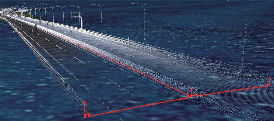
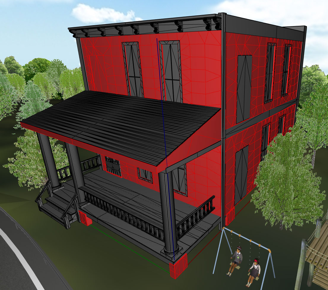
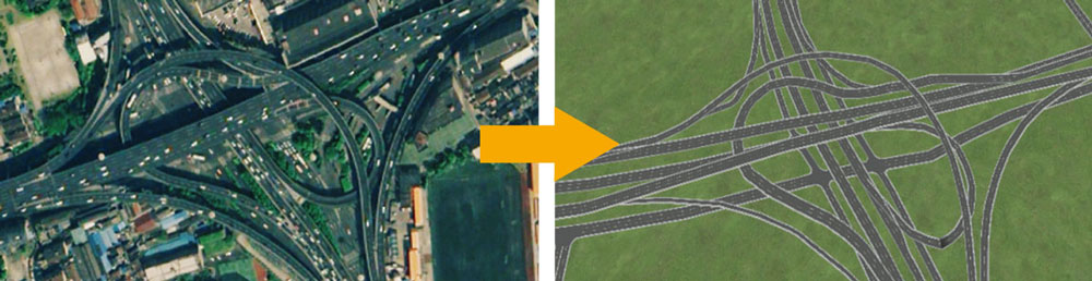
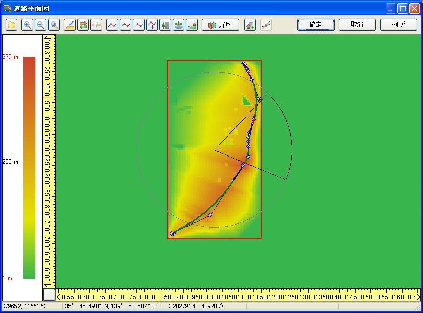
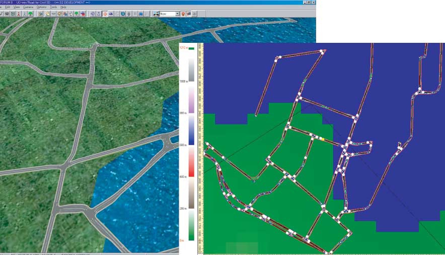
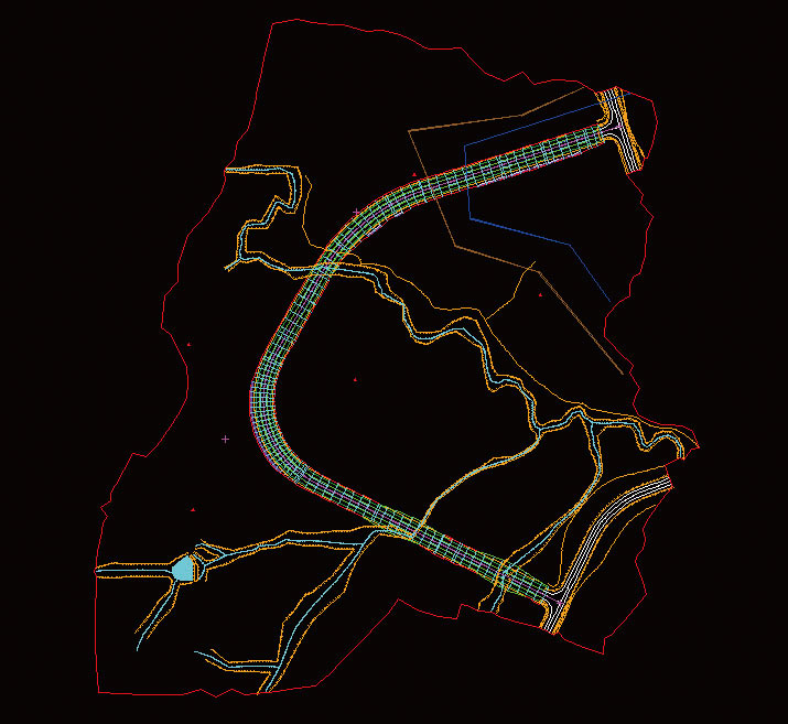
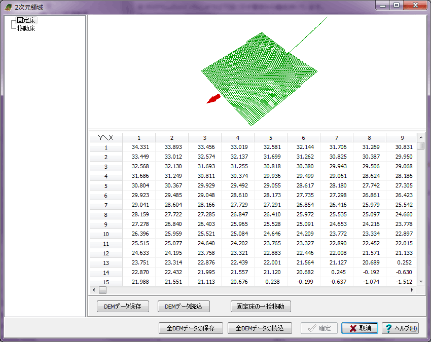
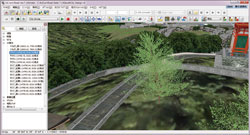
Point Cloud Modeling Plug-in Real time VR supports 60,000,000 point cloud. Advanced
- Display of 3D point-cloud data to VR space
- A variety of editing function including creation of horizontal and vertical
center line
- Conversion land and ocean bed into Tin, pasting of the image
- Automatic color assignment for aerial photographs
- Exporting to LandXML
- Supported point-cloud number 32bit : less than 40,000,000 64bit
: more than 70,000,000
Future development
- Enhancement of line creation.
- Enhancement of editing function. Partial deletion, high speed searching
of point clouds.
- Speeding up of display by point cloud LOD
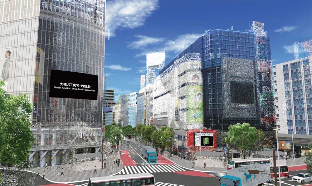
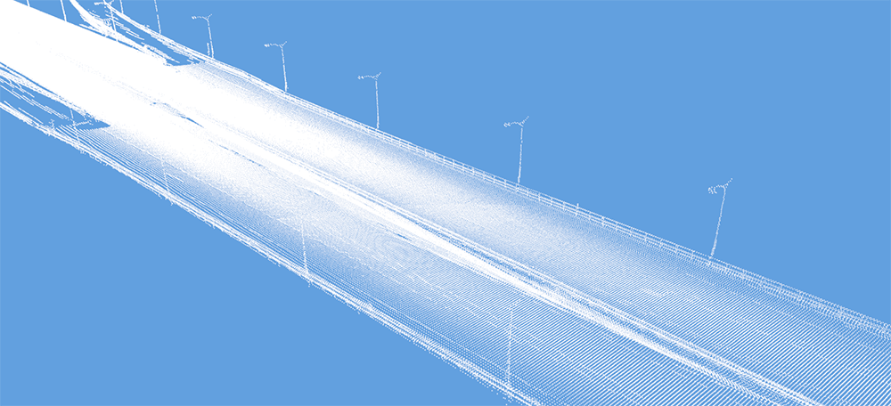
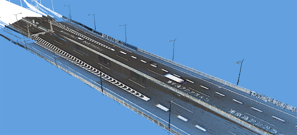
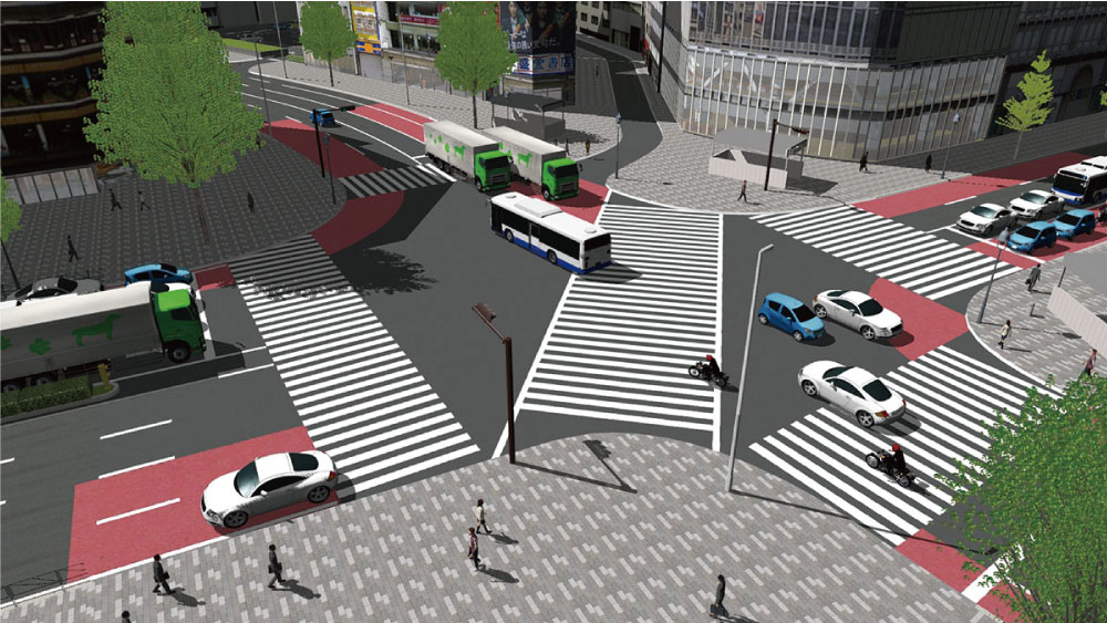
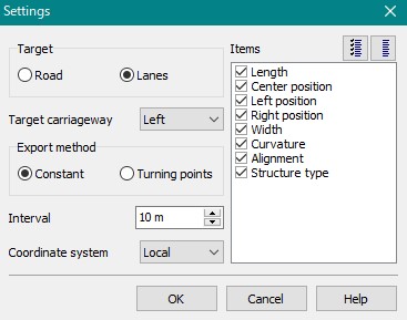
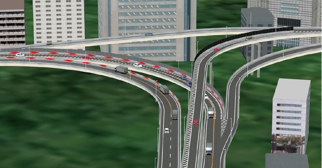
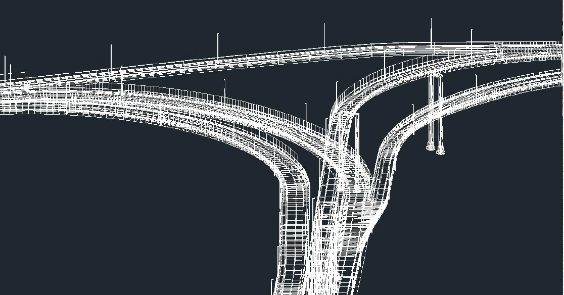
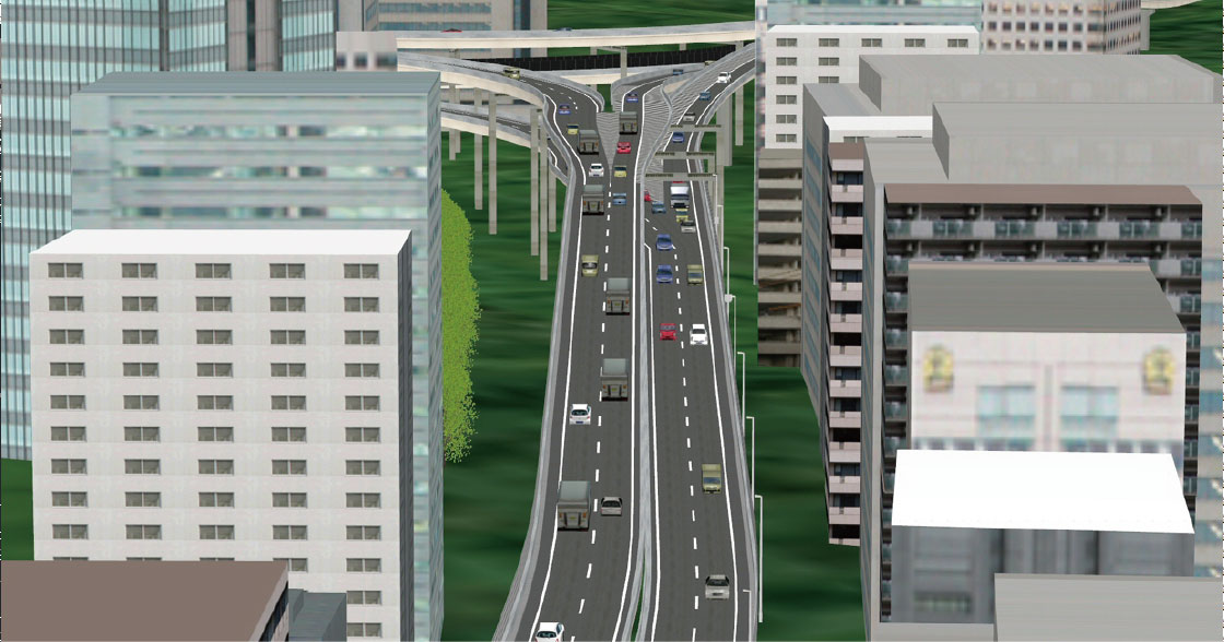
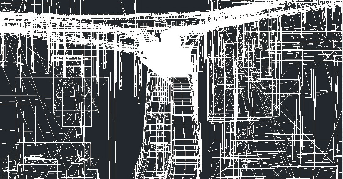
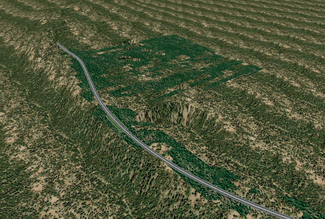
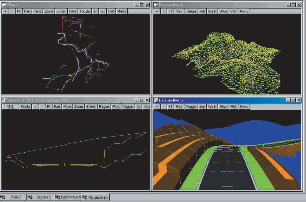
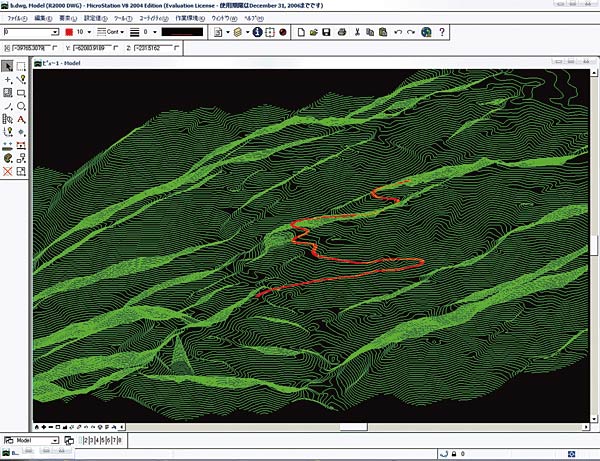
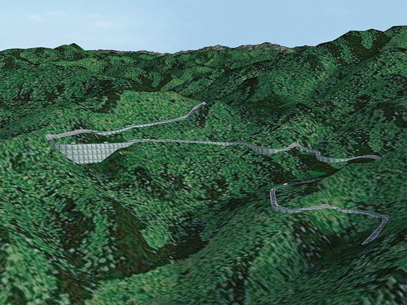
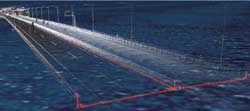
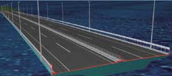
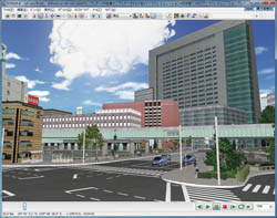
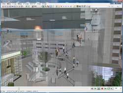
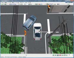
| Road cross section/ Road section editor |
 |
 |
| Road modeling |
 |
 |
 |
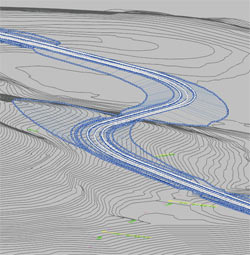
 Point cloud data only Point cloud data only |
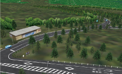
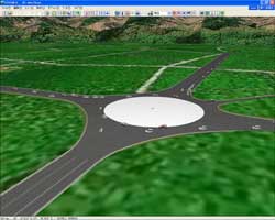
Road model |
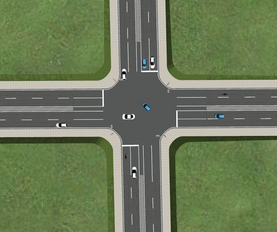
Model of traffic intersection
in Shibuya |
|
Photo Processing Extension Plug-in Option in additional cost
| When there is no color on the point cloud due to the specification of the measuring device, unfavorable condition at the time of measurement, or low accuracy, Photo-Log Point Cloud Modeling Plug-in is the answer as it uses photo-logs to add color to the point cloud data. (Point-Cloud Modeling Plug-in is required at an additional cost) |
 |
 |
| Before coloring |
After coloring |
|
Rhino Plug-in Option Option in additional cost
Plug-in that displays 3D models built by Rhinoceros® (Robert McNeel
& Associates http://www.en.la.mcneel.com/) within the 3D environment of UC-win/Road.
- Data are transferred back-and-forth between UC-win/Road (server) and Rhinoceros® (client) via a3s; 3D model in the process of being built by Rhinoceros® is reflected in UC-win/Road. Model positioned within the 3D environment can be edited.
- With the combination of VR-Cloud®, Rhinoceros® can be browsed by
VR-Cloud® user.
|
Export Scene Plug-in Advanced
This function enables the outputs of all models with geographical features
in 3D space of UC-win/Road in an arbitrary 3D model data format. For example,
it will be possible to use it with various editors and tools such as 3ds
Max by outputting it in 3ds format, (3ds format is the standard).The 3D
model output data format is planned to increase to include various formats
such as FBX, Obj, VRML and OpenFlight.
|
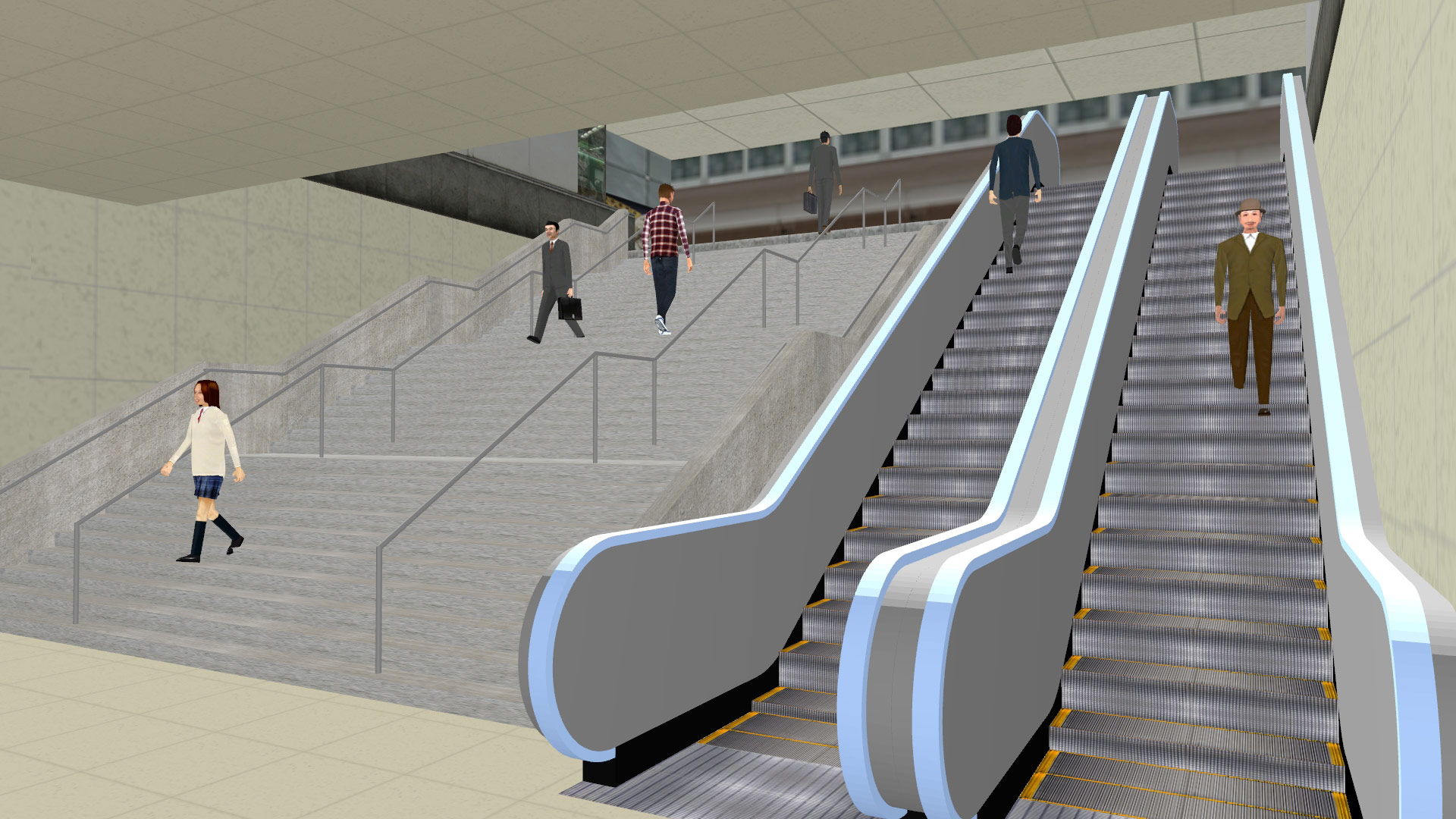
Parametric 3D modeling Standard
Sing, stairway, escalator, fence by parametric input can be generated.
In case of stairway, the width, height, number of bars and texture can
be assigned. Supporting grouping and display switching of signs.
Model List
General models / Vehicles / Cabs / Vehicle interiors / Road structures
/ Flags / Terrain textures / Video wall / Buildings / Railroads / Trailers
/ Traffic lights / Characters / Trees / Fire/Smokes / Text 3D |
 |
 |
|
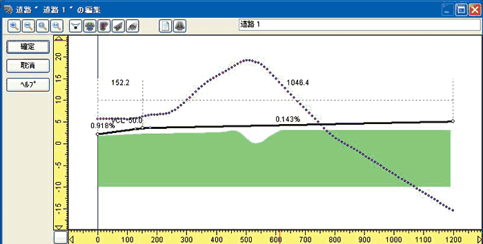
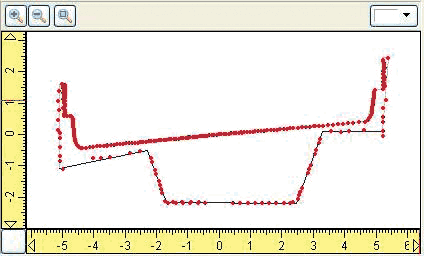
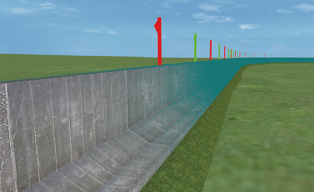
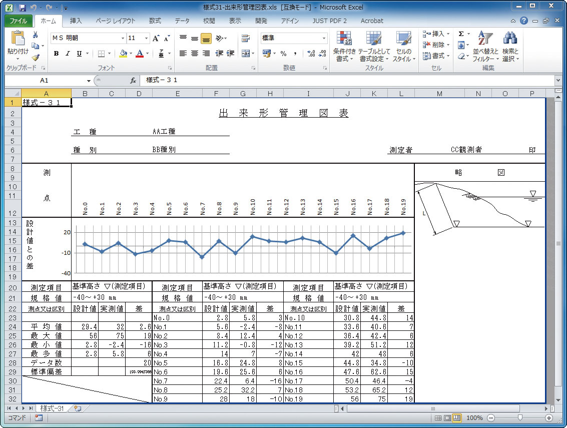
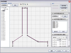
Dekigata (work progress control) Plug-in Option
Option in additional cost
The work progress control can be made by measuring the differences from
the design data and the point cloud data.
The difference is measured from the design data (designed value) and the
point cloud data (actual measurement value) and each work progress control
is created. If the design data has already been maintained with LandXML
etc., the work progress control can be made easily by way of acquiring
the work progress control in 3D laser scanning.
 |
 |
 |
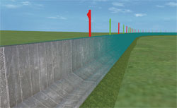
Superposition of
embankment
surface
and point cloud data
(Retaining wall) |
Retaining wall
- Finished cross section |
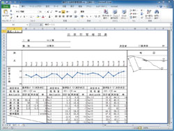
Management report
in Excel format (Style 31) |
|
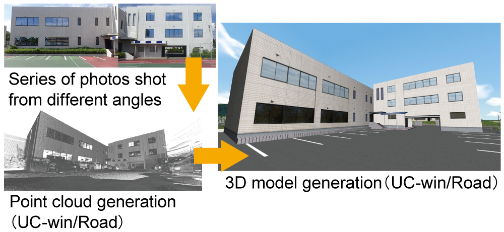
SfM(Structure from Motion) Plug-in Option in additional cost
SfM(Structure from Motion) is the name of a technique of generating point-cloud data from a series of photo
SfM Plug-in requires only a regular digital camera, which makes 3D data
modeling much more accessible. SfM plugin allows photos to be loaded into
UC-win/Road and analyzed to generate models.
Using the SfMPlugin mainly involves the following steps:
- Photoshooting the location to obtain 3-dimensional coordinates.
- Specify analysis parameters and perform SfM analysis.
- Adjust and refine the point-cloud data.
|
 |
|
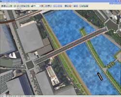
OSM(OpenStreetMap) Plug-in Ultimate
The new OSM plugin will allow importing of OSM (OpenStreetMap) data to
shorten the time for creating 3D virtual spaces.
Users can now import the OSM files, which will be converted into UC-win Road data. Roads, lanes, tunnels, and bridges are currently supported. The roads are complete with further information such as their names, types and lane widths. Each of these elements are all converted for further customization. |
 |
|
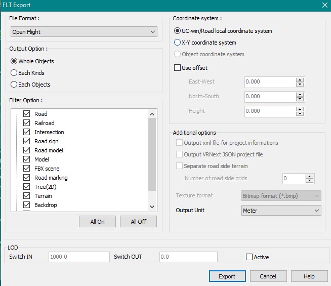
OpenFlight Plug-in Option Option in adittional cost
| Export / import OpenFlight format data on UC-win/Road. |
|
|
DS Course Converter Plug-in Option Option in adittional cost
Export road center line or lane center line in UC-win/Road data in CSV
format.
|
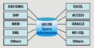
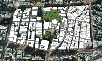
GIS Plug-in Advanced
3D GIS system can be built by importing data from road CAD, GIS software,
and 3D CAD software.
- Export into Google Earth
- VR model by UC-win/Road Web Viewer is published
- Coordinate conversions for GIS format files
- Import / Export of Image files or Vector files
- Attribute table conversion function
- Linkage between GIS file and UC-win/Road
|
 |
|
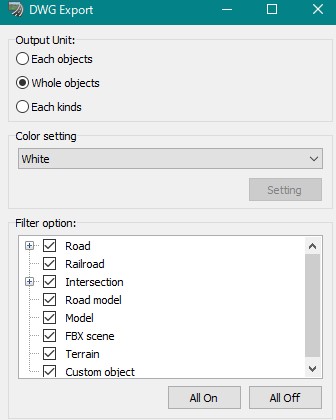
UC-win/Road DWG Tool Ultimate
3D/2D data exchange that supports CIM. (3D Model Export Plug-in is required at an additional cost)
Import: Import "Road section", 3D model from DWG data
Export: Roads/terrain within UC-win/Road 3D model are categorized into layers and then exported.
Exact colors as seen in UC-win/Road can also be assigned to the exported model.
|
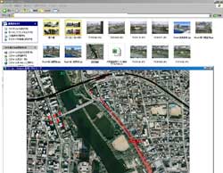
Online Map Import Plug-in Option
Option in additional cost
Import
objects such as building and forest from online maps
including
OpenStreetMap.
 |
 |
 |
| ▲OpenStreetMap map information |
▲Data imported from OpenStreetMap |
▲Data edited after importing |
|
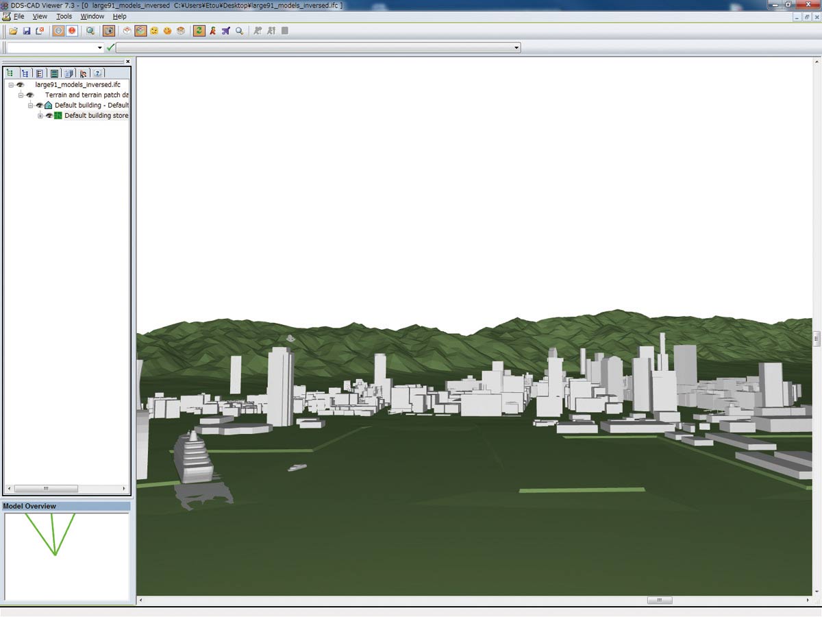
IFC plug-in Ultimate
- The terrain data in the file described in IFC format can be imported
into UC-win/Road as a terrain patch.
- The UC-win/Road as a terrain patch can be exported into terrain data
in the file described in IFC format.
|
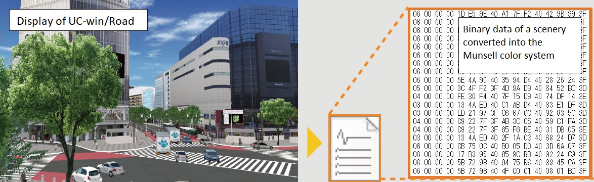
Munsell Color Space Export Plug-in Ultimate
It is a plug-in to convert the scene displayed on the main screen into
the "Munsell colour system", and preserves it in the munsell
colour file. It then becomes possible to use this scene for design and
research by using the munsell colour file by accessing the file output
with the plug-in.
|
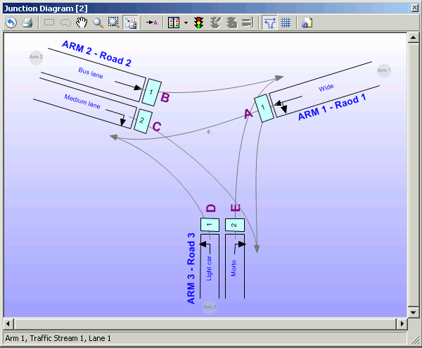
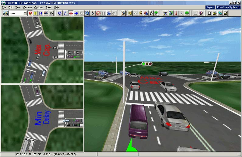
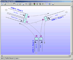
OSCADY PRO Plug-in Advanced
About OSCADY PRO
OSCADY Pro allows automatic setting of signal phase and arrangement, and
optimized signal capacity and congestion, and gradual and swift optimization
of traffic signal. It's compliant to "Revised at Grade Intersection
Plan and Design, the 3rd Basic volume, Japan Society of Traffic Engineers,
July 2007." To optimize, it automatically set the phase, based on
the signal phase and timing of signal changing cycle. Signal optimization
tool detects optimized timing, based on 3 policies- decisive time cycle,
aximum capacity and minimum delay. (Oscady developed by TRL : Transport
Research Laboratory)
 |
 |
 |
| Intersection figure |
Signal phase |
Import maximum capacity
and minimum delay |
Developed by TRL (http://www.trl.co.uk/)(Creating the future of transport) |
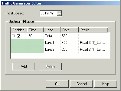
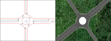
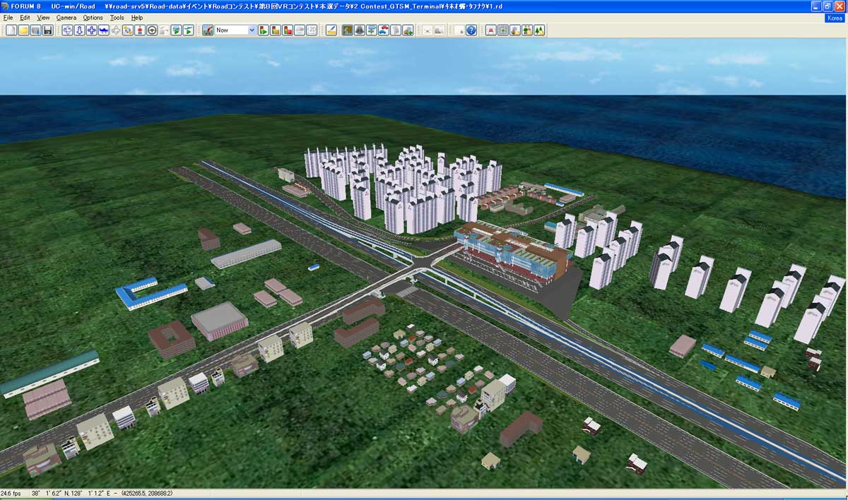
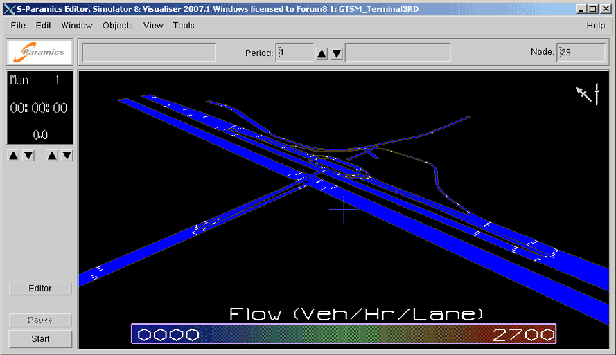
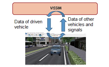
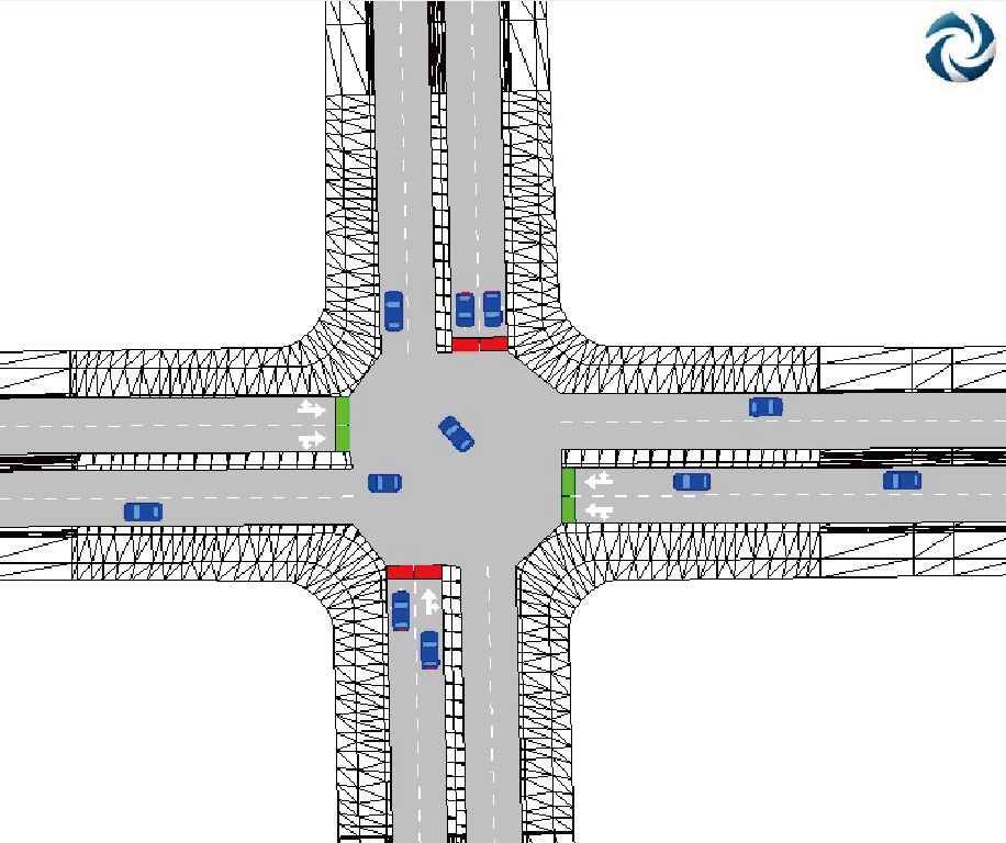
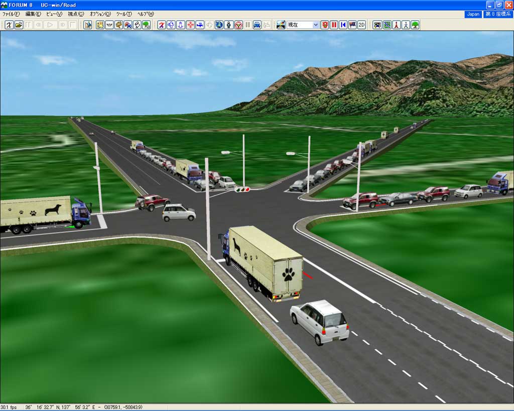
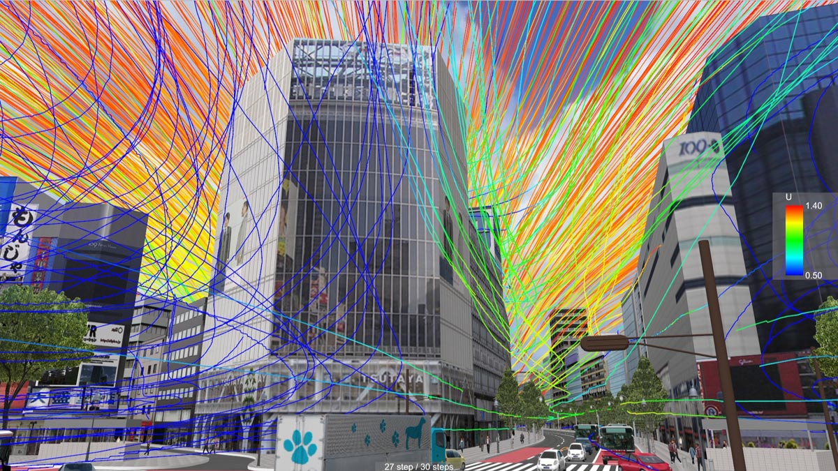
S-PARAMICS Plug-in Advanced
Advanced traffic simulation can be performed by linking with S-PARAMICS
in which the road shape data can be exchanged. The roundabout imported
from S-Paramics. The node with roundabout attribution and the transition
of right section are expressed in UC-win/Road.
Sample
The 9th 3D VR Simulation Contest data, "Transfer VR simulation at Junjon Service Area in Korea" GTSM Inc. (Korea), converted into S-PARAMICS data.
Developed by SIAS Company, UK (http://www.paramics.co.uk/) |
Aimsun Linkage Plug-in Option Option in additional cost
Vehicle behavior and signal phase from Aimsun (traffic modeling software that allows you to model roads and intersections, assign signal phase and traffic, and run mesoscopic and hybrid simulation based on the assigned conditions) can be reproduced real-time within the UC- win/Road 3D environment using the plug-in. In addition, by taking control of the vehicle within the animation played in UC-win/Road, the behavior of the driven vehicle over time can be reflected to the simulation in Aimsun.
Developed by TSS (Spain)(http://www.aimsun.com/) |
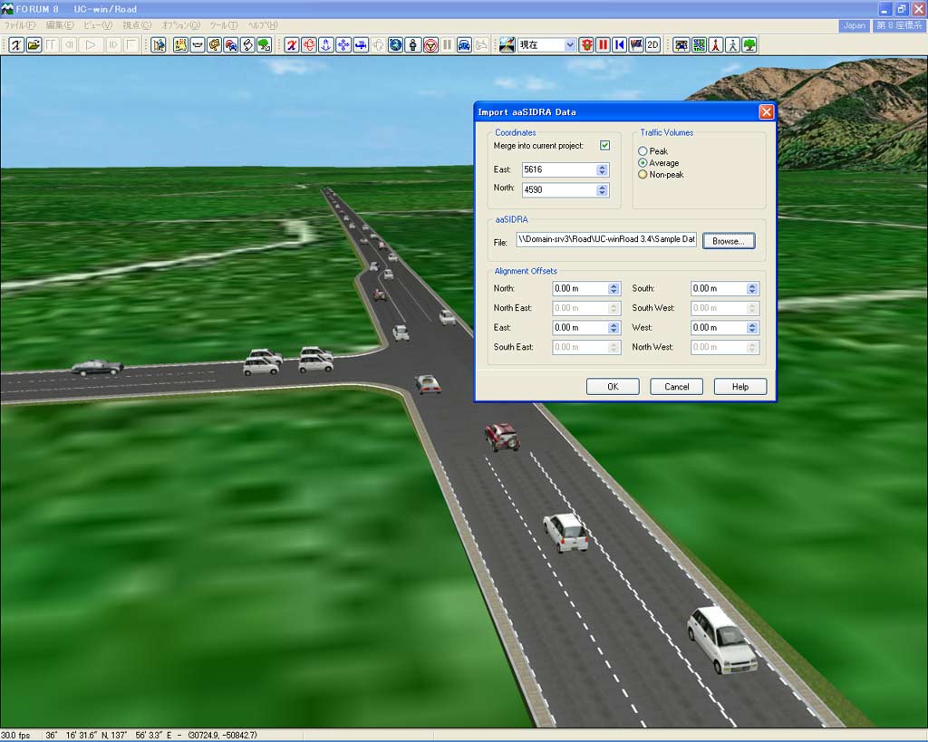
SIDRA Plug-in Advanced
| This plug-in enables you to express intersections that are designed in the intersection design software SIDRA as VR. The output file is used for generating a simple representation of one intersection, an accurate road axial sections, a traffic volume, and a timing of the traffic signals. |
 |
 |
 |
| Developed by Akcelik & Associates Company(http://www.sidrasolutions.com/) |
|
Civil 3D Plug-in Advanced
This system provides total support, including VR simulations and support
for presentations, by linking UC-win/Road with Autodesk Civil 3D, a leap
into the future solution which has brought a significant shift within the
civil engineering design process.
Developed by Autodesk (http://www.autodesk.co.jp/) |
 |
 |
|
OHPASS Plug-in Ultimate
The calculation result of OHPASS (Optimal Highway Path Automatic Search
System) can be linked with UC-win/Road. The optimal highway pass obtained
by calculation can immediately be visualized in UC-win/Road.
OHPASS will be linked with UC-win/Road by following the steps below.
- Calculates the optimal highway path via OHPASS
- Convert the calculation results file into LandXML
- Import LandXML into UC-win/Road
|
TRACKS plug-in Advanced
TRACKS is a suite of some sixty programs which have been developed by Gabites
Porter Consultants to assist the analysis and interpretation of land use
and transport planning problems. The result of TRACKS can be imported into
UC-win/Road as LandXML file.
Developed by Gabites Porter (http://www.gabites.co.nz/) |
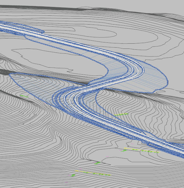
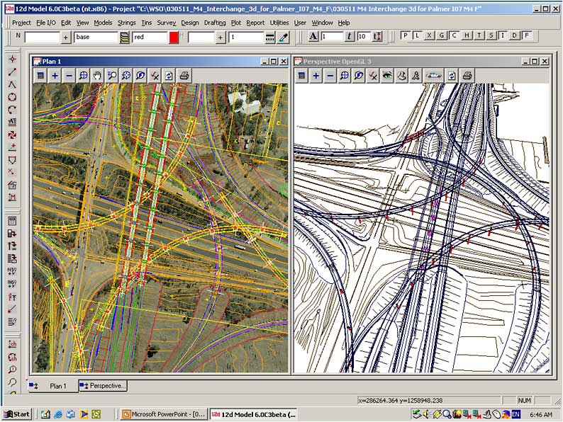
12D Model Plug-in Ultimate
12d allows fast production in a wide variety of projects including mapping,
site layouts, road, rail and highway design, residential & land developments,
and environmental impact studies.
- Bidirectional conversion of terrain and road alignment -Import
of road section
Data link from UC-win/Road to 12d Model
- Link of topography data: Topography data of UC-win/Road can be converted and exported to Tin file
of 12d Ascii File Format.
- Link of road data : Horizontal alignment data and the cross section data is converted and
exported to 12d Model. |
Data link from 12d Model to UC-win/Road
- Link of terrain data : TIn model of 12d Model terrain can be converted to UC-win /Road terrain
data or terrain patch data.
- Link of road data : Import road data created in the 12d Model. |
Developed by 12 Solutions Pty Ltd, Australia (http://www.12d.com/aus/) |
InRoads Plug-in Advanced
"InRoads", 3D land development /Road design system, can exchange
data based on LandXML data reading/writing function. Horizontal cross section
data is exchanged through the use of InRoads original XML format.
Developed by Bentley Systems Incorporated) (http://www.bentley.co.jp/) |
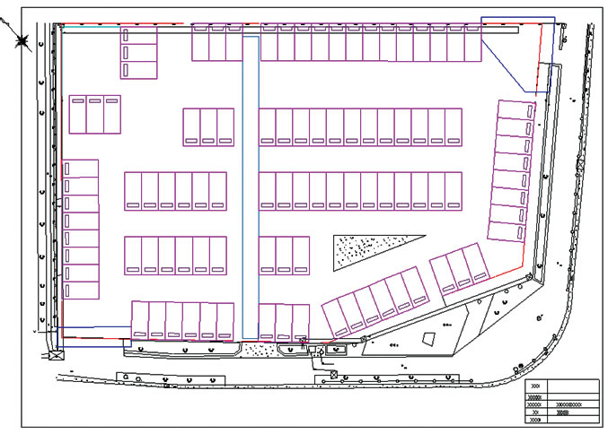
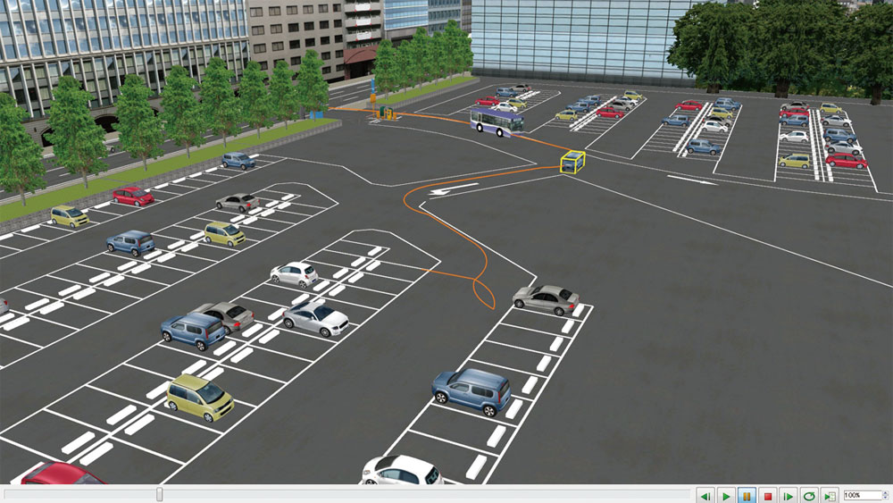
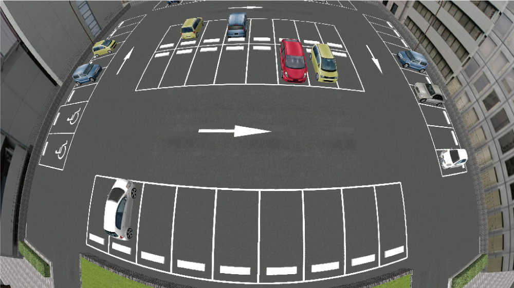
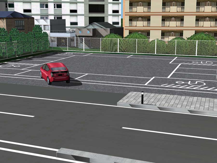
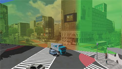
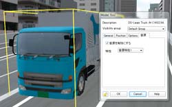
Parking Lot plug-in Advanced/DrivingSim
It is a plug-in which imports the parking drawing data made by CAD system
"UC-1 parking lot drawing system of FORUM8.
- Outer parking bays, internal parking and signs (driving direction
etc) can be accurately represented according to the CAD drawings.
- Since the imported drawing data is treated as a model which
is similar to the building and the car, it can be set on an arbitrary position
or the drawing itself can be rotated.
- Rendering performance has been improved using the Vertex
Buffer Object for visualizing the parking model.
|
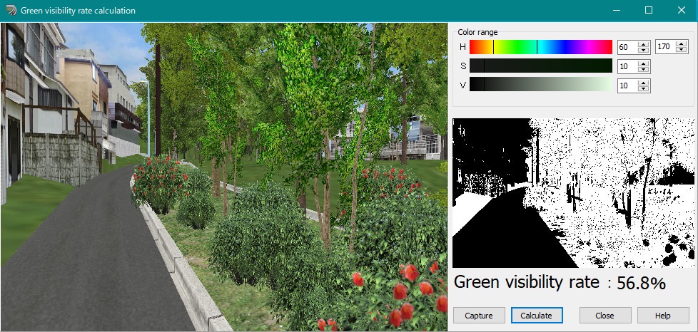
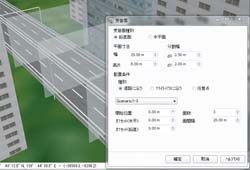
Assessment plug-in Option Option in additional cost
Environmental assessment plug-in enables to perform VR and simple assessment by using a variety of real-time simulation functions of UC-win/Road. The following three items can be evaluated.
- Assessment of green view rate: Calculate and display green view rate
- Assessment of sunshine obstruction: Investigate and display the hourly sunshine on the winter solstice of a model
- Prediction of reflected light: Measure reflection from solar panels and
display it in VR
|
|
|
xpswmm Plug-in Ver.2 Advanced
This is a dynamic 3D simulation of the tsunami analysis result by xpswmm.
Tsunami expression function by UC-win/Road.
 |
 |
 |
 |
 |
 |
| Simulation of analysis result with xpswmm |
<Simulation Movie>
|
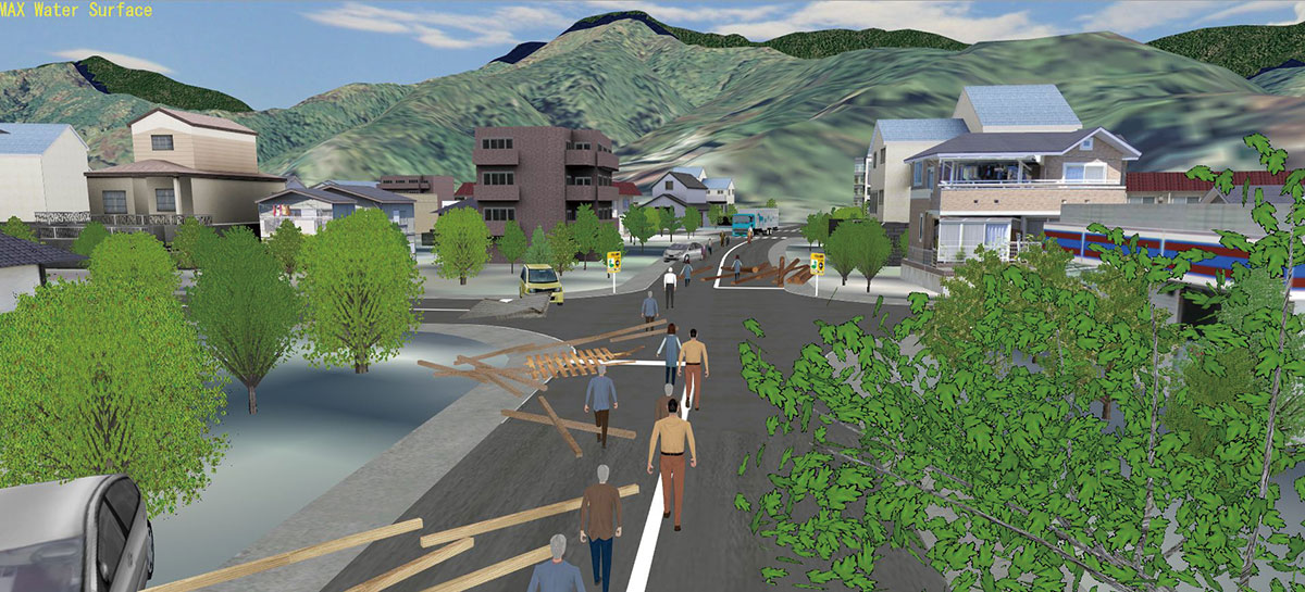
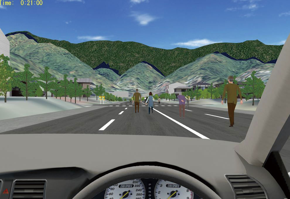
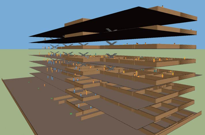
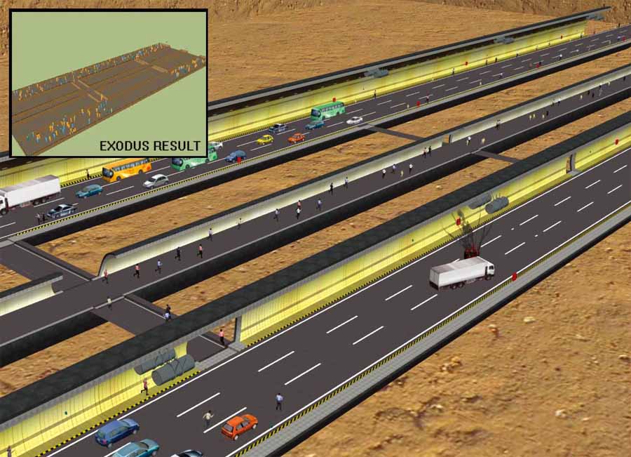
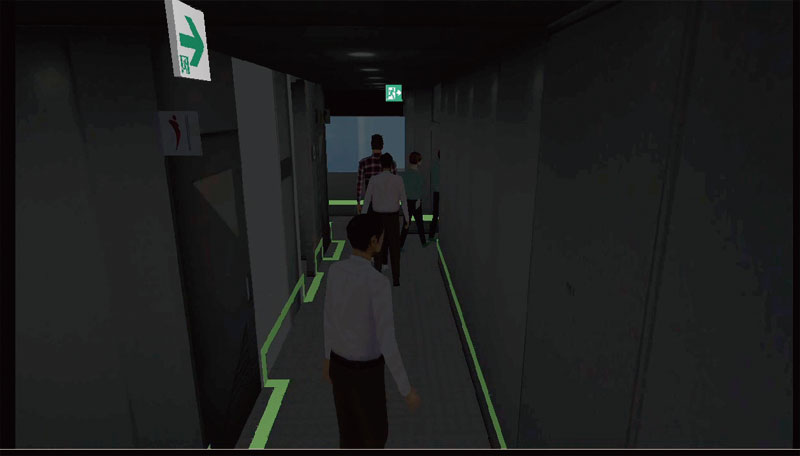
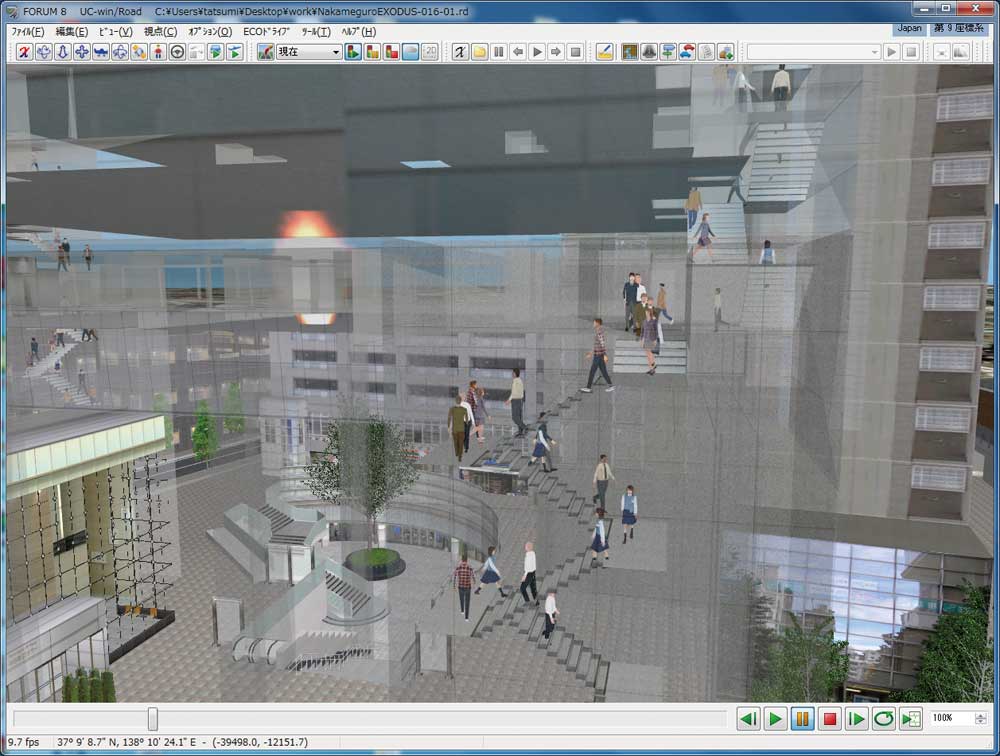
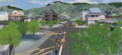
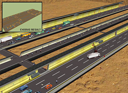
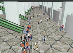
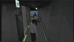
UC-win/Road for EXODUS Advanced
Data link of UC-win/Road and "EXODUS/SMARTFIRE" which was developed by Fire Safety Engineering Group (FSEG) in the university of Greenwich (England), fire analysis allows the viewing of the simulation result in 3D VR space.
 |
 |
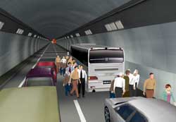 |
Example of evacuation
model display |
Tunnel evacuation VR |
Tunnel fire |
 |
 |
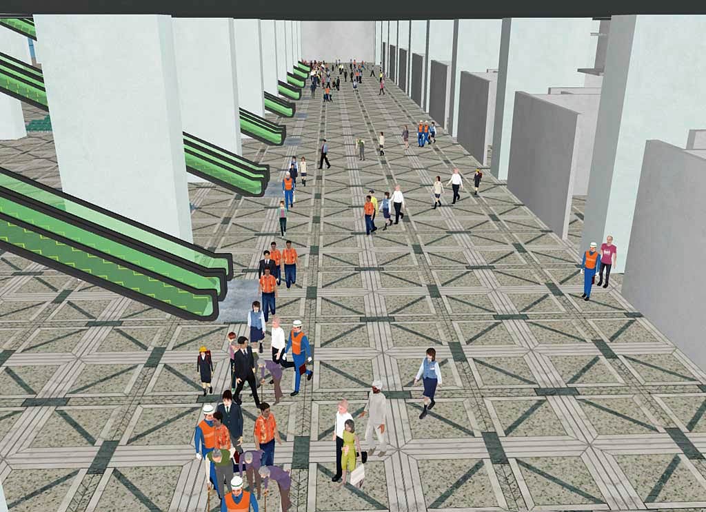
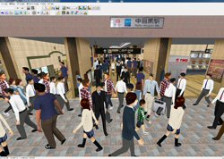
Crowd flow simulation
inside of the airport |
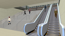
Passenger flow simulation
in Nakameguro station |
- Seamless data import
- High flexibility presentation with a 3D real-time visualization
- High quality 3D space
- Showing outer space allow sending more real image
Calculation method of evacuation time approved by Tokyo Fire Department |
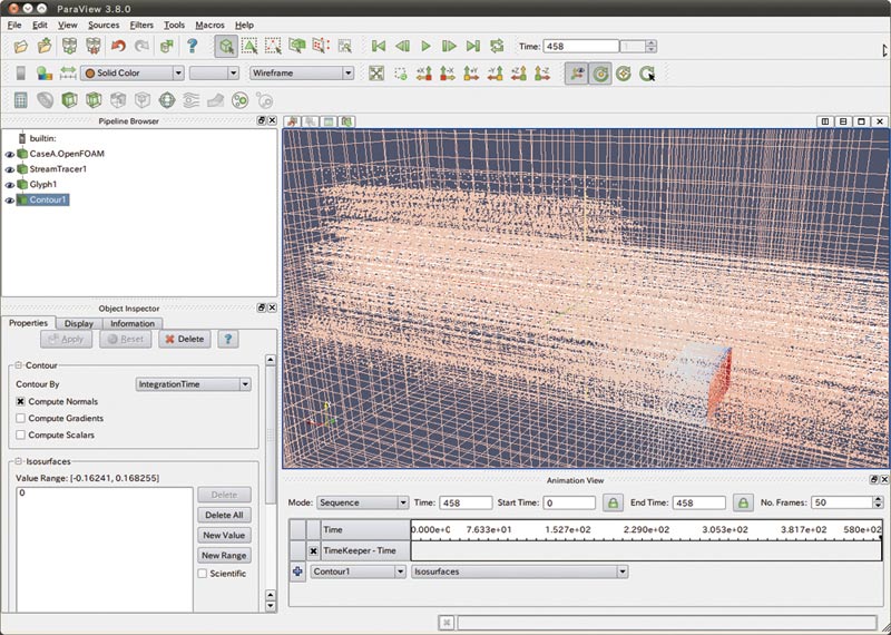
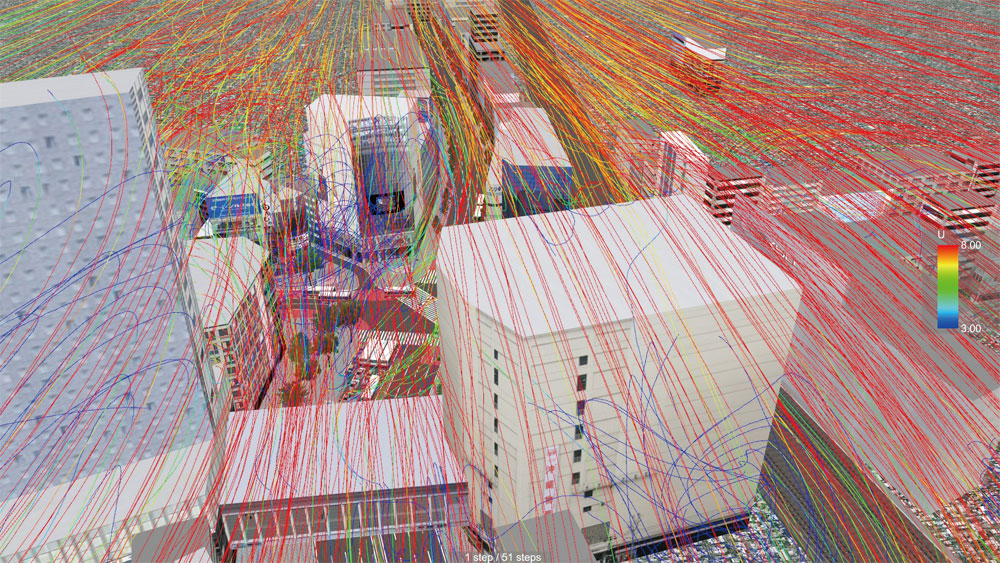
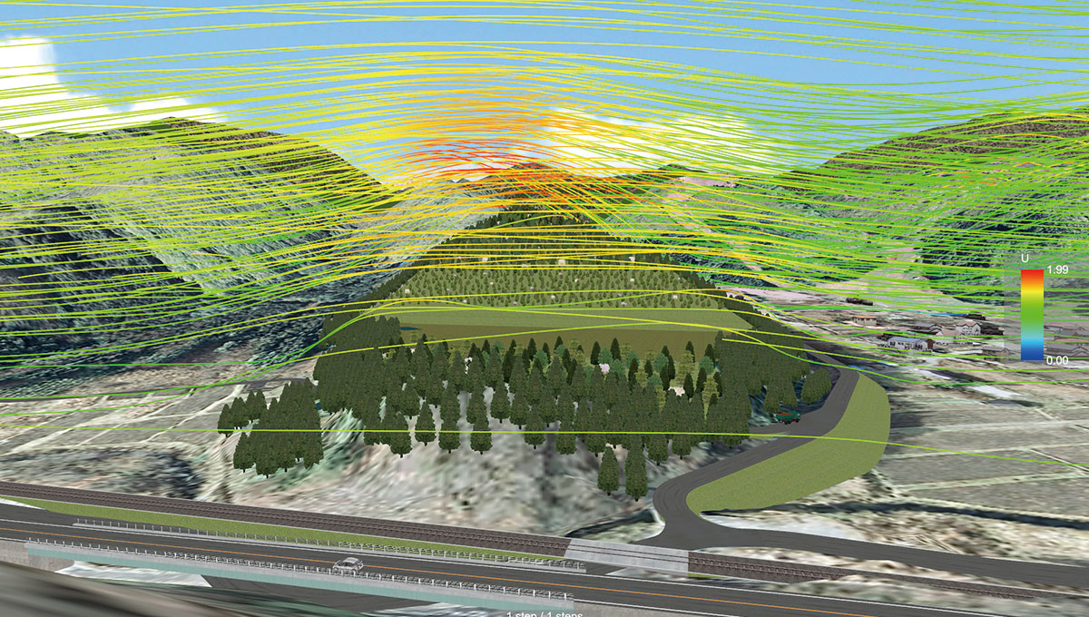
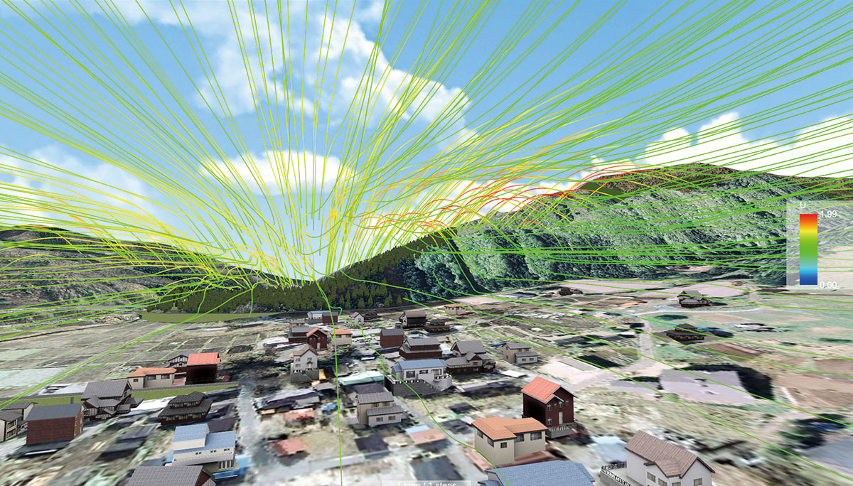
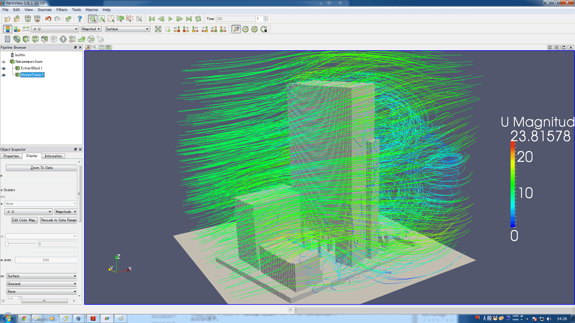
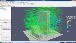
Plug-in for Super Computing ® Fluid Analysis Link
Option in additional cost
High-performance computing on cloud services Fluid Analysis Super Computing
Analysis/ Simulation Service. It is possible to simulate the complicated
flow of water including turbulent heat transfer by importing the water
analysis tool "OpenFOAM". Visualization of the stream line from
VTK (Visualization Tool Kit) file is also supported.
Wind and heat movement analysis super computing analysis / simulation service
This is the analysis/ simulation support service using the water analysis
tool "OpenFOAM" already installed in the FOCUS super computer.
 |
 |
|
Analysis result by OpenFOAM |
|
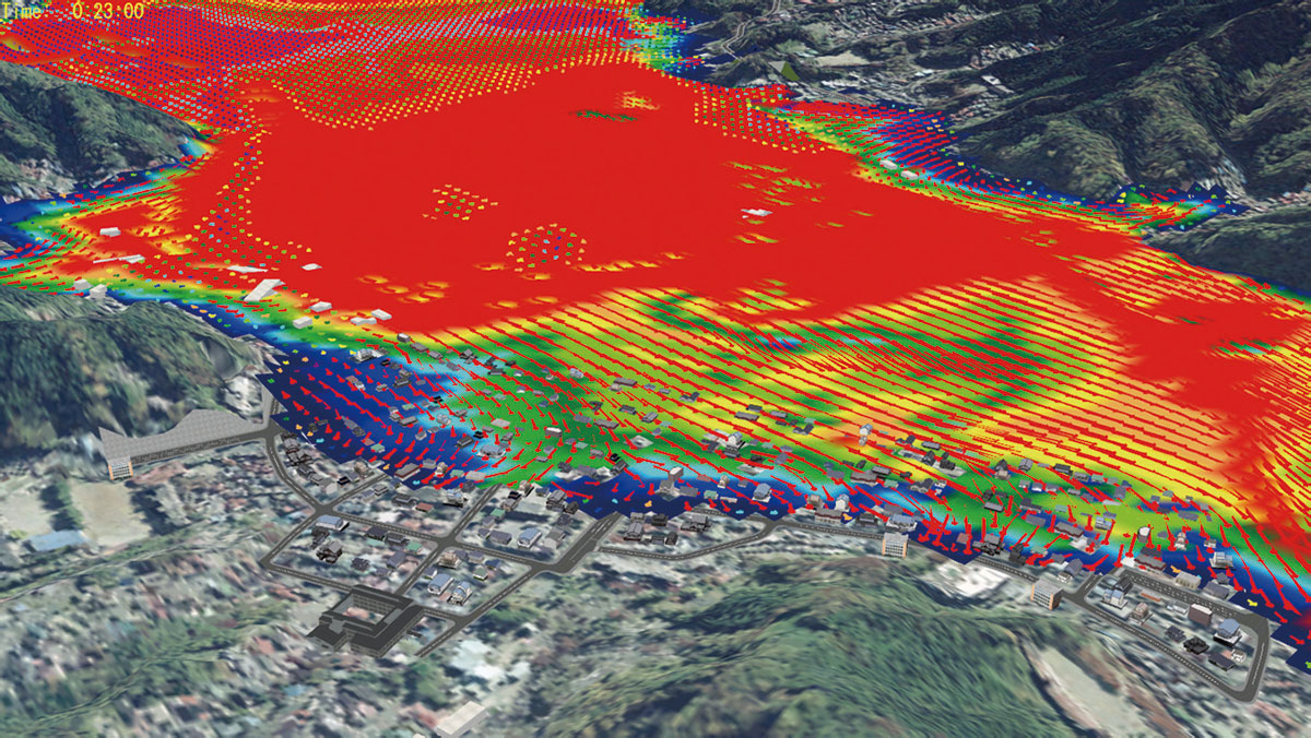
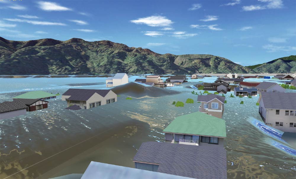
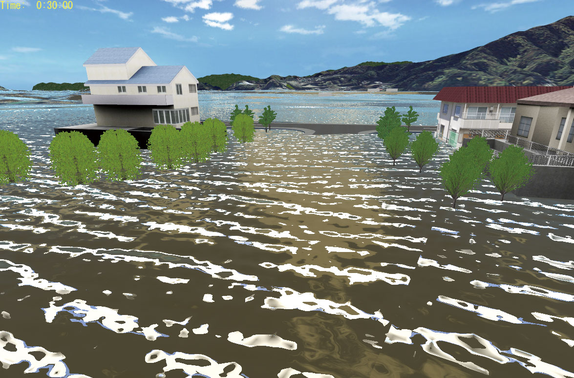
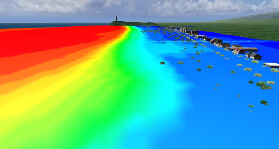
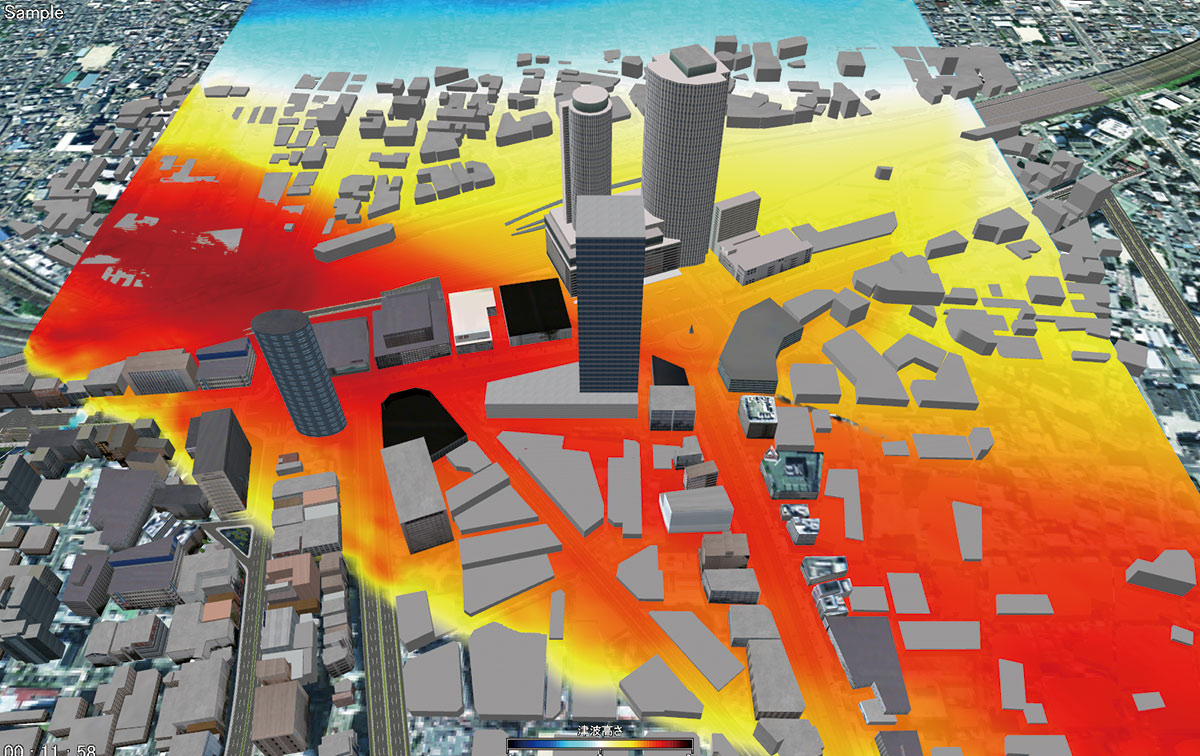
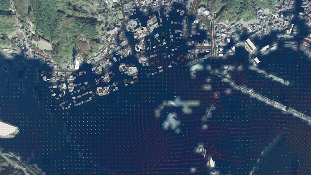
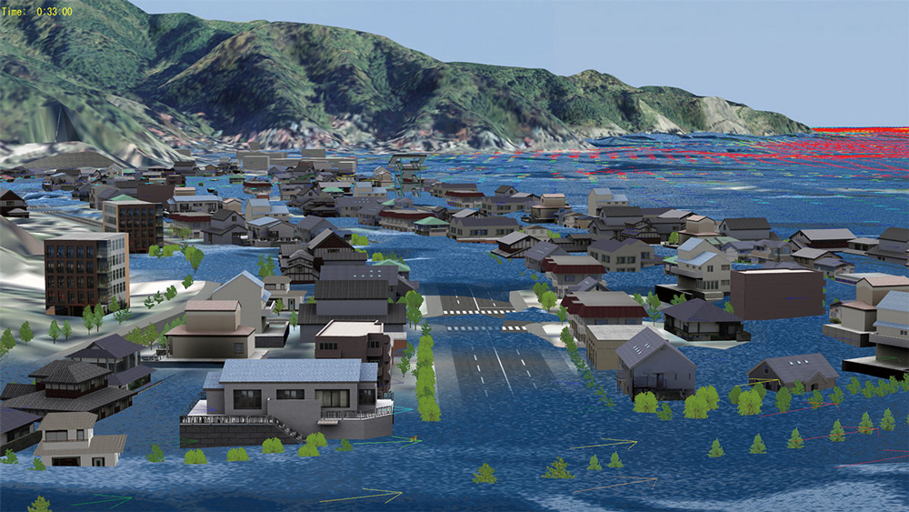
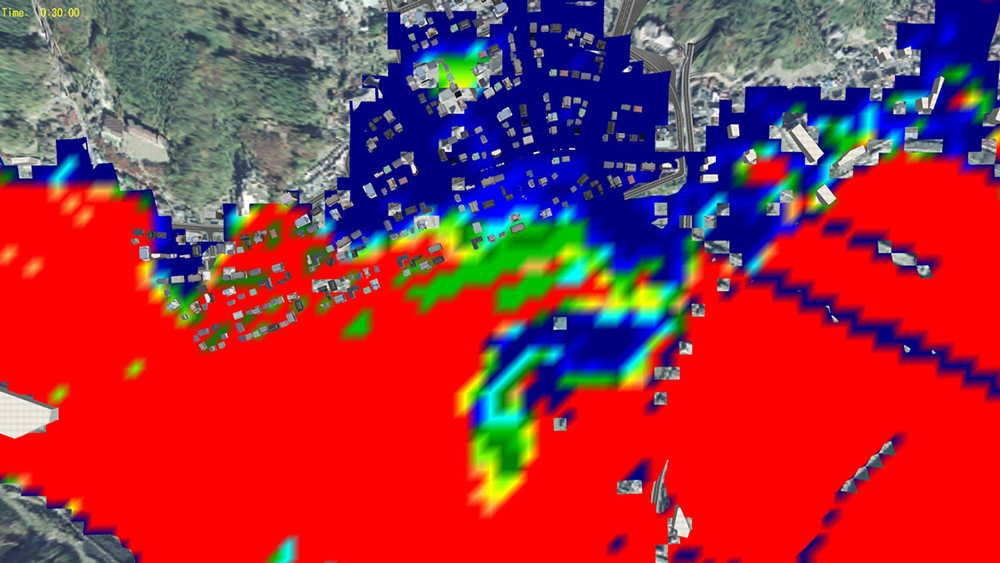
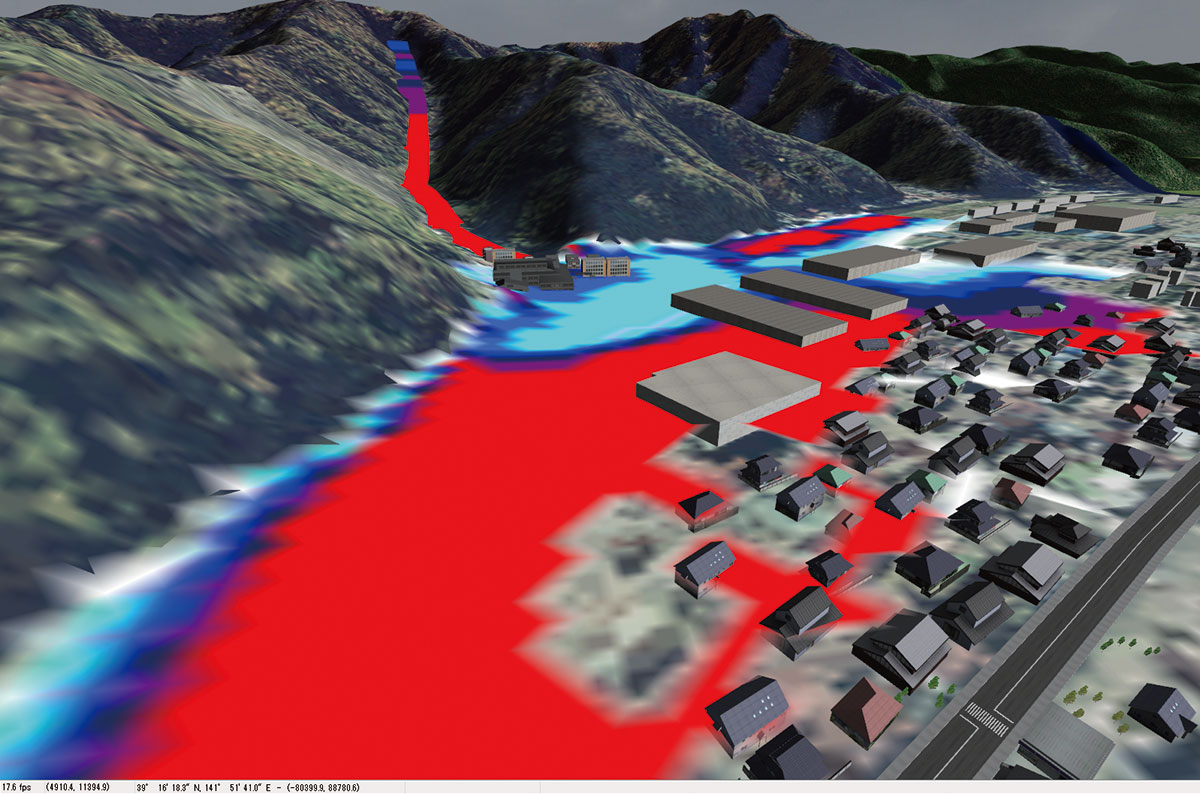
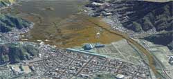
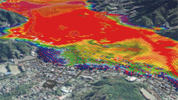
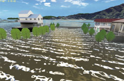
Tsunami Plug-in Option in additional cost
| This can visualize the situation of generation, movement and immersion of tsunami. This visualize not only tsunami but also river flood and sewer flooding. FORUM8's original open format is implementable. Data of any form can be visualized by converting the format. The function to import the aerial photo and terrain patch from the other plug-in is also implemented. |
 |
 |
| Contour of water depth |
Contour of altitude |
|
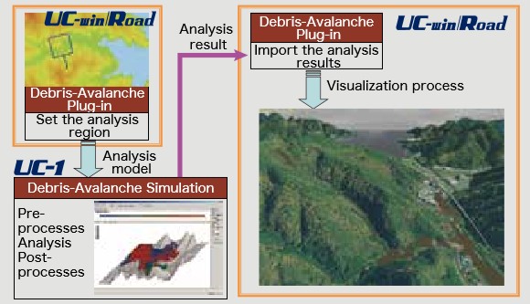
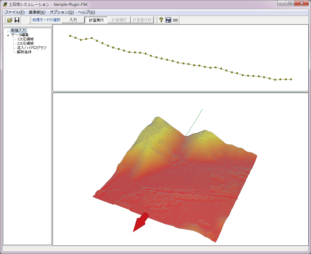
Debris Flow Plug-in Option Option in additional cost
The UC-1 Debris-Avalanche Simulation uses "Debris-Avalanche Simulator
(Kanako)" developed in the Graduate School of Agriculture, Kyoto University,
as a solver. FORUM8 has built the robust function that pre-processes and
post-processes the data to be analyzed so that a debris-avalanche analysis
can be run effectively in a series of process while incorporating the solver,
and that's how this intelligent solution named UC-1 Debris-Avalanche Simulation
came to be.
|
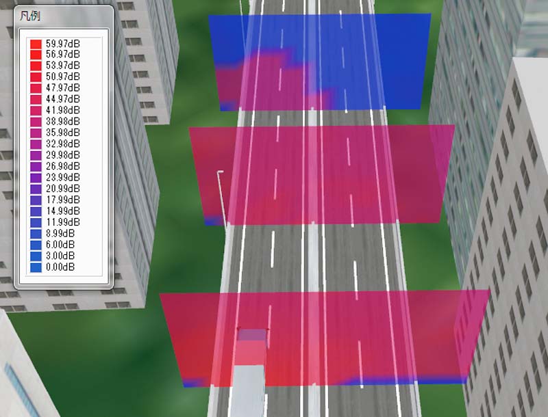
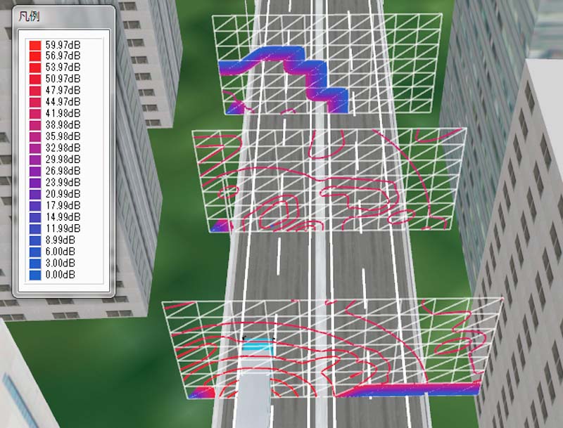
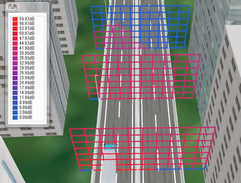
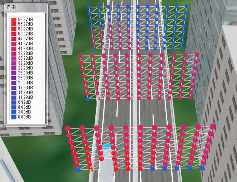
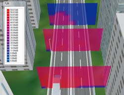
Noise Simulation Plug-in Advanced
Width of general sound range is simulated by arranging a sound source and
an audience area on 3D and VR space on UC-win/Road. In consideration of
the influence of earth surface, a structure, a building, etc. the sound
pressure level in each audience point on a audience side is analyzed. Noise
simulation consists of preprocessor (input part), mainprocessor (analysis
part) and postprocessor (Results view part).
 |
 |
 |
 |
|
Setting of audio source |
Arrangement of audience area |
Display of Contour figure |
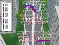 |
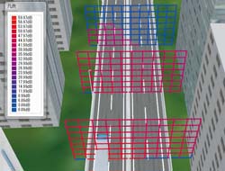 |
 |
| Display of Contour line |
Display of grid |
Display of sphere |
|
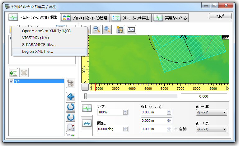
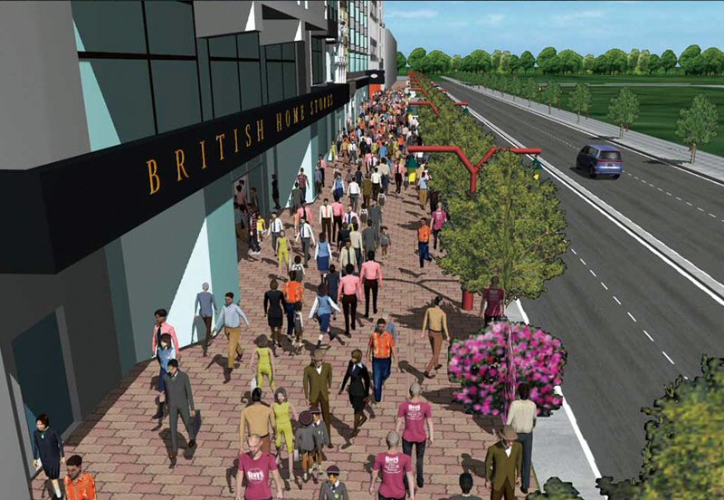
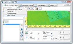
Legion Link Plug-in Option Option in additional cost
The Legion Studio software simulates and analyzes pedestrian movements,
step by step, within a defined space using the very latest scientific methodology.
This enables the precise simulation of pedestrians within a wide range
of environments and was developed by Legion Co.UK.
Principal Use : Congestion mitigation of pedestrians within train stations and airport
terminals etc. Evacuation planning. Evaluation, verification and proposal
of alternatives for guiding the audience in stadiums and concert venue.
Simulation of emergency evacuation within buildings, skyscrapers etc and
the examination of possible countermeasures.
 |
 |
 |
| Importing Legion file |
Visualization example of crowd simulation in a station |
|
Export for Free Viewer Plug-in Ultimate
Plug-in to output the data file for UC-win/Road Free Viewer Version
<UC-win/Road Free Viewer Version>
This is viewer product for free which allows to freely move in 3D environment
and play the scripts. It is possible to browse the RD data created for
free viewer version for free. This is the function limited version of Presentation
Version. Data and scenarios cannot be created. |
RoadDataViewer Plug-in Standard
This is the plug-in which displays the list of information of object (building
and tree), texture, intersection etc. in a tree format.
-Verifying the number of pixel of texture
-Verification of unconnected road connection point
-Verification of buried model |
 |
|
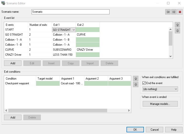
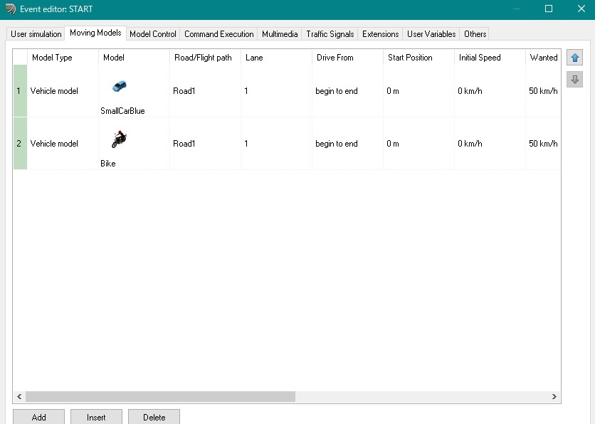
Scenario Plug-in Advanced/DrivingSim
Various pre-fixed movements can be set to
models.In driving changing scene, various
pre-fixed movements can be set to models. For
example, when the car reaches a set position,
pre-set model activity and various scenarios can
be made, such as "Signal mast changes to red",
"Car pushes in at the intersection", "traffic
congestion occurs", "a man starts walking" By
using these scenarios, the plug-in offers a
real-vehicle-like driving simulation environment
with realistic events.It's available to provide
the real driving simulator.
- Analysis results of EXODUS and Micro Simulation Player Plug-in are controlled via scenario.
Result of evacuation simulation can be replayed, camera mode can be changed,
Micro Simulation Player can be played and stopped, to name some of the many things
the scenario plug-in is capable of doing.
- It is possible to dynamically change the speed, the number of lane etc.
of the other vehicles. The parameter of ACC function can be changed in
case of your vehicle and the same parameter of the other vehicle can be
changed in case of auto-driving.
- Staggered vehicle and vehicles' pulling over can be expressed by setting
the other vehicle's cutting and traffic lane keep offset.
|
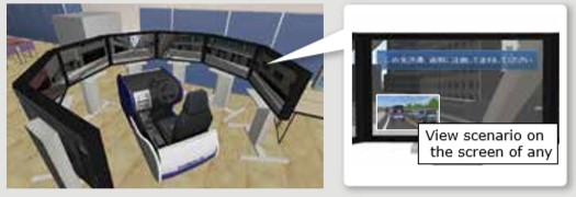
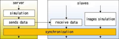
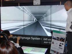
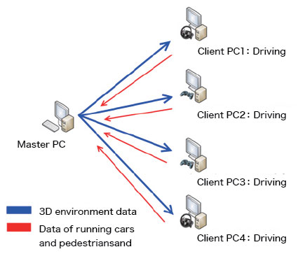
Communication Plug-in Advanced/DrivingSim
This Plug-in allows communication with multi users by the use of UC-win/Road.
Users can send chatting comment and surrounding information in UC-win/Road
such as view position, direction and time through the Internet. These feature
enables you to support joint designing and consensus building. In addition,
it allows for network-based driving simulation.
Example : Joint modeling work
User A
Explains the work by looking drawings and documents |
|
|
 |
 |
 |
|
- You can show your partner the same view that you are looking at.
- It becomes easier with the displayed model to explain to the person who
is not familiar with the data.
|
 Explanatory material Explanatory material |
|
|
Micro Simulation Player Plug-in Advanced/DrivingSim
Micro Simulation Player is the function to run various types of simulation
animation which is depicted as 3D model movement. It is capable to record
and play a traffic flow as a result of UC-win/Road and other traffic simulation.
- 3D animation function : It's possible to create various type of 3D model's
animation based on the information of model's location. It enables to run
several data at the same time.
- Snap function for vehicle and pedestrians : It's capable to locate objects
such as vehicle and pedestrian on the road and the lane, the pedestrian,
the ground.
- Controlling the existing objects : It's possible to control static objects
such as traffic light.
- Controlling drawing objects : Time, weather, light
- Optimal integration with the functions of UC-win/Road : Traffic, script,
camera mode
<User case study> UC-win/Road Micro Simulation Player for Legion (posted '10.05.17)
 |
 |
Traffic simulation
Record/Play |
Evacuation simulation |
 |
 |
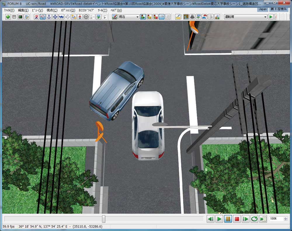
| Analysis of traffic accident |
4D Simulation
(Construction management) |
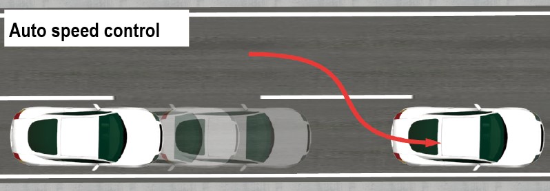
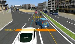
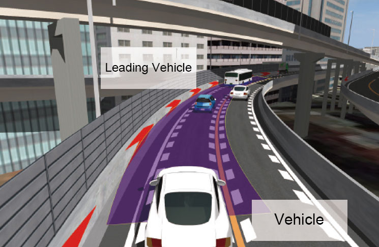
Surrounding traffic vehicles optimize the reproduction function of simulation. The function to detect the distance between the running vehicle in front of you and yourself at the time of driving is also supported. This detection function enables you to obtain the information including the speed and position etc. of the leading vehicle.
Analysis of traffic accident
This function allows the users to perform interference checks on the imported
traffic flow by using the simulation result; this in turn enables you to
apply the results of traffic flow analysis for the course on which you
drive within a driving simulator and thus confirming the traffic condition
from the point of view of the driver.
 |
 |
| Control the surrounding vehicles by using the micro simulation player |
OpenMicroSim site is open!
XML Schema Open site for Open Micro
Simulation Player http://openmicrosim.org/
Open Micro Sim is an open format developed
and proposed in our company. |
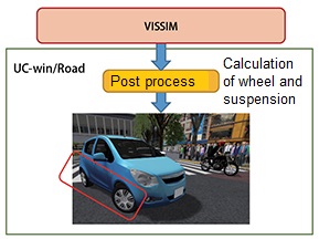
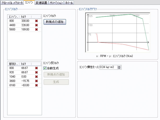
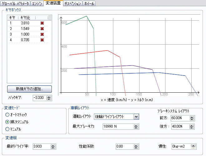
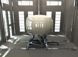
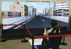
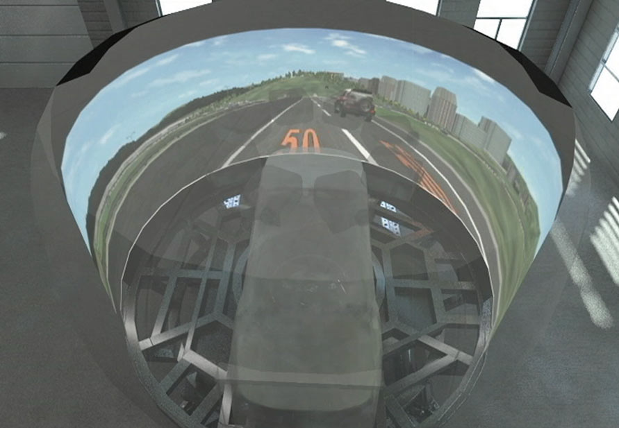
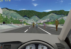
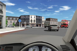
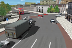
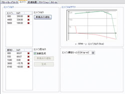
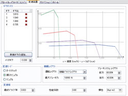
Driving Simulation Plug-in DrivingSim
With UC-win/Road and real car driving simulator with OEM-supplied, the
driving simulation is much more realistic. Compared with a conventional
driving simulator, a great improvement of the cost-performance is seen.
Moreover, the biggest feature is that the user can freely use existing
data or create a scenario specific to their needs. Equipped with models
of every transmission inside a real vehicle linking the engine with wheels,
a highly realistic vehicle dynamics can be visualized and the behavior
of vehicle itself can be confirmed. You can choose your favorite vehicle
dynamics model.
- Vehicle acceleration based on engine power, RPM, and weight is taken into
account
- Supports Force feedback effect: The steering wheel vibrates automatically
depending on the road surface texture and road geometry.
- Supports Antilock Brake System and gear shift time
- Tire slip: Road surface condition (dry, wet, show, ice) can be assigned.
- Sound effect system: Engine sound, break wind sound, slipping sound, engine
sound of surrounding vehicles, etc.
 |
 |
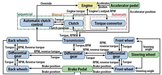 |
| Assign engine |
Assign transmission |
Structure of UC-win/Road's
Vehicle Dynamics model |
|
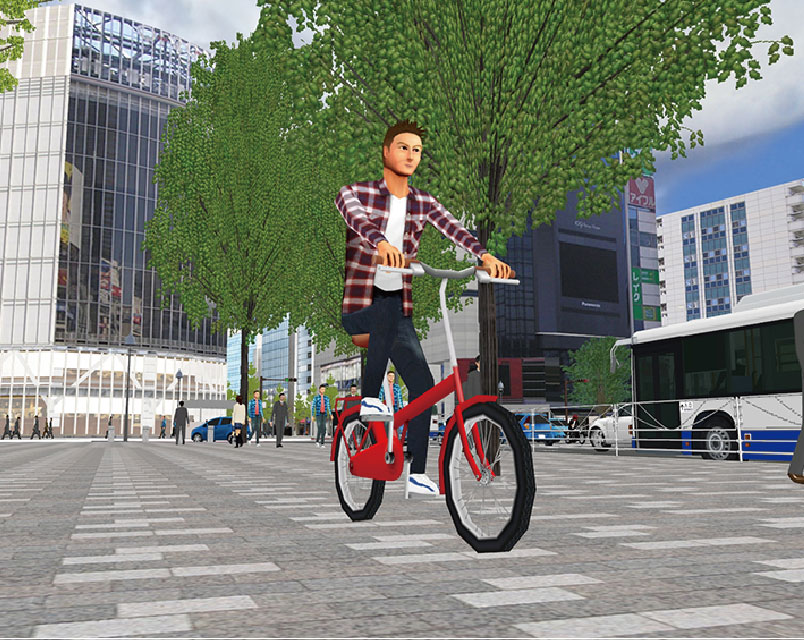
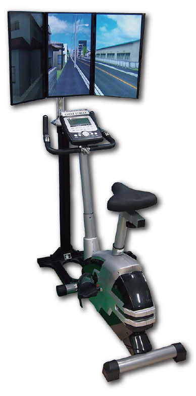
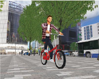
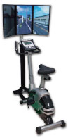
cycleStreet Link Plug-in Option Option in additional cost
| Virtual cycling system "Cycle Street Series City Edition" (Developer: FLOVEL CO., LTD.) is linked with UC-win/Road that renders a panorama image of 3D VR environment on 3 screens. As you cycle, the CG moves according to the speed of the rotating pedals, allowing you to get some exercise as if you're playing a game. |
 |
 |
|
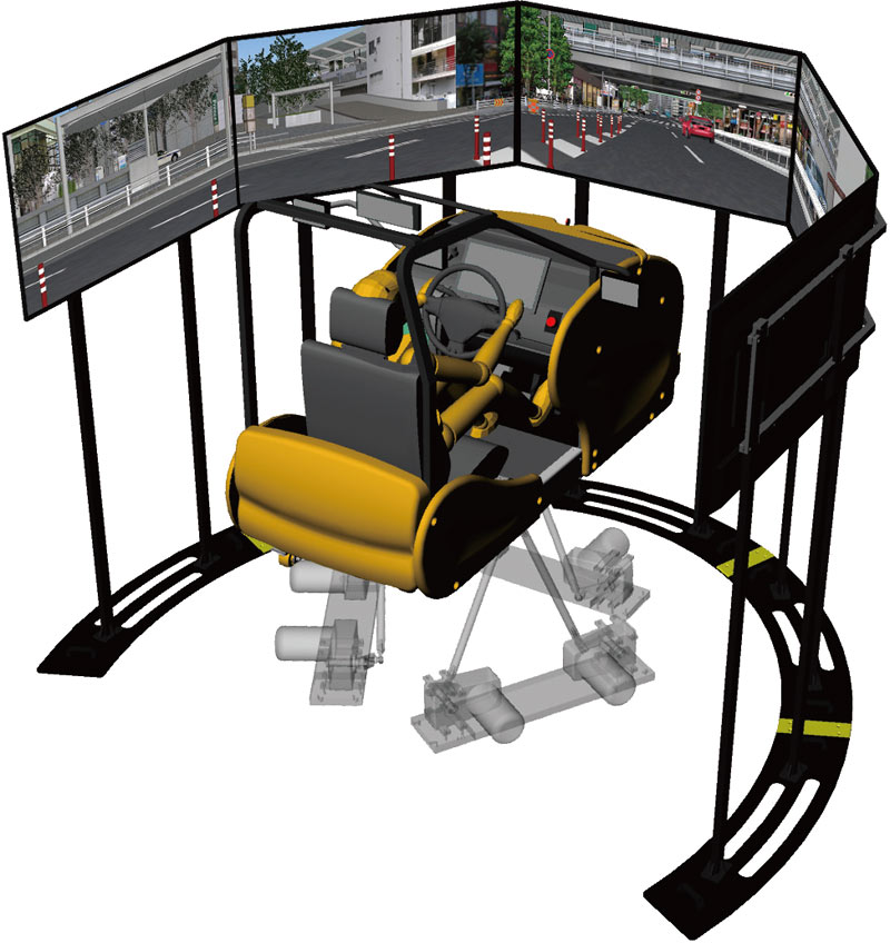
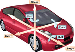
Motion Platform Plug-in Option
Option in additional cost (provided only for system development)
An optional driving simulation feature that links the software to the OEM
motion platform hardware of INNOSIMULATION, Inc
 |
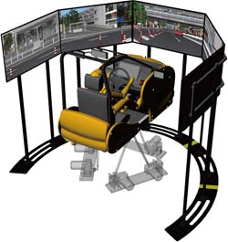 |
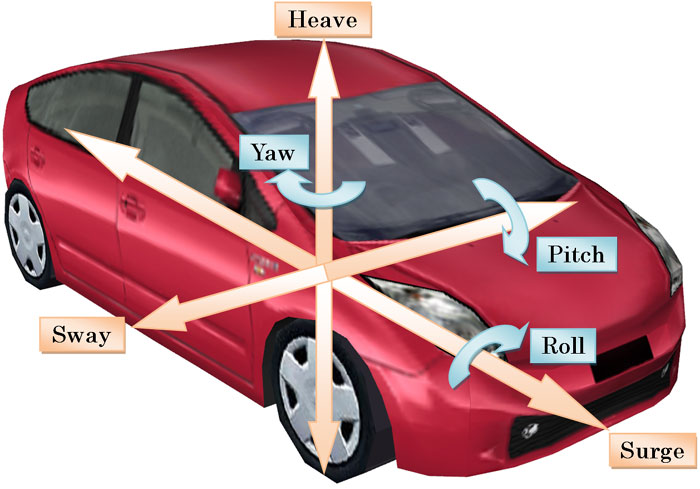
It is possible to perform 6 degrees of
freedom movement of surge, sway,
heave, roll, pitch and yaw |
6DOF Drive Simulator |
|
D-BOX Plug-in Option Option in additional cost Option in additional cost
| A plug-in required for the cooperation with D-BOX motion. This motion system
can be freely built with 1 to 7 actuators. In addition to 6DOF for vehicle,
it can be used for certain vibration of seat, road surface, etc. |
|
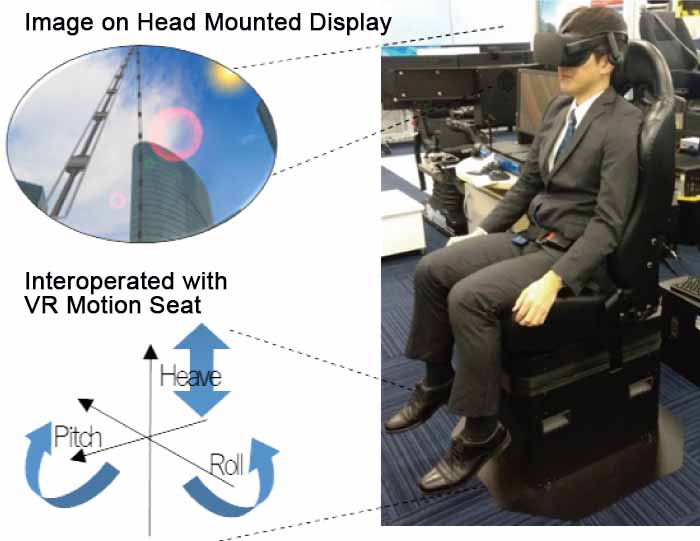
VR seat Plug-in Option Option in additional cost
This product is a plug-in for UC-win/Road to cooperate UC-win/Road and
INNO's 3 axial motion seat (VR seat). This plug-in converts the vehicle
movement of UC-win/Road simulation to 3 axial value (Roll, Pitch, Heave)
in real time and export to the VR seat.
When a drive mode simulation is performed in the UC-win/Road, the inertia
force generated from acceleration and deceleration is reproduced by using
the component of gravity. In this reproduction, the plug-in executes the
processing (washout) to get the seat back to the neutral position at the
speed not let the person sitting on the seat feel the inclination by acceleration
and deceleration while considering the motion range. In addition, detailed
customization of motion is available in the parameter setting. |
 |
|
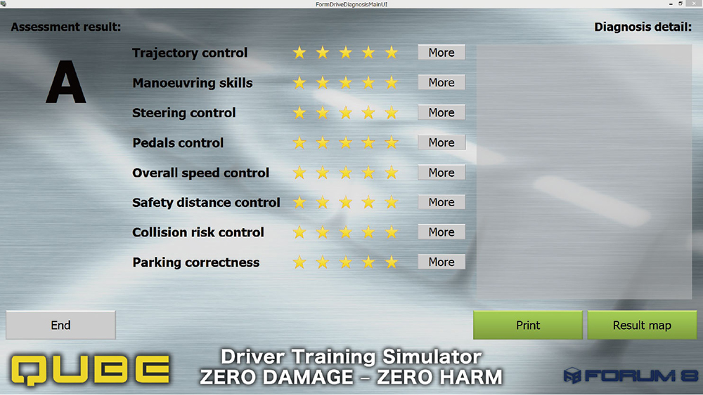
Drive Diagnosis Plug-in Option Option in additional cost
System that assesses driver's driving skill.
The driver is assessed for correct operating procedure and driving skill,
against criteria that include maintaining certain speed and an ideal route,
manuevering skills, collision risk control, and steering and pedal control.
You can assign scoring criteria and also store assessment results for each
driver, which assists in pinpointing areas for improvement.
|
Laser Sensor Plug-in Option Option
in additioinal cost
This plug-in simulates a laser sensor and transmits distance from the applying position,
coordinate of object, and object data via network. |
Simulation Realtime Link Option Option in additional cost
This option improves the cooperativeness, so that transfers simulation results in VR environment to TCP/IP in real-time, and override of own vehicle control and HUD display commands such as messages and images for the HMI simulation is also available.
|
Camera Sensor Base Plug-in Option Option in additional cost
Accurate distortion simulation by pixels can be performed by entering characteristic
of camera lens and sensor information.
"Equidistance projection", "Equisolid angle projection", "Stereographic projection", "Orthogonal projection", and "Arbitrary distorted table" are supported. |
|
 |
|
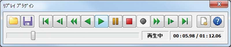
Replay Option DrivingSim
The function which records vehicles, a pedestrian, etc. which move every
moment over 1 second in real time on tens of times , and is reproduced.
- Combination with scenario : A start and play of record at the time of event are possible.
- Data management method : ZCompression of record data by Zlib (Compression algorithm used for ZIP)
- Combination with UC-win/Road SDK : Record from SDK side and control of play are possible.
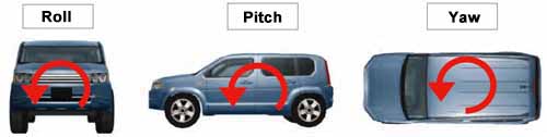
| Vehicle coordinate |
roll, pitch, yaw, turn signal, brake lights etc. |
| Pedestrian |
movements, roll, pitch, yaw |
| Traffic light |
lighting situation |
| Context |
context in scenario live |
|
| Replay memorizing function is available for below |
|
Because the vehicle records every little behavior (roll, pitch, yaw) as
seen on right pictures, vehicle behavior when it goes over a shoulder or
when it hits something is reproduced with high fidelity. |
|
 |
 |
 |
| Confirmation of accident during drive simulation from outside of vehicle |
 |
|
 |
| Operation panel |
|
Tool bar |
|
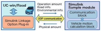
Simulink Plug-in Option Option in additional cost
Send/Receive the information of own vehicle in UC-win/Road via MATLAB/Simulink
and UDP communication.
Input: Amount of controller operation, road information, environment information
Output: Physical amount of own vehicle |
- Cooperative action function with external vehicle motion model via UDP
communication
- Export log of Log communication data
- Simulink sample block for simple vehicle motion model, control/communication
block
|
|
 |
|
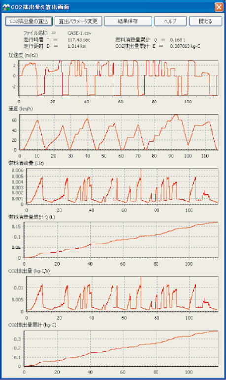
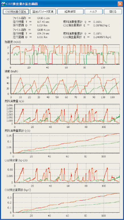
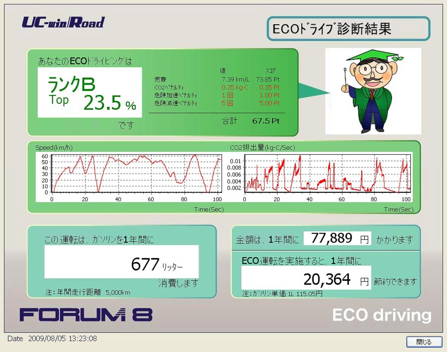
ECO Drive Plug-in DrivingSim
The Eco-Drive plug-in is a new software module that calculates the fuel
consumption and carbon footprint of individual vehicles whilst driving
through a 3D VR model and graphs the results by means of UC-win/Road's
driving log.Clternatively they can "Calculate the carbon footprint".
The various parameters within the Eco-Drive evaluation formula are all
capable of being altered by the user. All Eco-Drive data is automatically
read within the Drive Log data file so that calculations can be re-created.
|
Log Export Plug-in DrivingSim
Coordinate information, direction, speed and steering angle of a driving
vehicle can be output to a log. Traffic flow and characters can now be
exported. It is now possible to save in CSV format or output UDP in real
time through a network.
| Log output data |
| Basic data |
Simulation time, model name, model ID, model type |
| Coordinate, Attitude |
X coordinate, Y coordinate, X coordinate, pitch angle, yaw angle, roll
angle, vector |
| Engine, speed |
The number of engine rotation, gear number, car speed (km/h, m/s), speed
restraint |
| Input |
Steel wheel angle, accelerator position, braking amount, automatic driving |
|
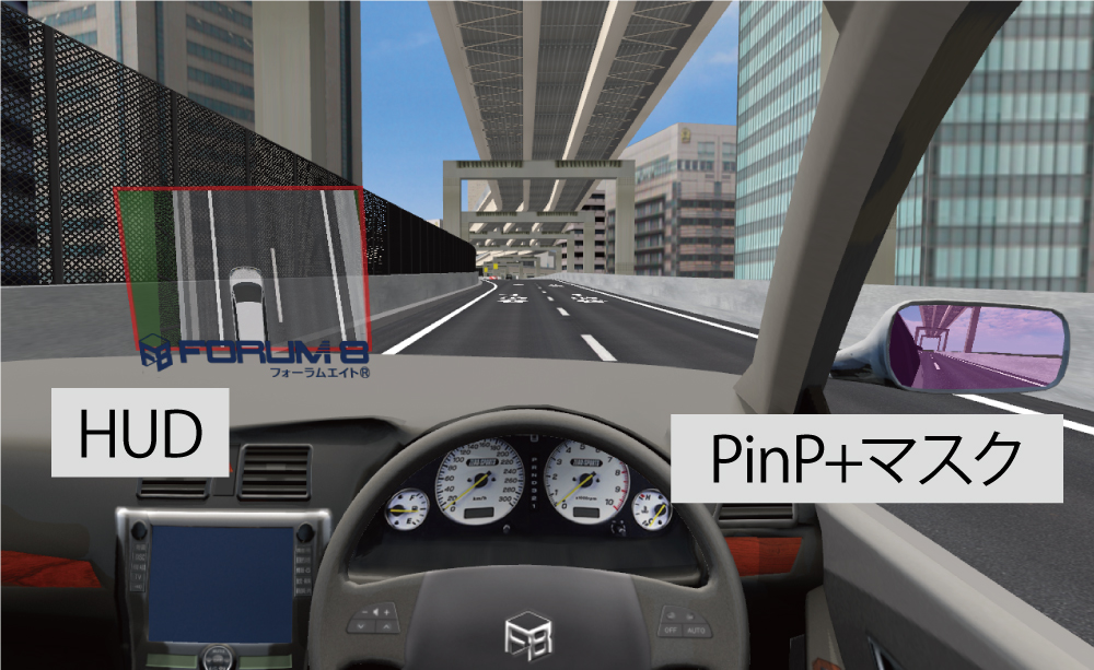
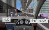
HUD (Virtual Display) Plug-in Option Option in additional cost
Image displayed in mirror or Images of another view or in mirrors are displayed
on the main screen and can be used as the 3D screen in 3D space.
Edge blending at the time of projecting via several projectors is supported.
Also available as a mask feature. |
|
 |
|
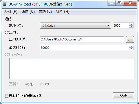
Log UDP Receiver Option Option in additional cost
This plug-in receives log data exported from
Log Export Plug-in by UDP
communication and outputs CSV file.
- Communicate with the Log Export Plug-in of UC-win/Road by UDP
- Export the data received by the UDP communication in CSV file
- Simple display of the data received by the UDP communication
|
|
 |
|
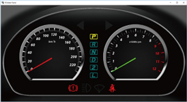
Speed Meter plug-in Option
Option in additional cost
Speed, engine speed and turn signal of own vehicle can be displayed on
another window. Customization enables the display on another PC.
|
|
 |
|
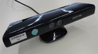
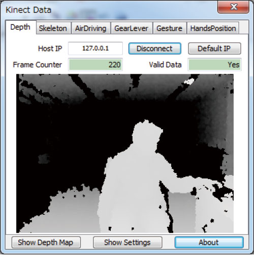
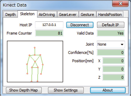
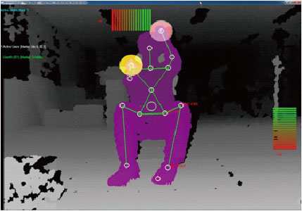
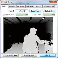
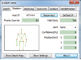
Kinect Plug-in Option in additional cost
 |
 |
 |
| AirDriving Interface |
▲Depth Map data |
▲Skelton tracking data |
|
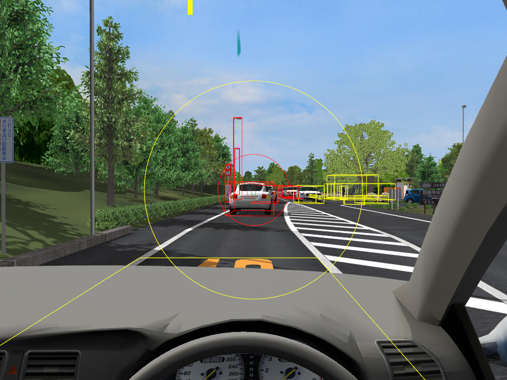
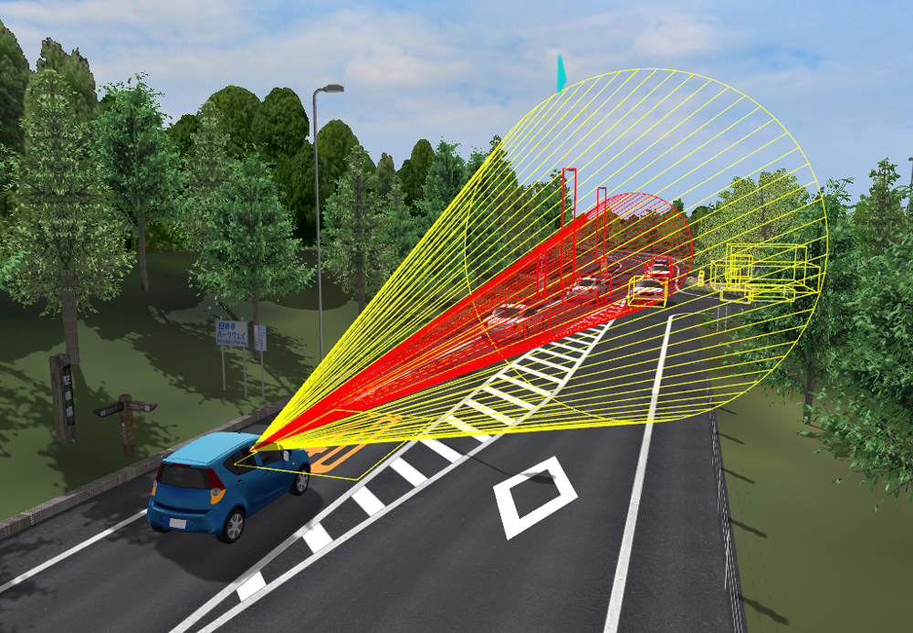
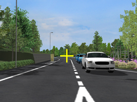
Object Detection Plug-in Option Option in additional cost
Object information detected in UC-win/Road can be acquired and utilized.
- The apex angle and distance defines a cone-shaped detection range as an object sensor, and the sensor detects objects in the range.
- The plugin can be used as a vehicle-mounted sensor and a static sensor. It can detect objects included in the gaze direction in cooperation with the eye tracker.
- The detection results can be used in the simulation real time link function. The simulation information including the object detection result can be transferred to the cooperated application via TCP/IP in real time and the application sends vehicle control commands based on that information to execute simulations of in-vehicle devices combining UC-win/Road and external applications.
 |
 |
| Detection range of object sensor and display of detected objects |
|
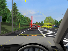
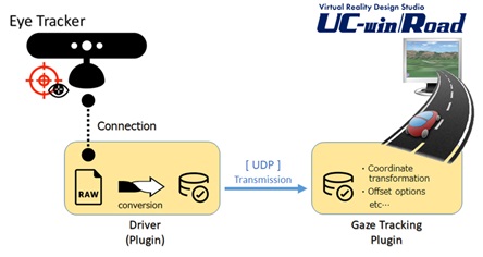
Gaze Tracking Plug-in Option Option in additional cost
Options to connect UC-win/Road and device measuring the line of sight
-Define an input interface by UDP communication of measuring equipment and develop a UDP communication section from the measuring equipment to the plugin to link UC-win/Road with any eye tracking device.
-Computes the direction of user's line of sight from the measuring device and displays where the wearer is seeing on UC-win/Road in real time.
-The cooperation between UC-win/Road and the object sensor simulation detects objects on UC-win/Road VR environment that the subject is seeing.
 |
 |
| Overlay display of gaze marker |
|
|
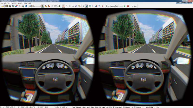
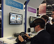
Oculus Rift Plug-in Ultimate
The Oculus Rift is a next-generation Head Mounted Display designed for immersive gaming with built-in sensor that uses custom tracking technology to provide its users an ultra-low latency 360° head tracking and Ultra Wide Field of View 3D stereoscopic image at an affordable price. Oculus Rift Plug-in creates a stereoscopic 3D image with lens barrel distortion and tracks the camera view within UC-win/Road in line with the user's head movement using the sensor data. This way, a sense of immersion into the 3D environment is further improved, and thus a higher quality driving simulation is feasible.
Developed by Oculus (http://www.oculusvr.com/) |
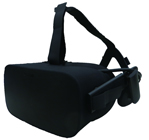 |
| ▲Oculus Rift DK2 |
|
FOVE Plug-in Option Option in additional cost
| This is a plug-in for eye line measurement. For the cooperation between
a Head Mounted Display "FOVE 0" sold by FOVE Inc. and UC-win/Road. |
|
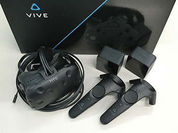
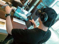
HTC VIVE Plug-in Option Option in additional cost
This is a plug-in that links UC-win/Road to VIVE HMD (Head Mounted Display) and allows wearers to experience VR space. HTC VIVE is a HMD for VR developed by HTC and Valve. In addition to displaying images on the screen inside the HMD, it can synchronize the movement of wearer's face with the UC-win/Road screen and give him/her a higher immersion because external sensors equipped on it detect the position and posture of the HMD.
HTC VIVE is a VR Head Mounted Display developed by HTC and Valve.
External sensors detect the position of HMD and the user's posture. The VIVE provides a playing space of 5m in the diagonal
or a wider VR environment.
|
|
Mindwave plug-in Option Option in additional cost
Users can drive a vehicle by their brain waves when they start drive simulation,
wearing the MindWave Mobile on their head.
The acceleration and braking can be controlled by brain waves.
|
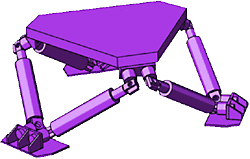
UC-win/Road for RoboCar® Option in additional cost
This VR simulation system will link UC-win/Road with car robotics platform
"Robocar®" in which the robot technology is mounted and controls
the 1/10 scaled model car on a model road by driving in VR space. Various
traffic circumstances and scenarios can be set and implemented through
being able to use the virtual reality space expressed by VR.
|
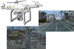
UAV Plug-in Option Option in additional cost
| You can create a flight plan by selecting passing points in UC-win/Road and adding actions on the points such as taking photo or starting video recording.
The information of the flight plan is uploaded on the UAV after the creation. The UAV fully automatically takes off, passes each passing points, acts if defined, and finally lands.
Media files of photos and videos can be downloaded from UC-win/Road over the wireless after finishing the flight. |
 |
|
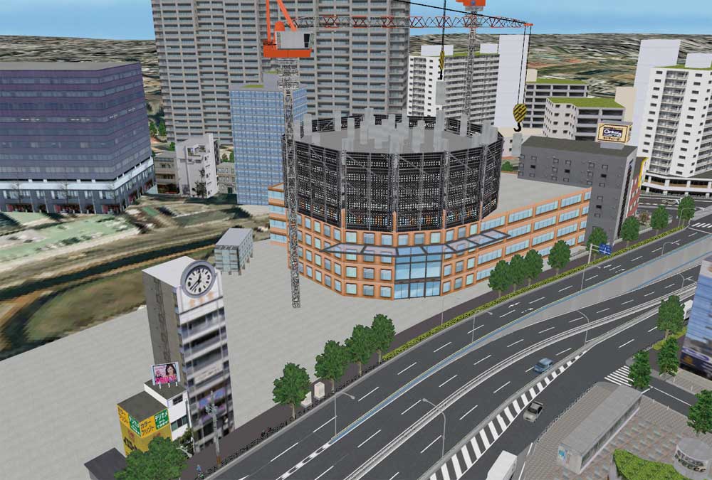
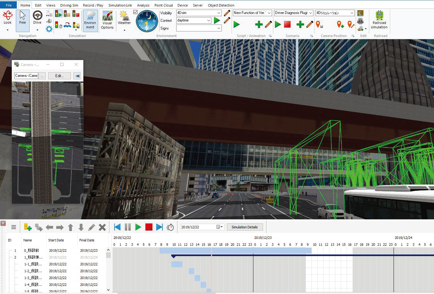
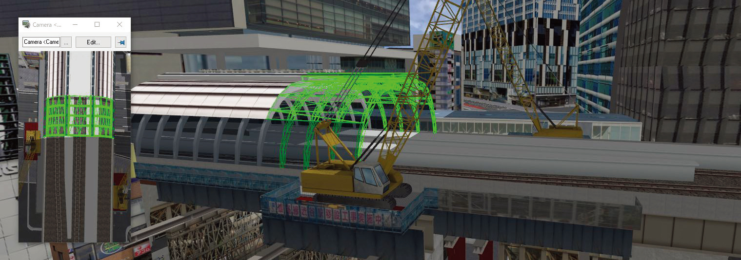
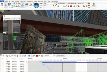
4D
Simulation Editor Plug-in Option Option in additional cost
The 4D simulation plug-in provides a function to manage a schedule from project schedule
definition through to progress simulation while linked with 3D data. The 4D simulation plug-in
was developed to provide easy-to-use project management tools linked to the 3D space of
UC-win/Road, allowing users to easily model project components.
 |
 |
 |
| ▲Example of station constrcution reproduction |
|
|
|